Category Archives: Hobart Bike Infrastructure

Nearly crushed by a cement truck on my ride today

Update 2 July 2014: Added two diagrams to mitigation of Boral Concrete Forecourt

An unfolding story

So, I was nearly crushed by a cement truck today.  It came around a corner, at about 40km/h, without indicating.  I was doing just 25km/h on my bike, which was fortunate, as otherwise I probably would be writing this from a hospital bed, or from a comfy freezer down at the neighbourhood morgue (do they have wifi?).

Perhaps he’d stepped in some cement during his delivery run, and found it hard to ease off the accelerator pedal.  Whatever the case, I don’t want to lay all the blame for this near miss at the feet of the driver.

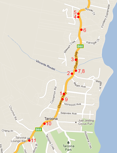
That’s because the real problem lies with the Hobart City Council. This incident occurred on the primary, and best cycling route North out of the city.  The HCC maps describe this route as a “Off-road – Shared Footway/Bicycle Path.”  I think I will now describe it as an “Off-road – Shared Footway/Bicycle/Cement Truck Path.”

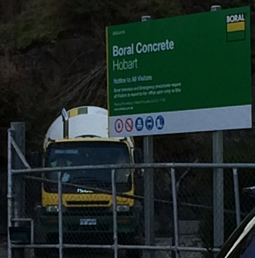
The site in question is the Boral Concrete Depot, through which the cycle route happily wends its way, and is probably the most dangerous of the obstacles which the intrepide commuter cyclist must negotiate on his or her way out of Hobart City.  But it is by no means the only obstacle.

An interview

Before I go into more detail on the obstacles, with pictures and lots of fun, I have taken down an Official Report from myself, viz.:

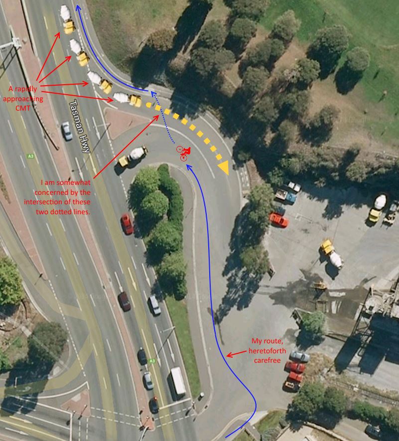
I was proceeding on my pedal cycle in a Northerly direction, at approximately twenty-five (25) kilometres per hour, through the Forecourt of the Boral Concrete Depot, upon the principal cycle route as shown on Council Maps, and paying due attention to traffic on the adjacent Highway, when my attention was caught by an approaching Cement Mixer Truck (henceforth, CMT).  Said CMT was proceeding in a Southerly direction at a speed which I estimate at no less than forty (40) kilometres per hour, and as CMT had not indicated that it would be leaving the aforementioned Highway, I presumed that it would continue past the entrance into the forecourt.

To my surprise, when the CMT reached the entrance of the Forecourt, it abruptly swung off the Highway and into the Forecourt, at speed, at which point I executed Evasive Manœuvres, to wit, braking sharply and turning my vehicle (2 wheeled pedal cycle) towards the West.  Additionally, I immediately alerted the driver of CMT to the impending danger with a carefully worded, shouted, phrase.

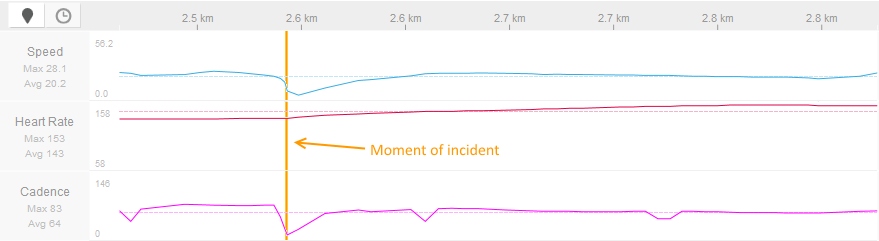
CMT then braked heavily; however this action was no longer necessary as I had already averted the danger with my Evasive Manœuvres.  I then proceeded, unharmed, on my journey, albeit with an elevated heart rate (see Figure 1 – ed).

Heart Rate and Speed
Figure 1 – Heart Rate and Speed
Incident Diagram
Figure 2 – Incident Diagram

Your daily obstacle course commute

The Intercity Cycleway is by far the most established and concrete (there’s that word again) piece of bicycle infrastructure in Hobart. Following the railway line North from the Docks, through Moonah, Glenorchy and Montrose, it is used by hundreds (in Summer, thousands) of cyclists a day for commuting and exercise. And until you reach the Cenotaph, it is, by and large, a decent piece of cycle infrastructure.

The bliss of the Intercity Cycleway

I think a good question to ask when looking at bicycle infrastructure design is: is it safe for an 8 year old to ride? Not necessarily unaccompanied, but looking more at bicycle control and potential danger points. And at the Cenotaph, things start to go downhill. First, we encounter a confusing road crossing, up-hill, with traffic approaching from 4 different directions. The confusion is mitigated by typically low speeds, but it’s not a good start.

Traffic comes from four different directions as you exit the Intercity Cycleway

After crossing the road, a cyclist is presented with two possible routes. The official route heads slightly up hill, and a secondary route heads past the Cenotaph. All well and good, almost.

Approaching the Cenotaph - Two Routes
Approaching the Cenotaph – Two Routes

The “almost” comes into play shortly. The official route turns abruptly at the edge of the highway, where traffic is passing at 70km/h. There is no safety barrier.

Approach the Highway, and Turn Left

Here the path goes downhill, literally. The typical cyclist picks up a bit of speed here, coasting down the hill. We reach the other end of the Cenotaph route.

This point is just plain dangerous, which is no doubt why the newer, ‘official’ route was introduced. However, without signage or recommendation, there is nothing to encourage riders to use the slightly less dangerous, slightly longer route. So what’s the problem?

Mind you don't miss the corner!
Mind you don’t miss the corner!
  1. There is a conflict point with cyclists merging, at speed, coming down hill both on the official route, and the Cenotaph route. This can be a conflict with pedestrians as well.
  2. Worse, cyclists coming down the Cenotaph route run a significant risk of overshooting, if not careful, into the highway. I have seen a cyclist do this. They were lucky: no cars were in the near lane.

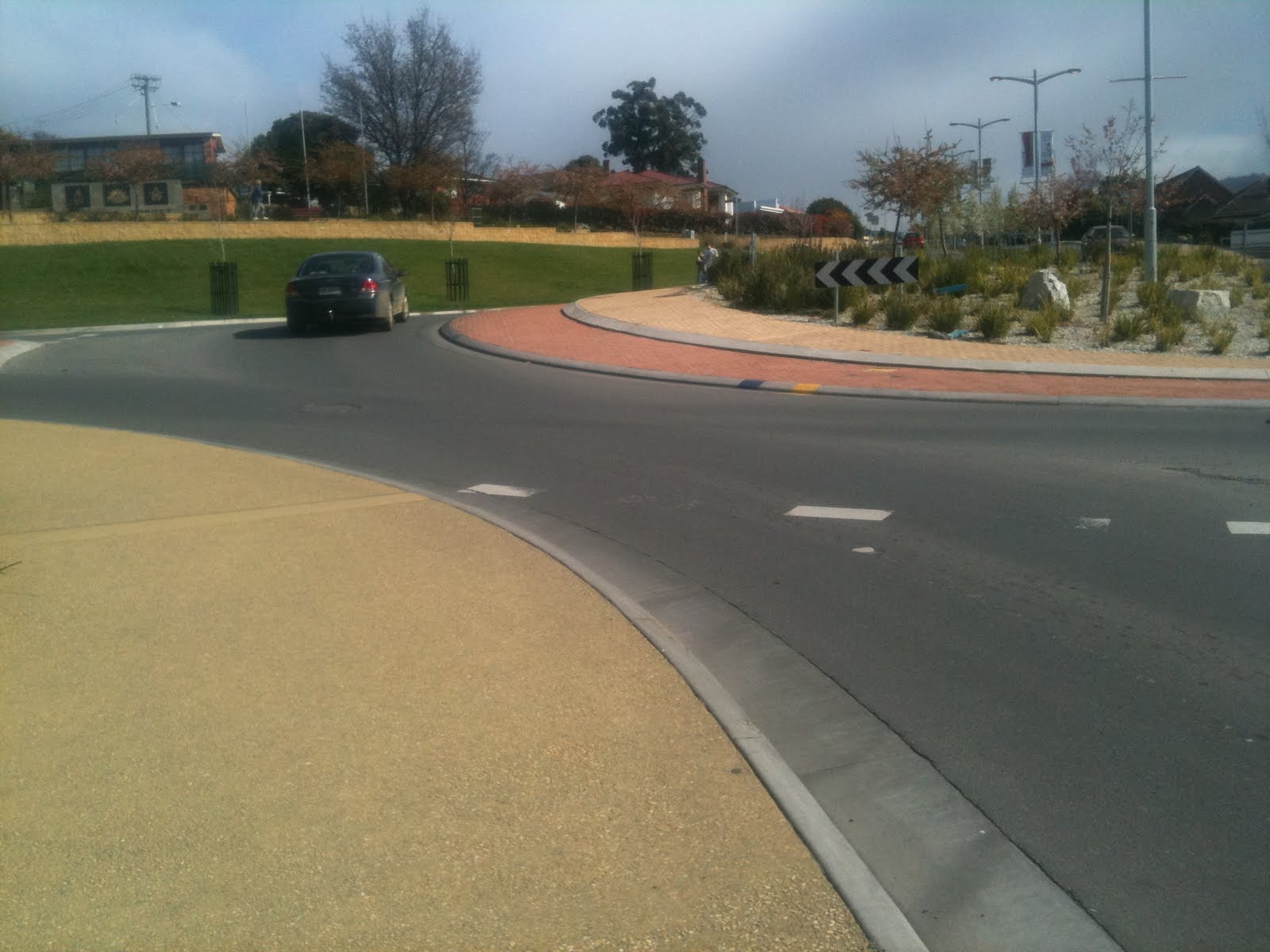
Now we approach the bottom of the hill, with a blind corner. Pedestrians regularly round this corner on the “wrong” side of the shared path. Cyclists should ride their brakes down here to avoid picking up too much speed.

Approaching Boral Concrete

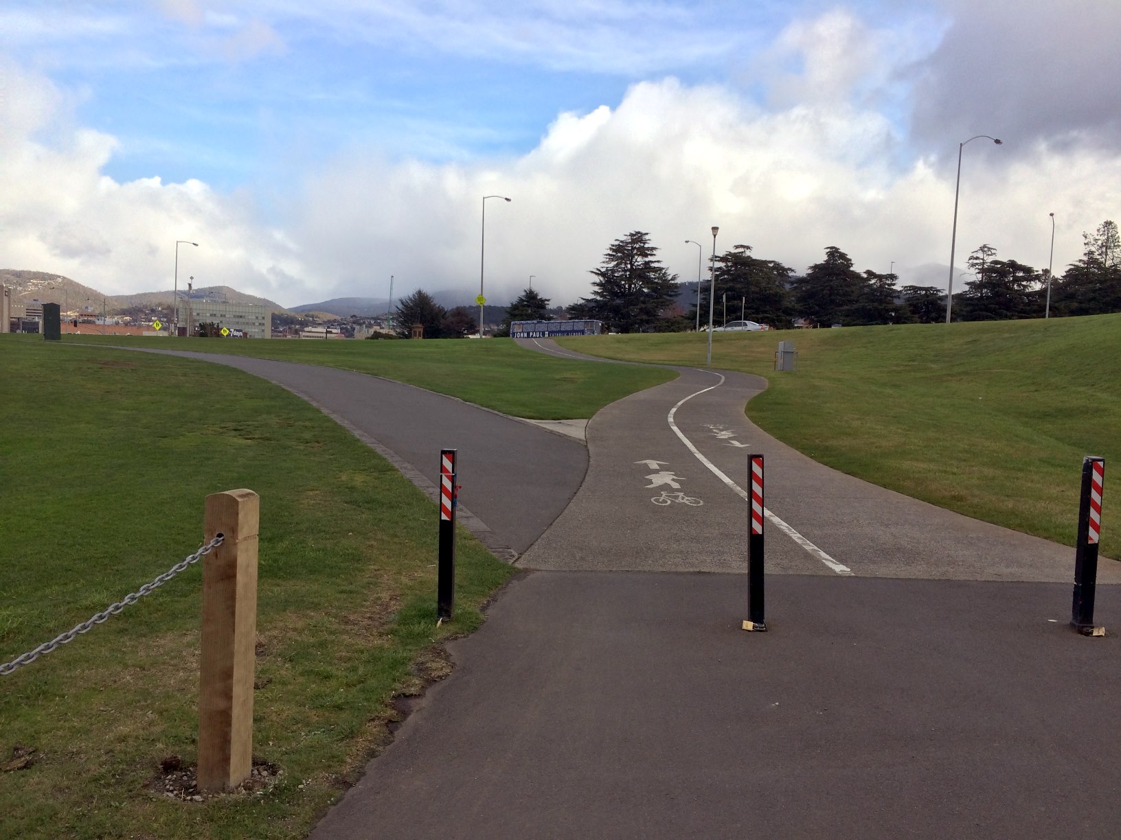
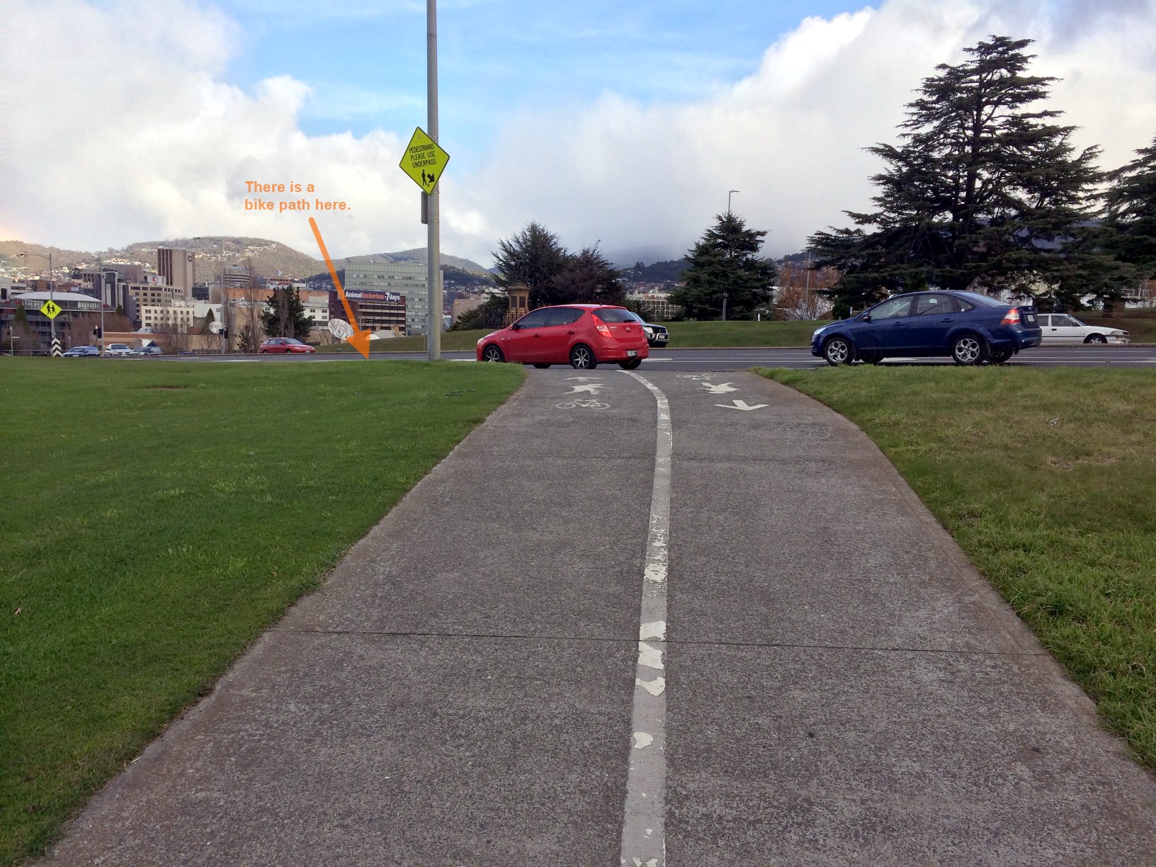
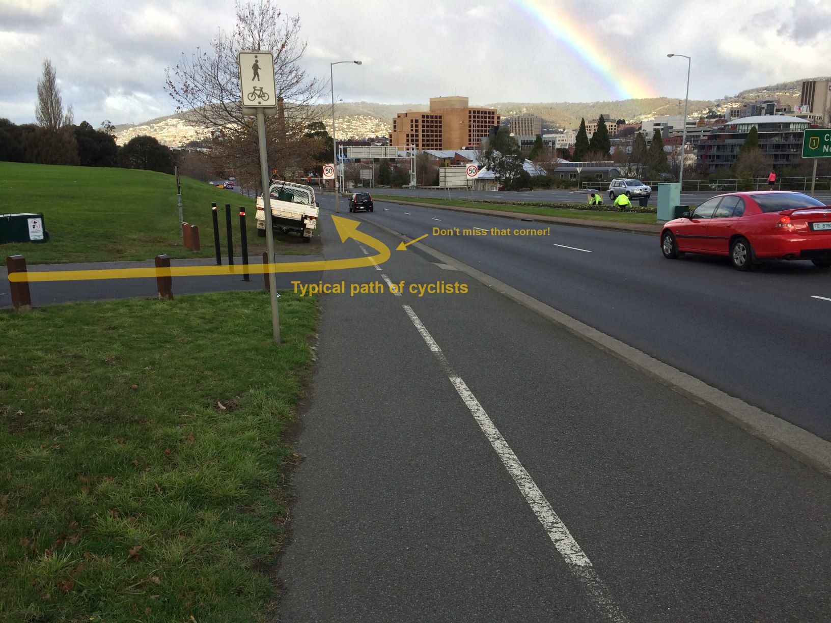
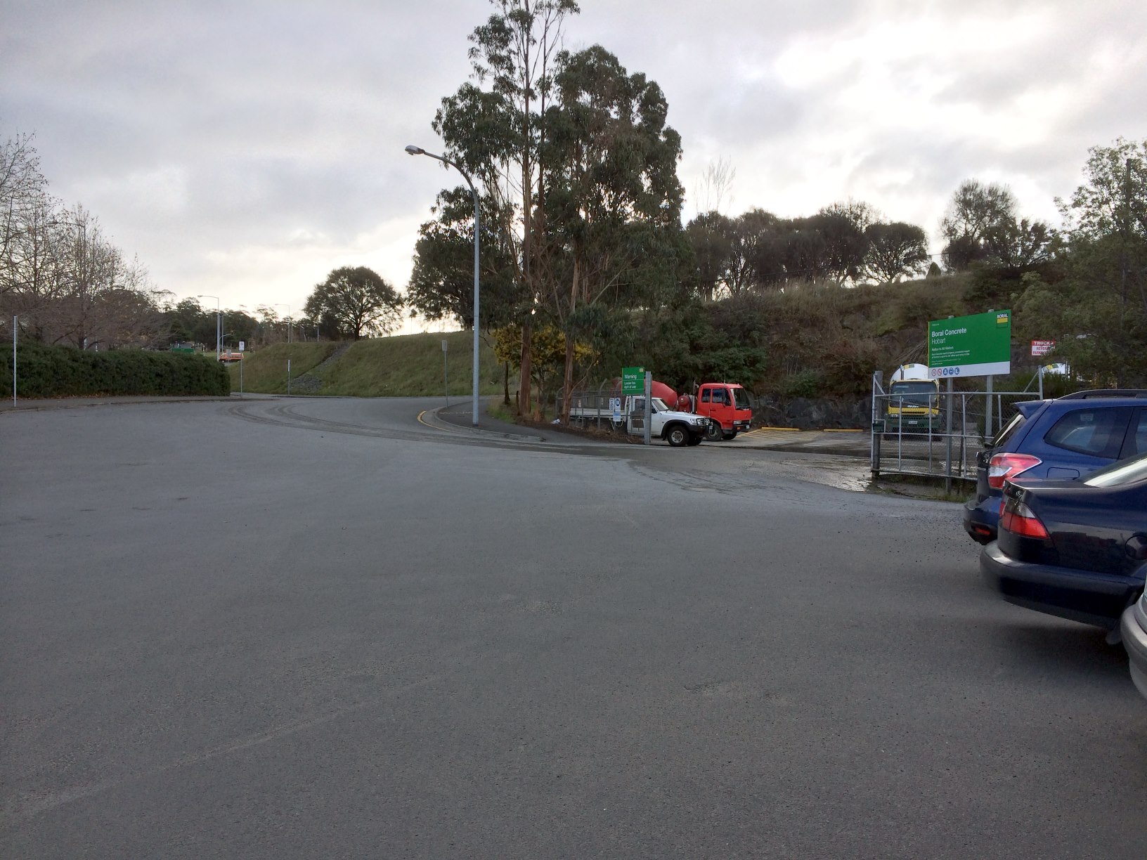
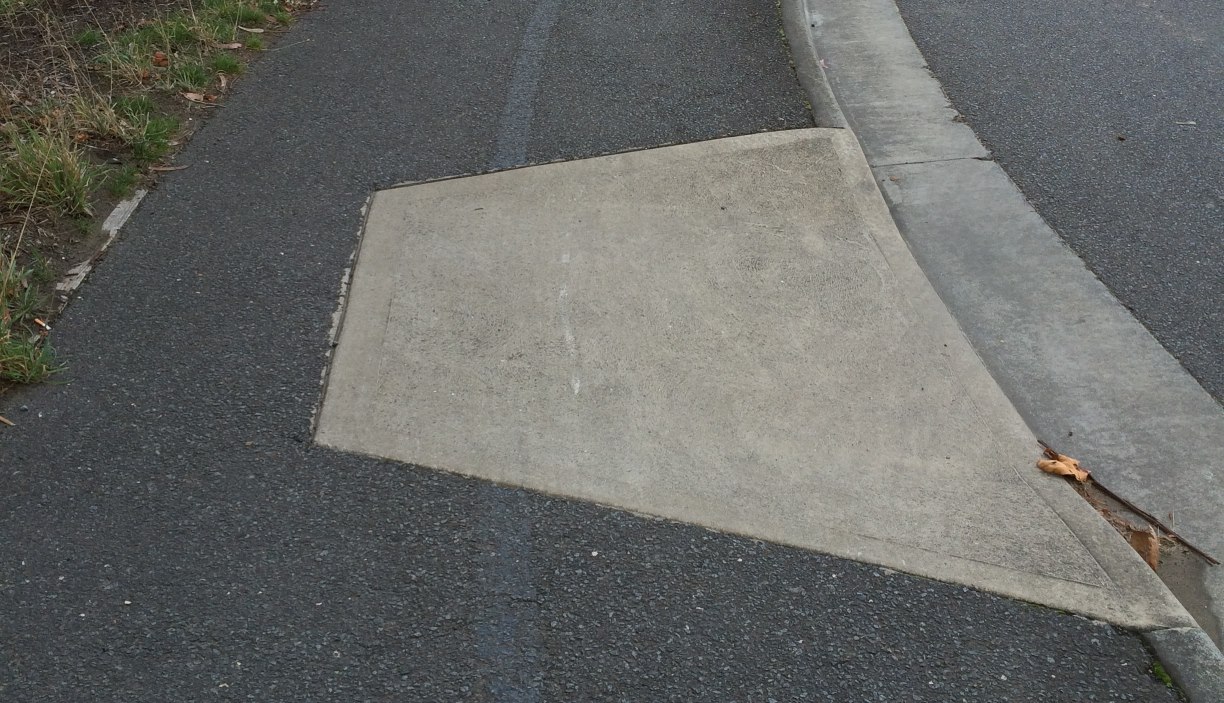
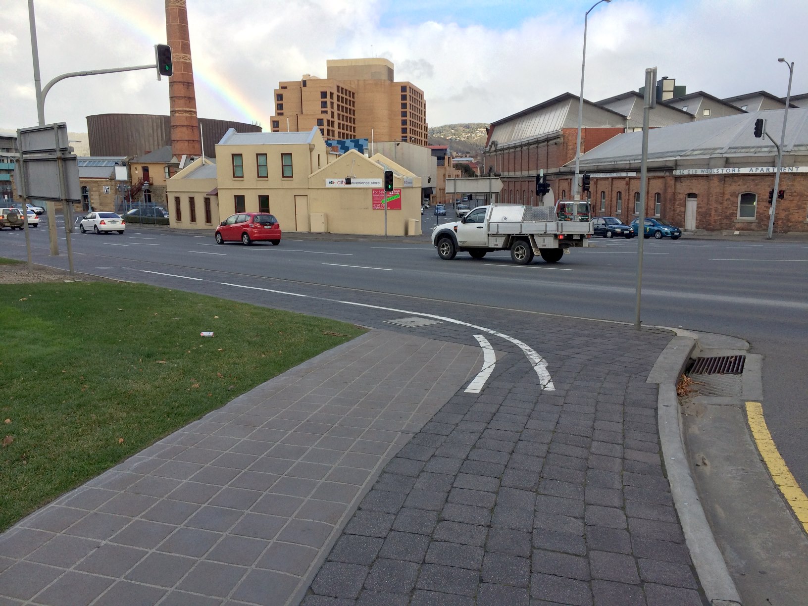
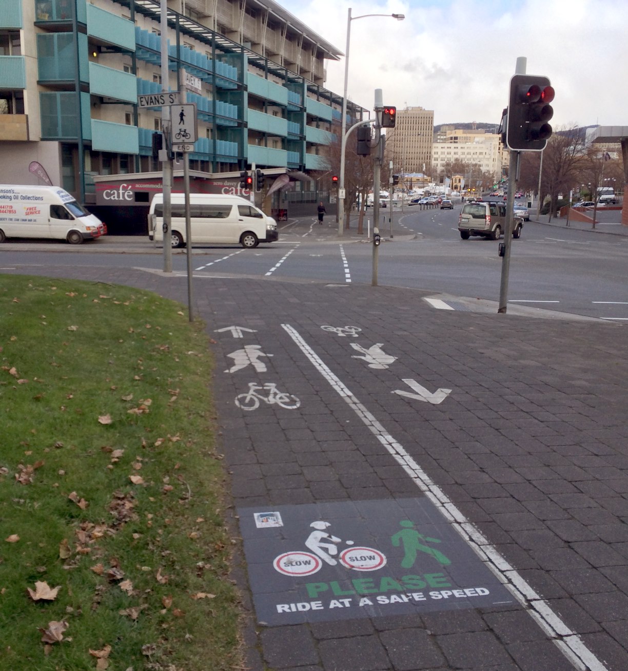
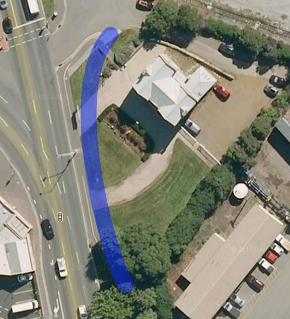
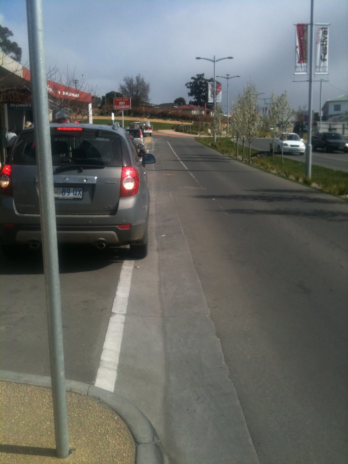
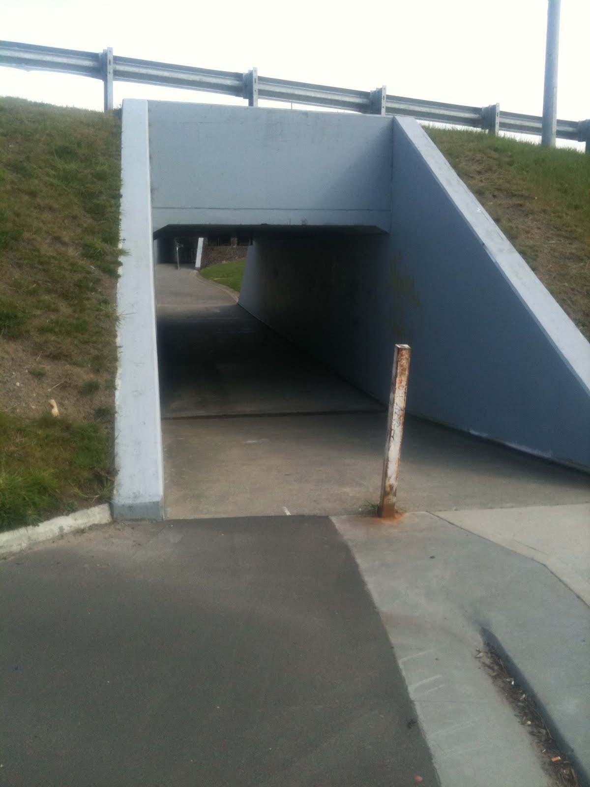
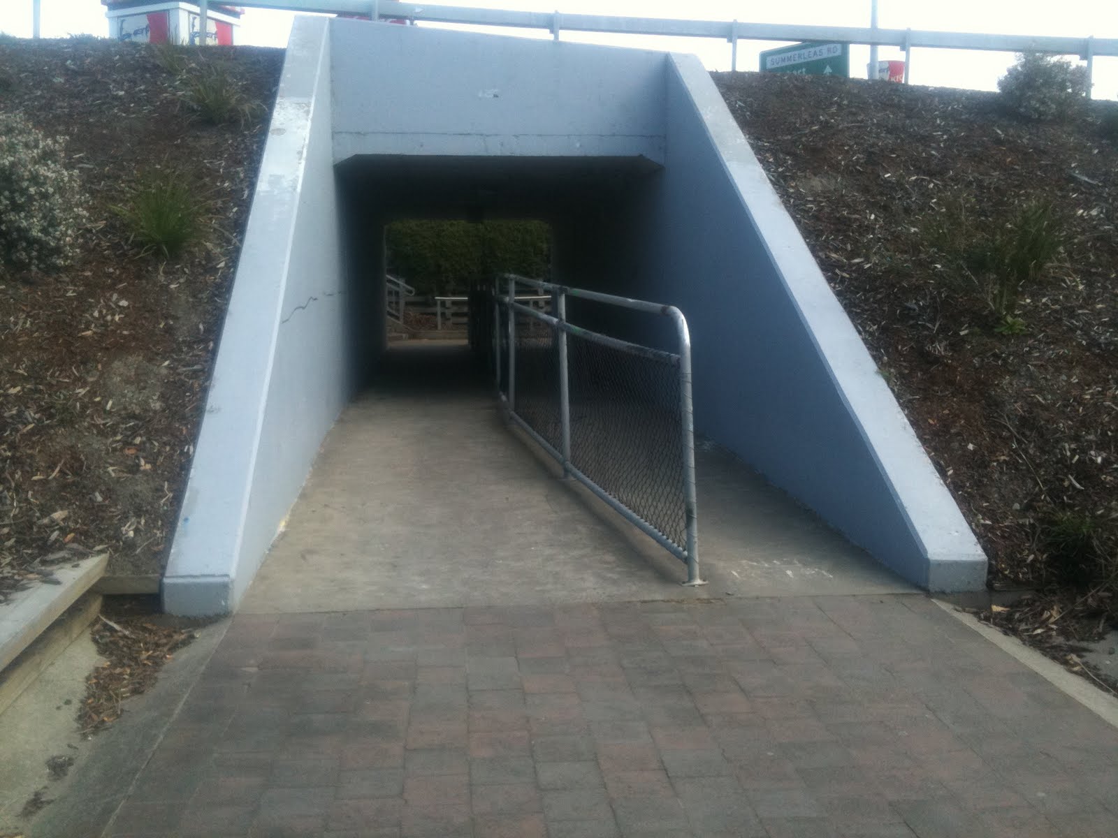
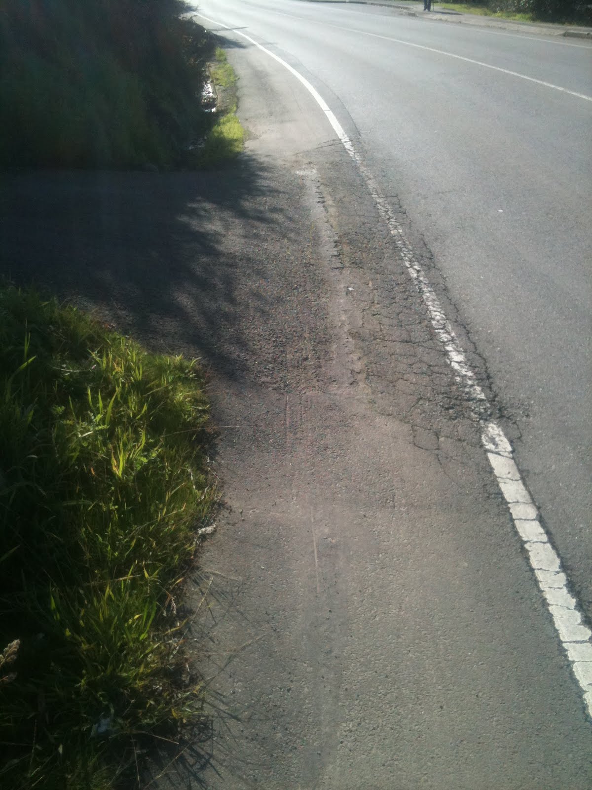
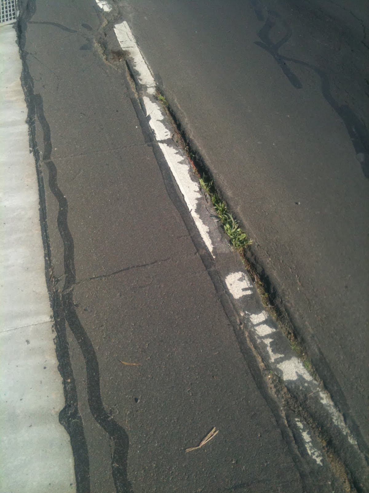
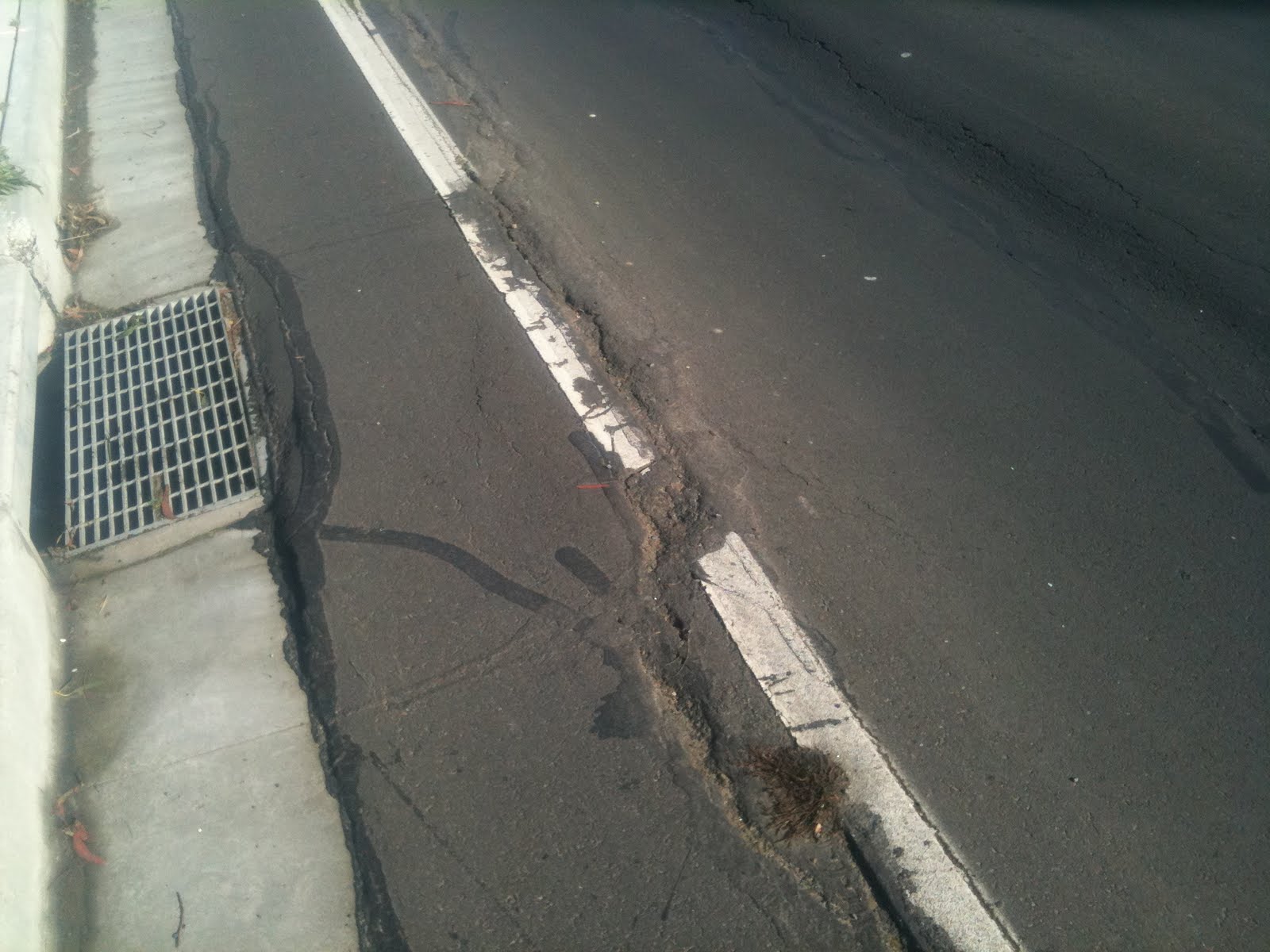
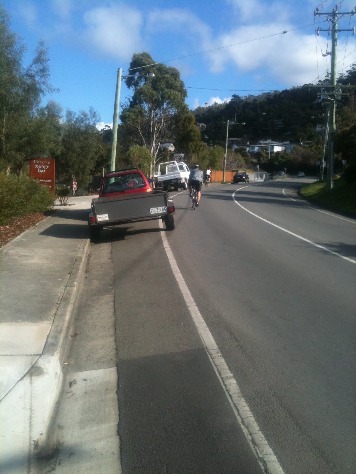
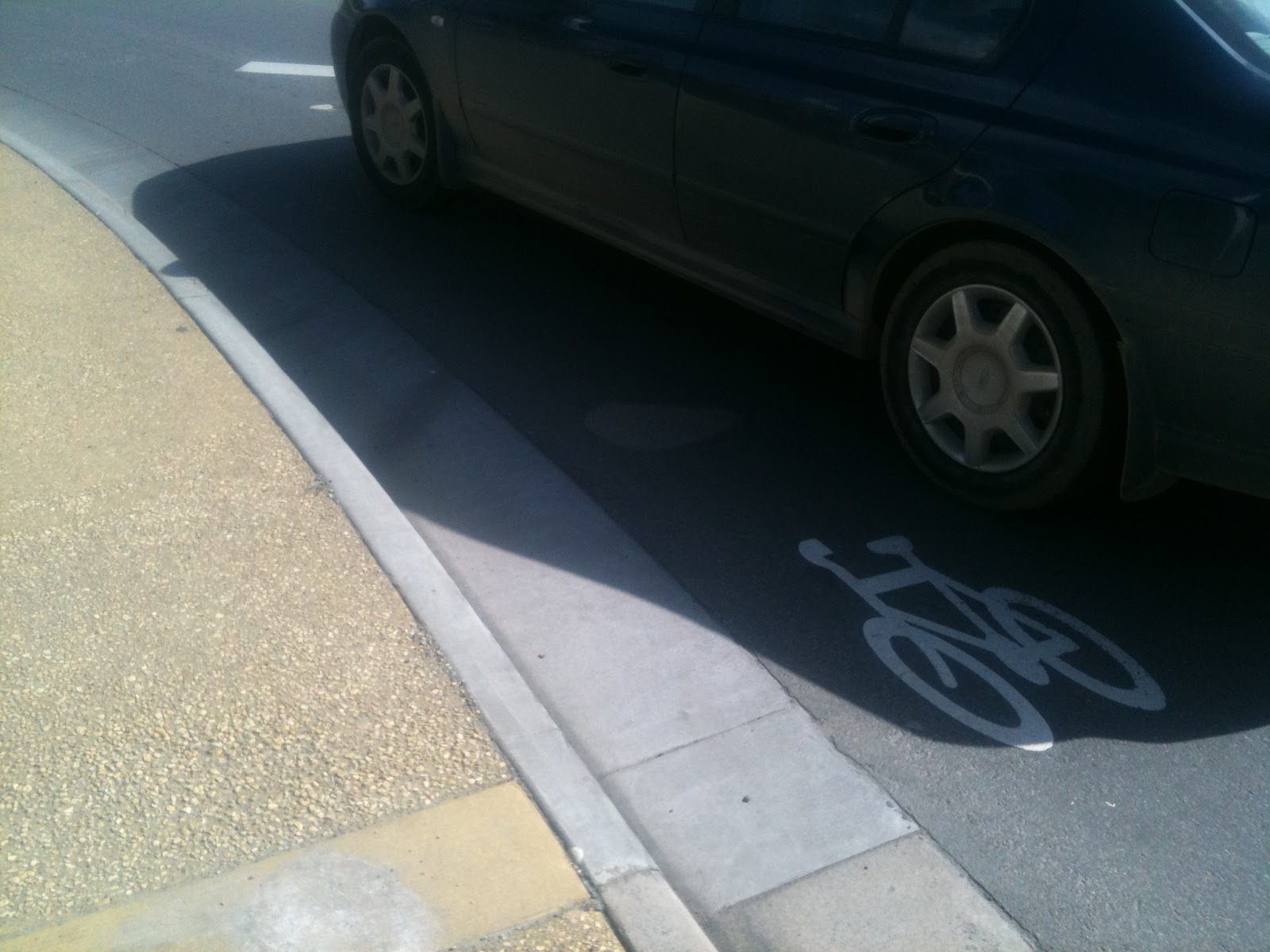
Confusion ensues: there are three marked routes here. Which is the proper route? The only frequently used route is the closest exit onto the forecourt roadway. But this exit is also the most dangerous, as I found today. The two more distant exits are just awkward to access. This forecourt is dangerous: with traffic entering from the highway, potentially at speed, and trucks turning and reversing, it’s just not a great place for bikes. Yet it is smack bang on the primary bike route into Hobart.

The iPhone does a Telephoto Spy Shot into Boral Concrete's Depot
The iPhone does a Telephoto Spy Shot into Boral Concrete’s Depot
The Forecourt, Heading North
Yes, Ride Past the No Entry Sign
Yes, Ride Past the No Entry Sign to exit South
The Route North to the Intercity Cycleway in all its glory
One of the three off ramps into the forecourt

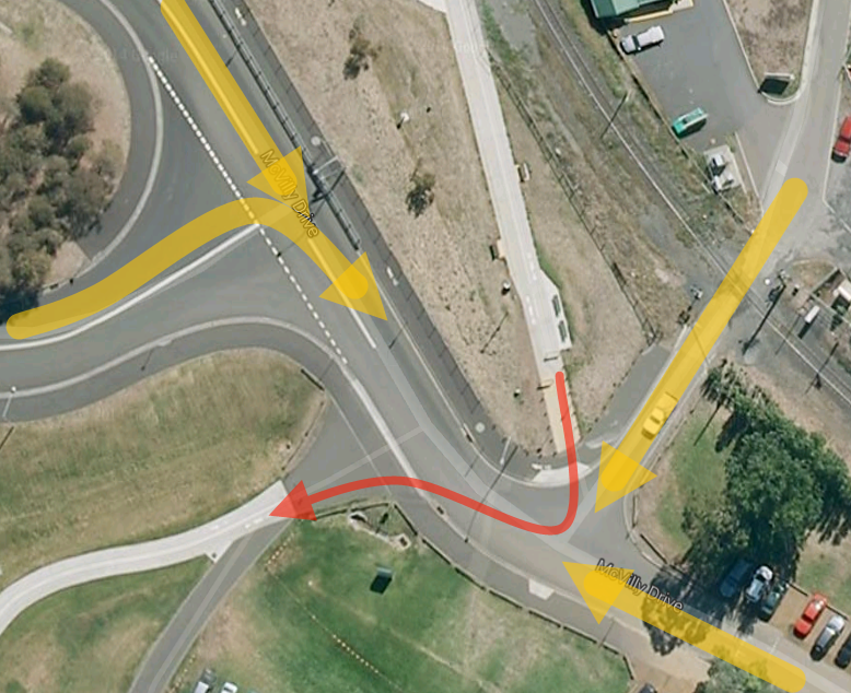
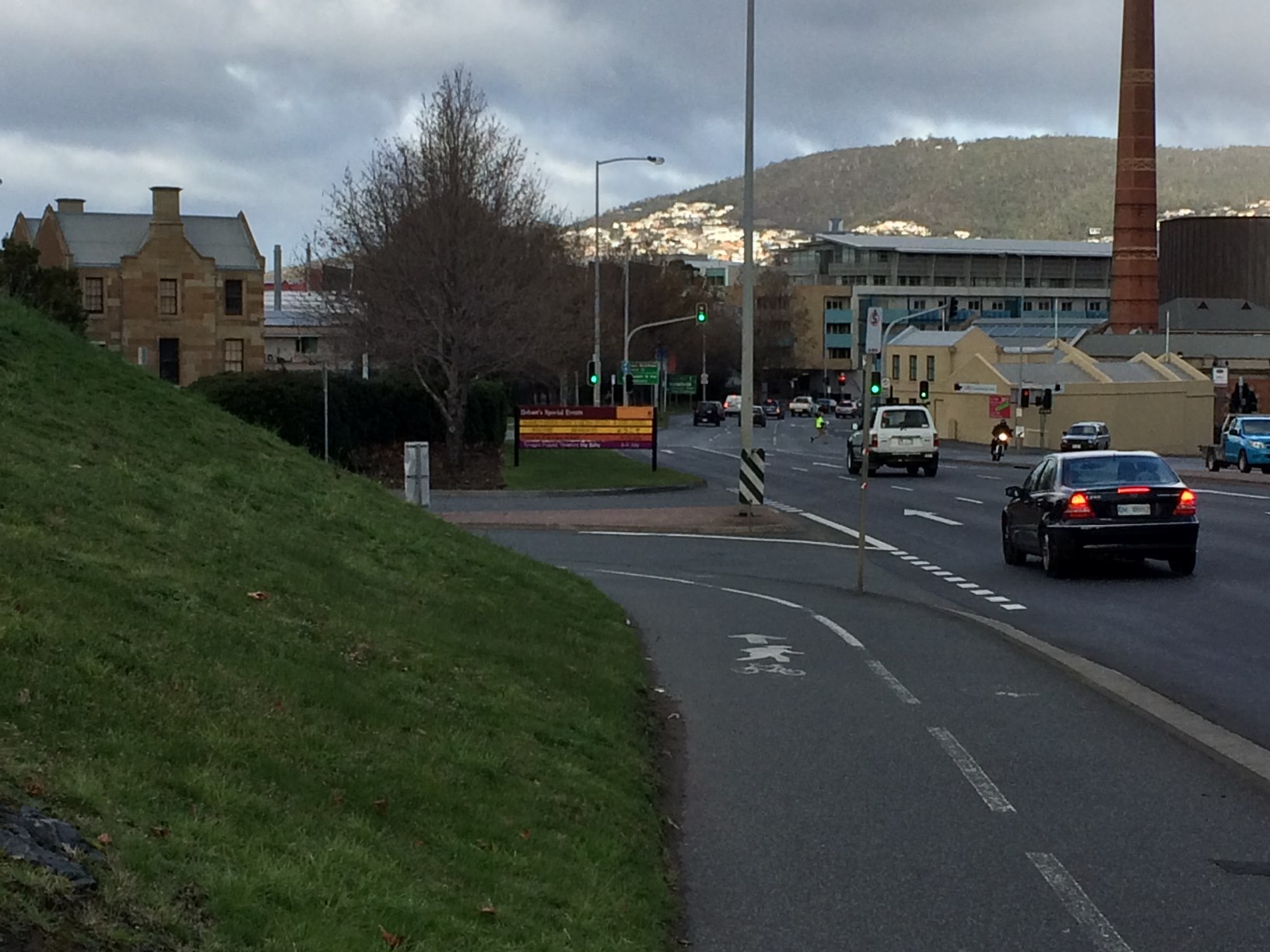
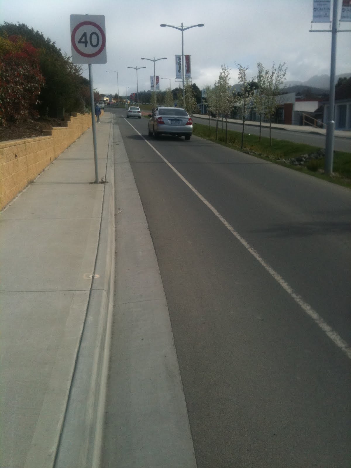
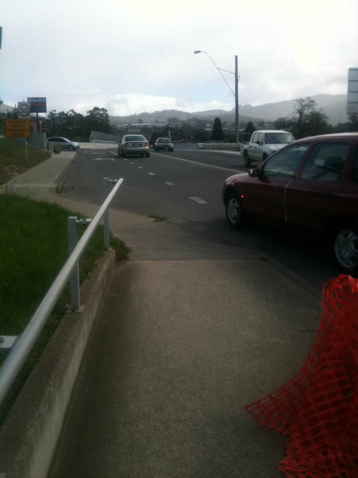
Things improve a little on the far side: we have a reasonably well marked pathway, albeit with another sharp corner right on the edge of the highway.

Turn Hard Left.  This does not qualify as high quality infrastructure, sorry!
Turn Hard Left. This does not qualify as high quality infrastructure, sorry!

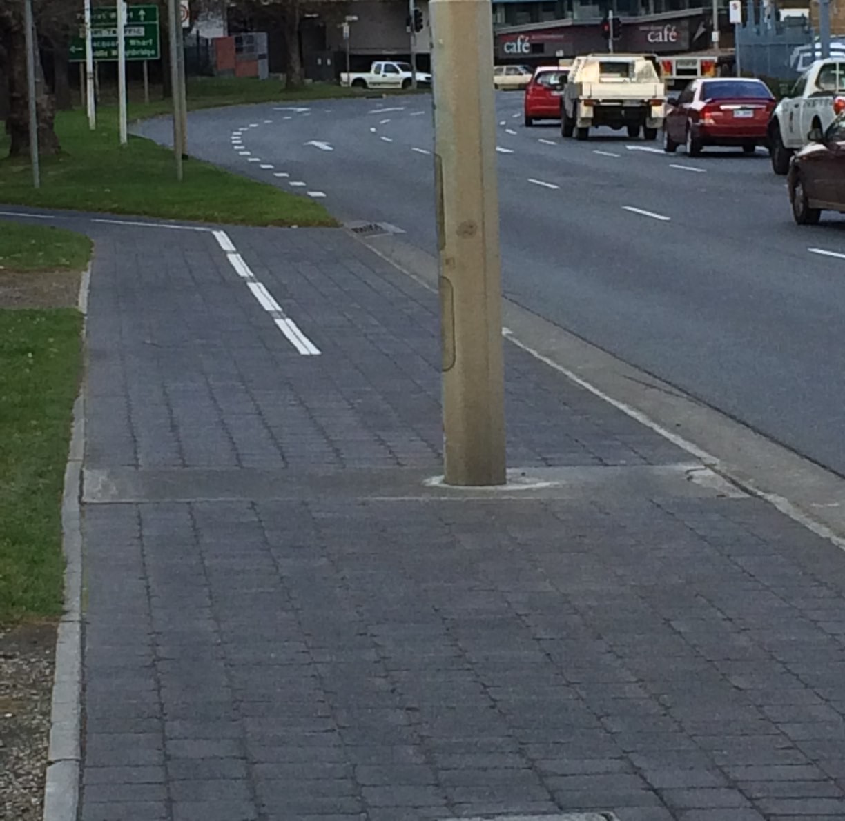
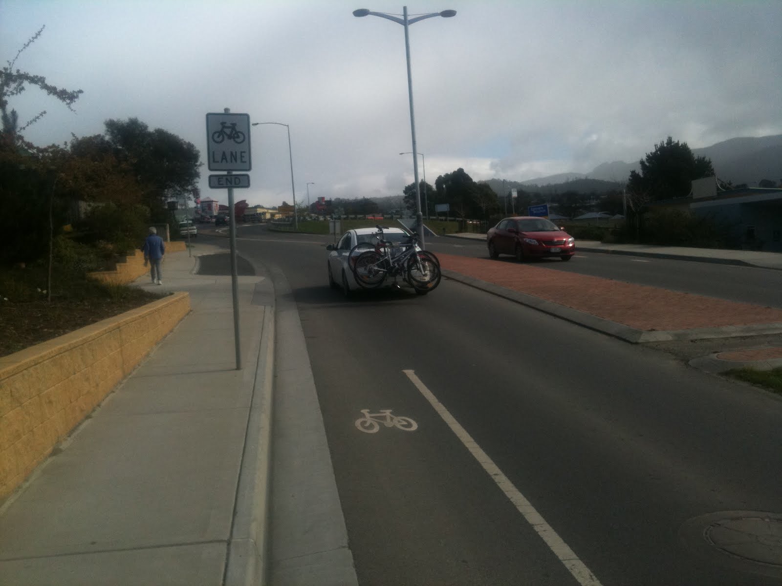
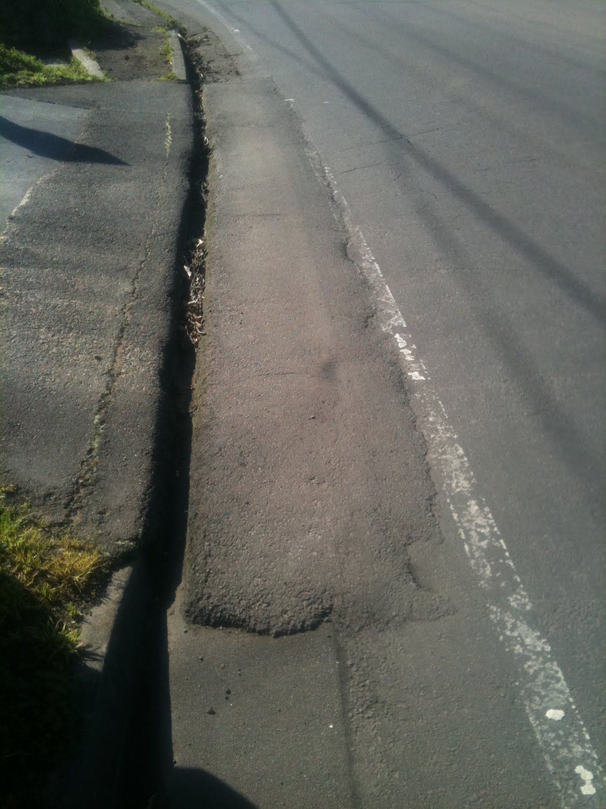
Now we are faced with a traffic light pole in the middle of the path, narrowing the path in one direction to less than a metre right beside a very busy roadway. That’s nasty.

The Pole
The Pole

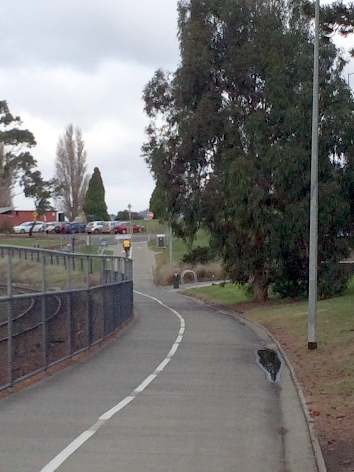
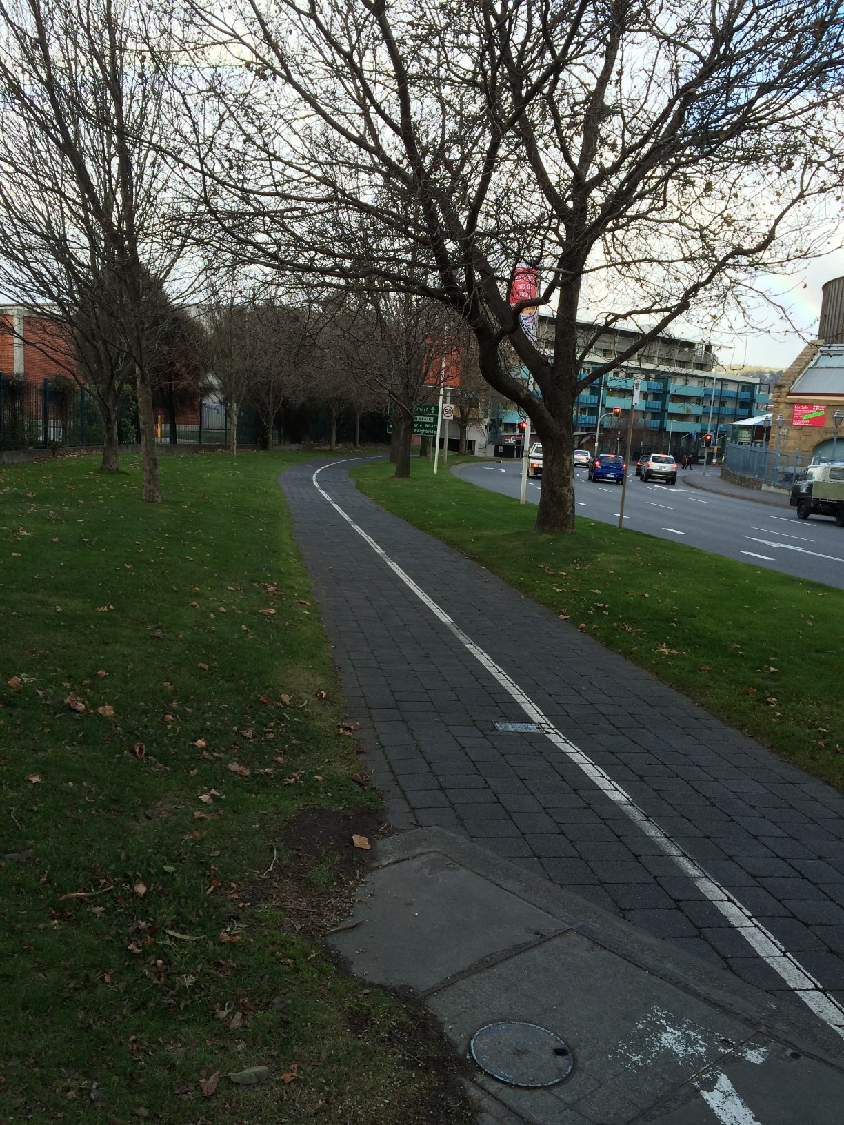
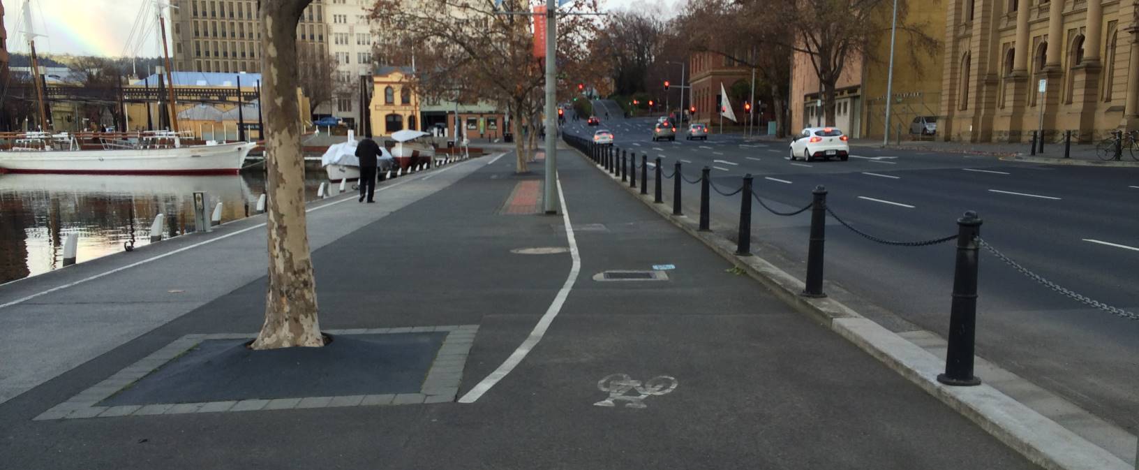
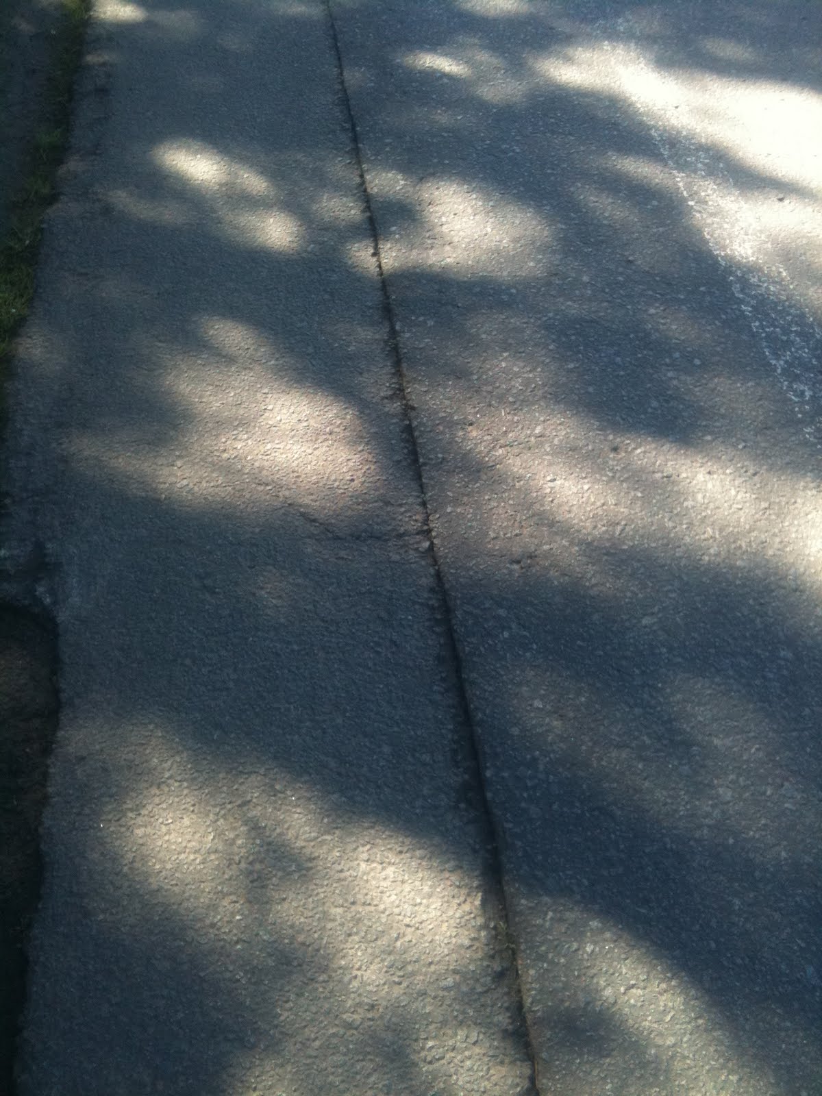
The next section, however, is quite pleasant, offset from the road and through an avenue of trees. Apart from some minor maintenance on the ‘cobblestones’ to level them out, I have no complaints.

Pleasant Times
Pleasant Times

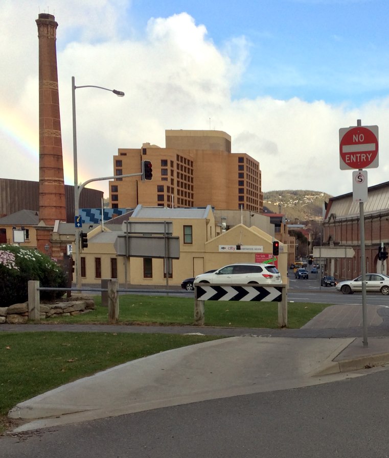
Now we come to the Hobart Docks precinct. First we have a road crossing, with a separate light for and control system for bicycles. I’m not sure why. The button is on the wrong side of the path, causing conflict for oncoming bicycles.

Road crossing
Road crossing

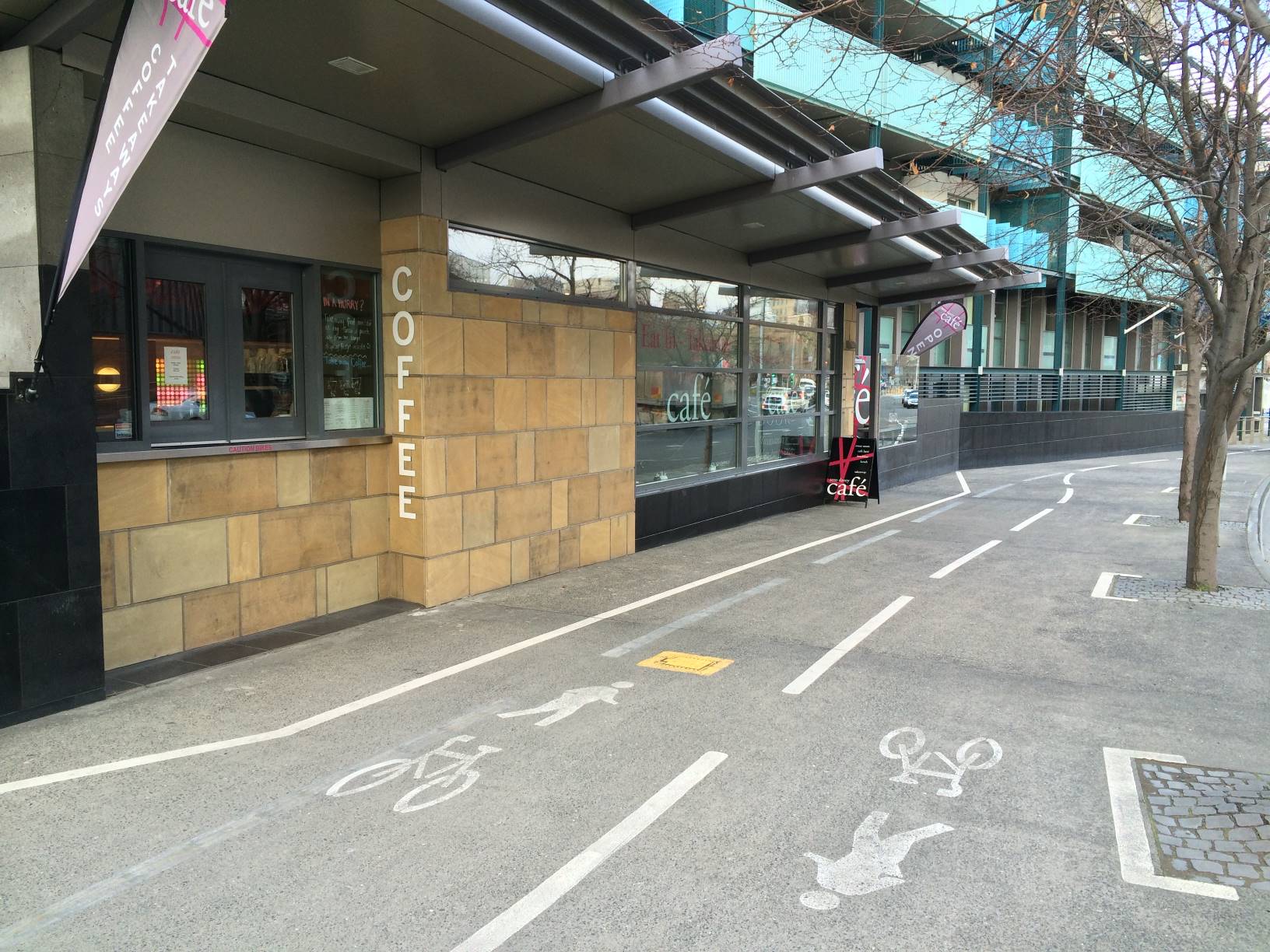
Enough has been said about the placement of this Cafe. But perhaps the signs which frequently encroach into the bike lane (not too badly in the photo today, but worse on other days) should be relocated.

The Cafe
The Cafe
A Sign Encroaches
A Sign Encroaches

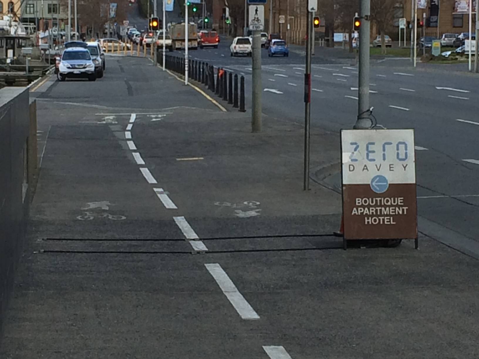
Crossing the docks themselves is not ideal, with a path shared with pedestrians and parking cars. But it is a low speed area and most of the conflicts are overcome without too much trouble. However, the Mures carpark entrance is still dangerous, even with the upgraded crossing treatment. Sight lines are poor and I have observed drivers crossing this intersection at speed, attempting to make it into a break in the traffic on Davey St.

Crossing the Mures Entrance

Finally, we have another shared path, with a somewhat ambiguously marked bike lane on the street side of it. Perhaps it would be better to treat the whole path as shared, and not ‘reserve’ a section for bikes if it isn’t going to be clearly marked, but it’s not a big issue.

Shared Path Past Docks

Mitigations

The sections of the track that need attention most urgently are those along the edge of the highway, and where the route crosses the Boral Concrete forecourt area.

Engineers Australia Building

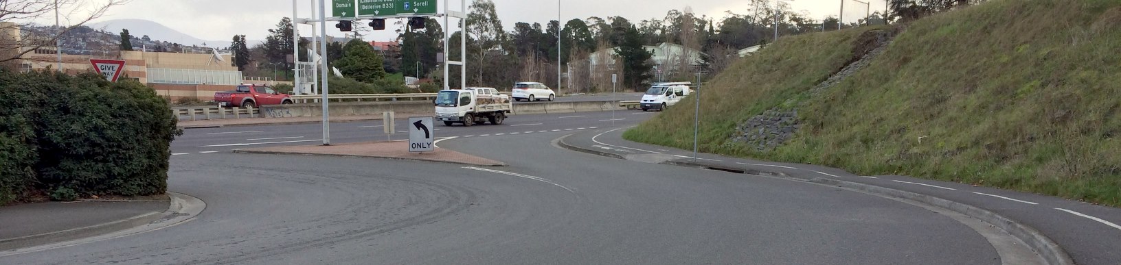
Travelling from the city this time, the first danger point, where the path traverses the edge of the highway and narrows around the traffic light pole, could be improved by shifting the bike path away from the edge of the road, and across the otherwise empty lawns outside the Engineers Australia building. No doubt there are some property boundary issues there. But perhaps it wouldn’t hurt to ask them? Even a one or two metre setback would improve the situation considerably.

Adjusting the shared path past the Engineers Australia building

Boral Concrete Forecourt

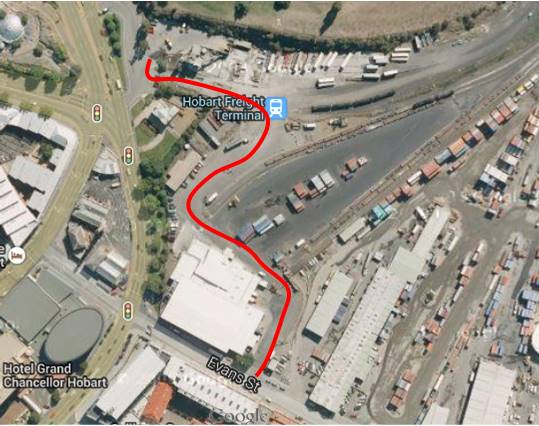
The safest solution to this area would be to close the car and truck access to and from the highway entirely, and reroute traffic to Boral Concrete and the Engineers Australia building through the dockyards. This would also address the problematic entrance of vehicles onto the highway in the middle of a major intersection.

Alternative access to Boral Concrete
Close highway access to forecourt

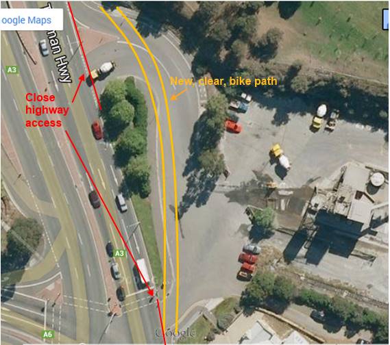
This may be a hard sell, however if the Hobart City Council wants to increase the bike share into the city, it will need to take serious steps to improve the safety of this primary route through this area.

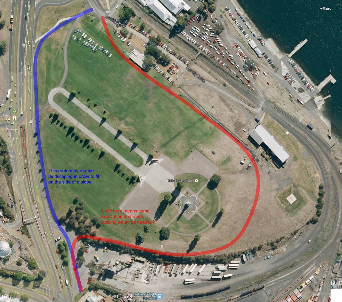
Realignment of path past Cenotaph

The bike path along the side of the highway could be rerouted behind the Cenotaph, or with some work, shifted away from the edge of the highway. Alternatively, a safety barrier could be put into place along the path beside the highway.

Alternate Cenotaph Routes: both would take some work

I’ve been wanting to write this post for quite a while. The Incident of the Cement Truck was sufficient to rekindle my blogging ‘abilities’. Other posts in the Hobart Bike Infrastructure series:

The New Huntingfield Roundabout Cycle Lanes: Here’s Why They Are Dangerous

I was recently made aware of the design of the Huntingfield Roundabout at the end of the new Kingston bypass.  This new roundabout incorporates a bicycle lane around the outside.  Incorporating bicycle facilities in the new road design is fantastic news, except for one big problem: around the world councils and road authorities are removing bicycle lanes from roundabouts for safety reasons1, and encouraging a dual approach, depending on the confidence level of the cyclist:

  • Either leave the road and negotiate the roundabout via pedestrian crossings, or,
  • Merge with car traffic when approaching the roundabout, and negotiate the roundabout in the centre of the vehicle lane.

Unfortunately, the Huntingfield Roundabout has a really strange compromise: bicycle lanes around the outside, but cyclists must give way to car traffic exiting the roundabout at each exit.  That means that bicycles are giving way to traffic approaching them from behind!  Perhaps this was in response to problems with a bike lane where cars give way to cyclists, but in my view this approach is just as dangerous.

Bicycle lanes on the new Huntingfield Roundabout

I just can’t see how this design is going to be safe:

  • While it’s certainly possible for a cyclist to give way, it’s counter-intuitive to how a roundabout normally works when driving a car, and so unless all cyclists are aware of the special rules for cyclists in the roundabout there’s definitely a real risk of collision when they fail to give way.
  • But a similar problem applies for car drivers who are not aware of these unusual rules: they would give way to a cyclist that was about to cross their exit, which leads to an ambiguous situation and causes risks for other drivers and the cyclist who will not be expecting it.
  • Moreover, this special cyclists-give-way-to-traffic-behind-them rule will lead to drivers unconciously driving in the same way at other intersections, overtaking a cyclist and immediately turning left in front of them, causing T-bone accidents.  This is already an issue today, but adding new and confusing road rules will exacerbate it!
  • Update (28/11): One of my friends (who happens to design bike lanes for a living) noted that cars would tend to stop on top of the bike lane when waiting to enter the roundabout.
  • Finally, I (and many other riders) would tend to avoid the bike lanes anyway, both because of the frustration of stopping potentially 4 times just to get around the roundabout, and also because one is more visible when riding within the traffic lane at a roundabout.  But this will cause resentment amongst drivers who just see a cyclist not using the bike lane!  (Stop 4 times?  Yes, a common lunch time loop ride goes up Channel Highway, round the roundabout, and back again down the highway).

 It’s probably a little late now, but I wish the relevant authorities would reconsider this design!

If you are keen, here’s another opinionated post on Kingston’s on-road bicycle facilities!

(Yes, of course, with help from Wikipedia and other sources):

[1] R. Schnüll, J. Lange, I. Fabian, M. Kölle, F. Schütte, D. Alrutz, H.W. Fechtel, J. Stellmacher-Hein, T. Brückner, H. Meyhöfer: Sicherung von Radfahrern an städtischen Knotenpunkten [Safeguarding bicyclists in Urban Intersections], Bericht der Bundesanstalt für Straßenwesen zum Forschungsprojekt 8952, 1992

Hobart Bike Infrastructure – Kingston On-Road Cycle Lanes

After receiving quite a few positive comments, online and offline, about my previous blog post on the Taroona cycle lanes, I thought I might explore some of the cycling infrastructure in Kingston.  I have focused on the on-road cycle lanes, but Kingston also has a bike path or two that are good recreational routes, especially for families, and more are under construction.

I would describe the quality of bicycle lanes in Kingston as good, and the newer lanes in the centre of town are of high quality. The Kingborough Council also has the distinction of being the first council in Tasmania to install a bike lane, on the Channel Highway.  The Kingborough Council is also in the process of reconstructing roads in the town centre, which I believe will include bicycle lanes.

If I was to pick one problem with the Kingborough bicycle infrastructure, it is that most of the lanes end abruptly on very busy roads or roundabouts.  This problem is certainly not unique to Kingston — I saw the same issue many times in Melbourne, for instance.

On with the tour!  The map below shows the approximate locations of the photos.  In most photos I will pick on an issue, quite unfairly of course.  The on-road bike lanes are also marked in blue.

1. Church St.  Minor.  Bike lane markings are worn, as cars frequently cross into the lane.

This is a typical problem with bicycle infrastructure everywhere — the lane markings tend to be driven on, and not just by larger vehicles that have somewhat of a reason.  Of course, as the markings get less distinct, the problem is exacerbated.  This particular lane is reasonably wide, in a 40 zone, and hence is quite safe, apart from the very steep descent to Beach Rd immediately ahead.  The parking spots are not highly used and so dooring is not a huge risk (but always be aware!)

2. Beach Rd.  Moderate.  A beautiful bike lane that abruptly ends as the road narrows.

Again, the lane markings are very worn, but what I wanted to pull out here is how the bicycle lane ends and leaves the cyclist in the middle of a very busy section of road.  This is a very popular route for cyclists through to Kingston Beach, and it is disappointing that the lanes which start so well do not continue on at least through to the traffic lights 100m down the road.

3.  Good  Beach Rd / Church St Intersection: Clear and safe bicycle lane

On the opposite side of the road, this intersection has a clearly marked bike lane.  It is wide, clean, and smooth.  Great!  For extra points (or to get an ‘excellent’ rating), paint the bike lane green.

4.  Minor  Church St: this up-hill lane has worn markings and is very steep (15%)

The lane in this picture has worn lane markings, and is not sign posted.  The street is also very steep, which would deter some riders.

5.  Moderate  Beach Rd: Again a situation where the bike lane ends in a busy intersection.

This bike lane ends at a busy 4 way traffic light.  There is no provision for bicycle storage boxes in the intersection.  You’ll also note the roadworks signage encroaching right into the middle of the lane.  Roadworks signage obstructing bike lanes is a common problem in Hobart — this forces the cyclist to merge into the traffic lane.

6.  Minor  Channel Highway: Good but isolated bicycle lane

This bike lane is wide, with sufficient room to negotiate around parked cars; beware of dooring of course. This section of road is also posted at 40km/h, which means that although it is busy, there is a much lower risk of serious accidents.  The only real problem is that this section of lane does not extend all the way back through the town centre.

7.  Moderate  Channel Highway. No provision for cyclists in the roundabout

All three major roads entering this roundabout have cycle lanes in both directions.  That’s fantastic.  But there’s no provision for cyclists at the roundabout, and hence some confusion from drivers who are not sure where the bicycles are going.

8.  Good  Channel Highway. Nice clear section of cycle lane

The image above shows a section of Channel Highway south of the town centre.  Clear, clean and smooth bike lanes in both directions!  But…

9.  Not so good  Channel Highway. The lane ends abruptly on a busy road

Just 100m further south, this is one area that really needs some work.  The roundabout just ahead is extremely busy, is not flat, and you see a lot of rapid entries and exits by car drivers.  It’s not a great place to be cycling through.  But unfortunately this cycle lane just ends here, with no direction for the poor rider.  If you look closely at the base of the light pole, you can see an underpass.  That’s where you should be heading (unless, like me, you are silly enough to just ride through the roundabout…) — but there’s no clear way for you to get there.

10.  Serious  This roundabout is the focal point of nearly all traffic south of the town centre

Here’s a picture of the roundabout I was just talking about.  No provision for cyclists on the roundabout.  But if you look closely, you can see the underpass.  But again, there is no clarity on how cyclists get from the end of the cycle lane to the underpass.

11. Underpass #1 through the roundabout

12. Underpass #2 through the roundabout

13.  Far side of the roundabout, exiting to Summerleas Rd

I think most safe bicycle access through this roundabout could be resolved quite easily.  The only difficult route really is Summerleas – Channel Highway (Southbound).  Even that can be solved with signage and directions.

The image above shows how the cycle infrastructure could be easily improved at the roundabout:

  1. Add a clearly marked bicycle and pedestrian crossing on Westside Circle, with railings on each side of the road.  To the west, this joins the existing off-road cycleway.
  2. Add a clearly marked bicycle and pedestrian crossing on Channel Highway, with railings on each side and in the centre of the road.  On the north side of the road, construct an off-road two-way cycle path to the entrance of the underpass.
  3. Widen and tidy up the exit of the underpass, and construct a ramp heading south for bicycle access.
  4. Extend the cycle path, possibly off-road, on Channel Highway south through the small service road, and signpost clearly the route.
  5. Add access to the new ramp down to the underpass from the Channel Highway.

For the ideal solution, you would construct an underpass from the centre of the roundabout under the south-western side for the best bicycle and pedestrian access in all directions.

14.  Good  Bike lane heading south on Channel Highway

This section of bike lane is on an extremely busy road.  It is in reasonable condition, and was actually the first bike lane constructed in Tasmania, as far as I know.  However, some clearer markings at intersections would be worthwhile, and as you can see from the picture above, there’s not a whole lot of room for larger vehicles.

15.  Serious  Channel Highway, heading south Bike lane is far too narrow and not clear

Along this stretch of road, the bike lane needs some attention. The dirt in the lane has narrowed it significantly, and this makes it the worst kind of bike lane: drivers expect you to ride in it, but there is not enough room to do so safely.

Overall, Kingborough is certainly heading in the right direction in terms of the scope of its bicycle infrastructure.  I haven’t touched on the off-road cycle paths, but these are also becoming significantly more extensive.  I’d love to see some of the disconnection issues above resolved — my biggest gripe with cycle infrastructure all over Australia is that it is all so disconnected.  I leave you with a picture of how this feels to a cyclist.

Cape Town’s abandoned freeway, started many years ago and never finished.

Hobart Bike Infrastructure – the Taroona Bike Lanes

The Taroona bike lanes are some of Hobart’s earliest bicycle infrastructure.  Kingborough Council was the first council in Tasmania to install on-road cycle lanes – in Kingston on Channel Highway in the 1990s. I don’t know who is actually responsible for the installation of the bicycle lanes in Taroona in 2002 but I believe it comes under the auspices of DIER. I must applaud the forward thinking of whoever pushed for the bike lanes and for getting the ball rolling on the whole bicycle infrastructure problem in Hobart.

So then, what’s the blog about?  As such I hope this blog can be read as constructive criticism. I use the bike lanes in Taroona on an almost daily basis and have become very familiar with certain pressure points on the route.  Unfortunately, the Taroona bike lanes have a few problems which limit their accessibility and compromise the safety of riders using them. I’ve opted to describe these issues pictorially; the little map below shows where each of these photos was taken.

The issues do of course vary in severity and I’ve tried to indicate this in terms of how serious I think the issue is and the risk to the cyclist.  A general problem with the lanes is that they are very narrow – much narrower than is really necessary for a safe separation from the already narrow traffic lane.  This is particularly obvious when large vehicles such as buses pass.

Despite being one of the most frequented cycling routes in Hobart, the cycle lanes frequently have sections covered in gravel or other rubbish.  This is a maintenance issue.

Map of Taroona with approximate photo locations highlighted
1. Seams in the bitumen (minor)

The first problem is not a huge one but when wet can pose a danger to the commuting cyclist.  The seams running along the middle of the bike lane have a tendency to catch wet tyres and cause the cyclist to come off their bike.  Given that the bike lane is narrow, there is potential for the rider to fall into the path of an oncoming car.

2. Raised driveway access (severe)

This is one of the more serious obstacles in the bike lane.  After rounding a sharp bend, the commuting cyclist is presented with the obstacle above which completely blocks the bike lane.  This is very dangerous, particularly in the wet.  Most cyclists on road or commuter bikes really have no choice but to enter the road lane, at a point with poor sight lines.  The drainage gap to the left is a further danger to the cyclist, being a perfect width to capture a wheel!

3. Driveway access, uneven broken surface and lumpy (moderate)

The driveway pictured above looks navigable from the photo but in reality has a lumpy and broken surface which is treacherous, again especially in the wet.  Many cyclists will opt to enter the roadway to avoid riding over this driveway.

4. Wheelie bins (moderate)

Wheelie bins are generally fairly visible but tend to be placed in the bike lane on garbage collection day in many locations through Taroona.  This means that cyclists must ride in the road lane for much of the route through Taroona on garbage days.

5. Parked cars #1 (minor)

This picture shows a driver who has attempted to move their car as far off the road and as far out of the bike lane as possible.  Unfortunately, they still encroach into the lane by about 20cm, and cyclists who are wary of being doored will give the parked car a wide berth, again entering the roadway.  This picture also shows some minor gravel on the bike lane: the question becomes who’d choose to ride in gravel when the clean, smooth road surface is just 50cm to the right?

6. Parked cars (severe)

On the opposite side of the road now, heading towards Kingston, we see one of the biggest issues with the bike lane in Taroona.  There is simply nowhere for drivers to park along this section of road but smack bang in the middle of the bike lane.  This of course forces riders into the middle of the roadway, causing conflict with drivers and potential for collisions. I have had issues with impatient drivers overtaking me quite dangerously along this stretch of road, where there are often several parked cars.

7. Broken surface and sloping, extremely narrow lane (severe)

This is unfortunately a new section of road outside Taroona Primary School.  The road was widened about a year ago I believe, but some slippage has caused the bicycle lane to become virtually unusable, with wide cracks and a slope on it which is positively dangerous in the wet.  It is also extremely narrow.  I almost always ride in the road lane to avoid the obstacles in this section.  It is disappointing that such a poor job was done on this new section of road.

8. more of broken and sloping (severe)

This picture shows more of the cycle lane outside Taroona Primary School.

9. Drain completely impeding passage along bicycle lane (severe)

This one hardly needs any commentary.  This drain, with its broken edges and covering 90% of the bicycle lane, is simply not safe to ride over. The blue access cover just prior to the drain further complicates safe passage.  The only safe route past this drain is in the roadway.  You might be picking up a pattern by now.
 

10. Uneven service covers (moderate)

These seem almost unimportant in comparison to some of the other issues I’ve covered.  However, small obstacles in the bike lane surface are dangerous, both in terms of cyclists spotting them late and then swerving around them, and also for those who are unfortunate enough to ride through them.

11. Parked cars (severe)

To finish off, I include another photo of parked cars, this time on the initial slopes of Bonnet Hill on the southern end of Taroona.  In the picture you can see cyclists who are forced to ride almost in the centre of the road lane to pass the parked cars

In conclusion, the primary issue with the Taroona bike lanes is that they are narrow and frequently obstructed.  This means that cyclists must merge with car traffic in the road lane several times on a typical journey through Taroona.  Frequent merging is a safety risk — it only takes one slip for a serious accident.