As I am taking on some new challenges at work, I realised I needed to clear the decks a bit with my side projects. So with some sadness, I’ve decided to close down or hand over the following cycling-related projects and activities to other people.
mesmeride.com
Mesmeride was a holiday project I put together to teach myself Ruby on Rails. Mesmeride renders the elevation profile from a Strava ride in a variety of ways, imitating the Giro d’Italia profiles among others. I did want to put some more time into this, having ideas for maps and more flexible profiles, but it isn’t going to happen.
The site will shut down in a couple of weeks — time to get your graphics off or to tell me you want to take over running it (currently costing $9/month for the Heroku instance).
The Hobart 10,000 is an annual ride over 3 days where a bunch of keen cyclists tackle 10,000 metres of climbing on some of Hobart’s iconic hills and mountains. Barry Jones and Mark Breen (@clunkersrule) are already doing a great job of running this event — I’m just handing over the digital reins.
The TassieCup Twitter account reports on the progress of Tasmanian cyclists in the major pro races. I’ve handed control of the account over to the inimitable Daniel Wood (@danielwood1).
Update 2 July 2014: Added two diagrams to mitigation of Boral Concrete Forecourt
An unfolding story
So, I was nearly crushed by a cement truck today. It came around a corner, at about 40km/h, without indicating. I was doing just 25km/h on my bike, which was fortunate, as otherwise I probably would be writing this from a hospital bed, or from a comfy freezer down at the neighbourhood morgue (do they have wifi?).
Perhaps he’d stepped in some cement during his delivery run, and found it hard to ease off the accelerator pedal. Whatever the case, I don’t want to lay all the blame for this near miss at the feet of the driver.
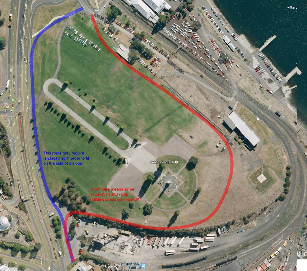
That’s because the real problem lies with the Hobart City Council. This incident occurred on the primary, and best cycling route North out of the city. The HCC maps describe this route as a “Off-road – Shared Footway/Bicycle Path.” I think I will now describe it as an “Off-road – Shared Footway/Bicycle/Cement Truck Path.”
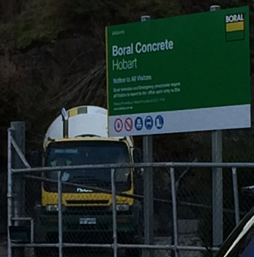
The site in question is the Boral Concrete Depot, through which the cycle route happily wends its way, and is probably the most dangerous of the obstacles which the intrepide commuter cyclist must negotiate on his or her way out of Hobart City. But it is by no means the only obstacle.
An interview
Before I go into more detail on the obstacles, with pictures and lots of fun, I have taken down an Official Report from myself, viz.:
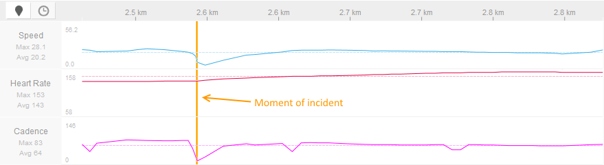
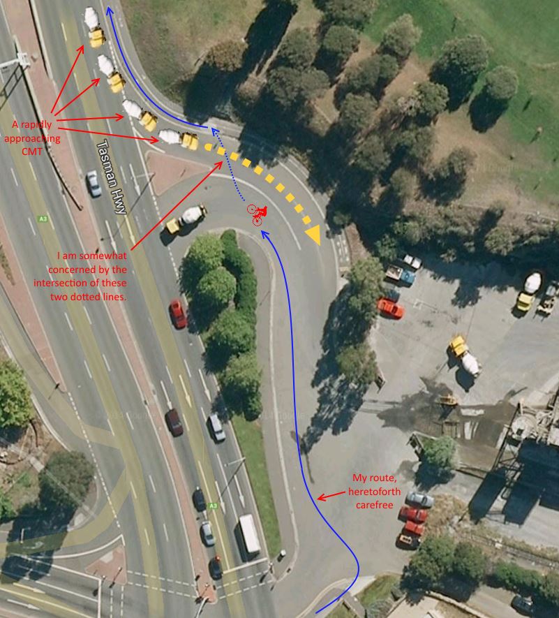
I was proceeding on my pedal cycle in a Northerly direction, at approximately twenty-five (25) kilometres per hour, through the Forecourt of the Boral Concrete Depot, upon the principal cycle route as shown on Council Maps, and paying due attention to traffic on the adjacent Highway, when my attention was caught by an approaching Cement Mixer Truck (henceforth, CMT). Said CMT was proceeding in a Southerly direction at a speed which I estimate at no less than forty (40) kilometres per hour, and as CMT had not indicated that it would be leaving the aforementioned Highway, I presumed that it would continue past the entrance into the forecourt.
To my surprise, when the CMT reached the entrance of the Forecourt, it abruptly swung off the Highway and into the Forecourt, at speed, at which point I executed Evasive Manœuvres, to wit, braking sharply and turning my vehicle (2 wheeled pedal cycle) towards the West. Additionally, I immediately alerted the driver of CMT to the impending danger with a carefully worded, shouted, phrase.
CMT then braked heavily; however this action was no longer necessary as I had already averted the danger with my Evasive Manœuvres. I then proceeded, unharmed, on my journey, albeit with an elevated heart rate (see Figure 1 – ed).
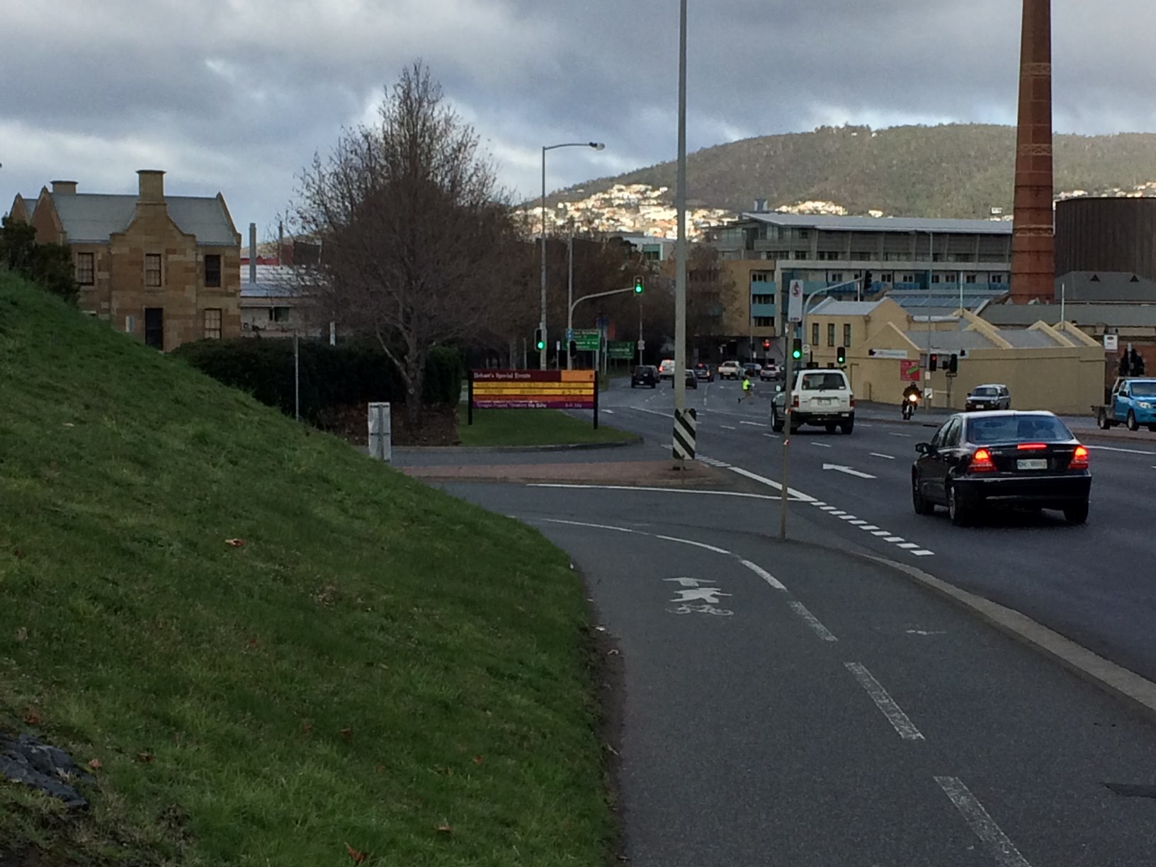
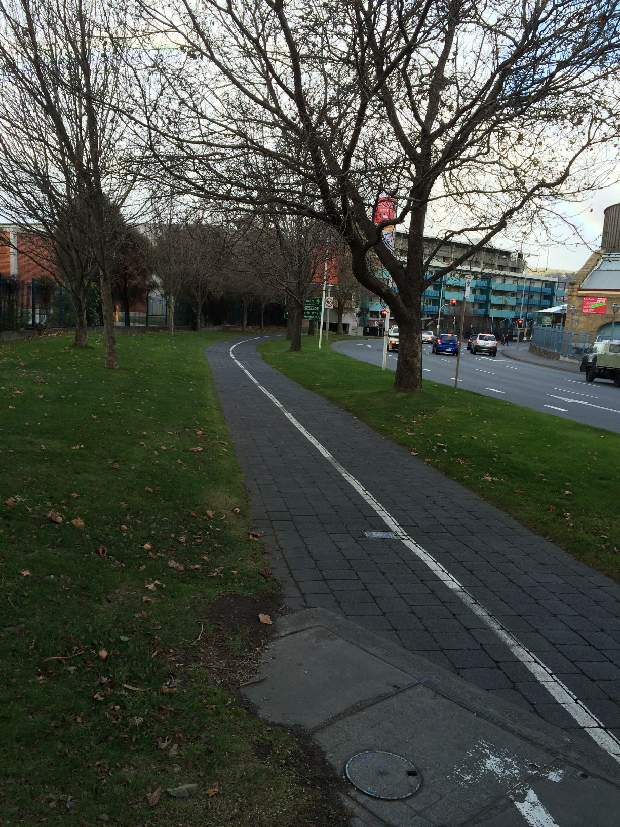
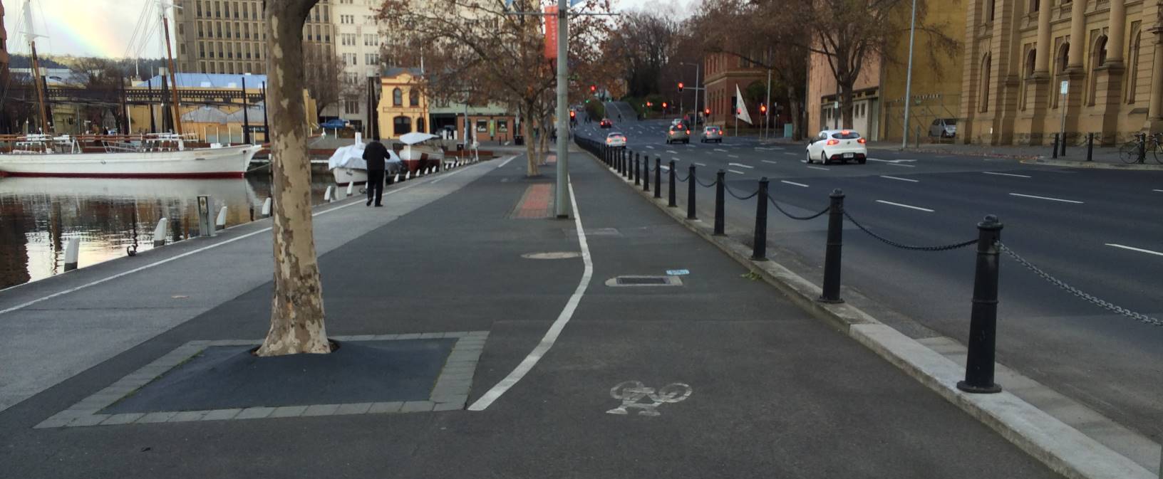
The Intercity Cycleway is by far the most established and concrete (there’s that word again) piece of bicycle infrastructure in Hobart. Following the railway line North from the Docks, through Moonah, Glenorchy and Montrose, it is used by hundreds (in Summer, thousands) of cyclists a day for commuting and exercise. And until you reach the Cenotaph, it is, by and large, a decent piece of cycle infrastructure.
The bliss of the Intercity Cycleway
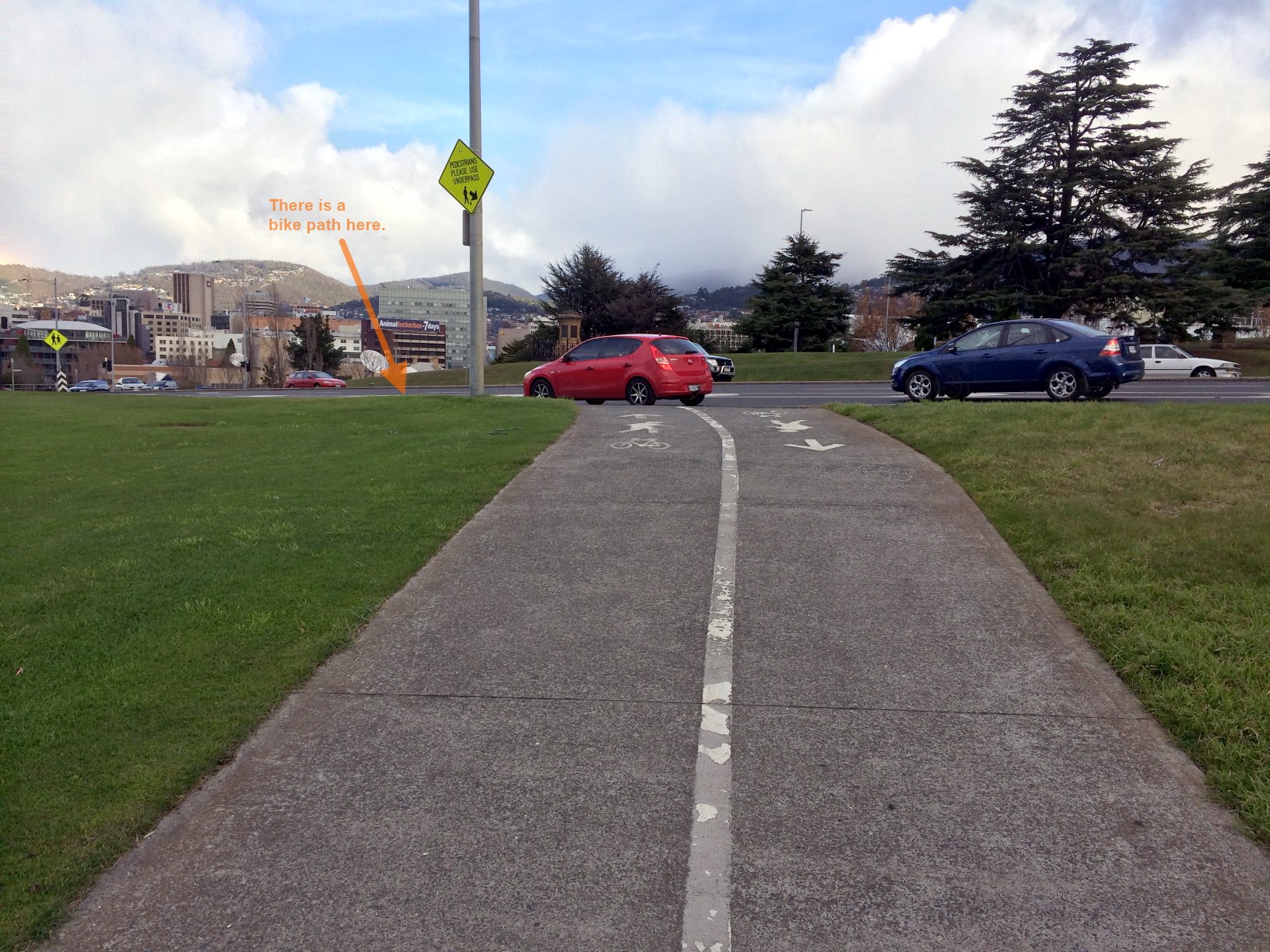
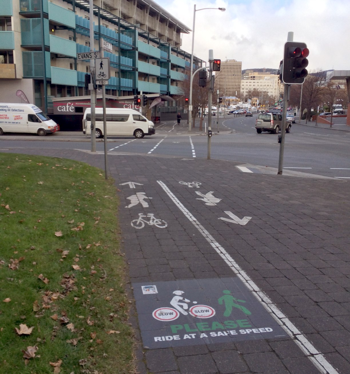
I think a good question to ask when looking at bicycle infrastructure design is: is it safe for an 8 year old to ride? Not necessarily unaccompanied, but looking more at bicycle control and potential danger points. And at the Cenotaph, things start to go downhill. First, we encounter a confusing road crossing, up-hill, with traffic approaching from 4 different directions. The confusion is mitigated by typically low speeds, but it’s not a good start.
Traffic comes from four different directions as you exit the Intercity Cycleway
After crossing the road, a cyclist is presented with two possible routes. The official route heads slightly up hill, and a secondary route heads past the Cenotaph. All well and good, almost.
Approaching the Cenotaph – Two Routes
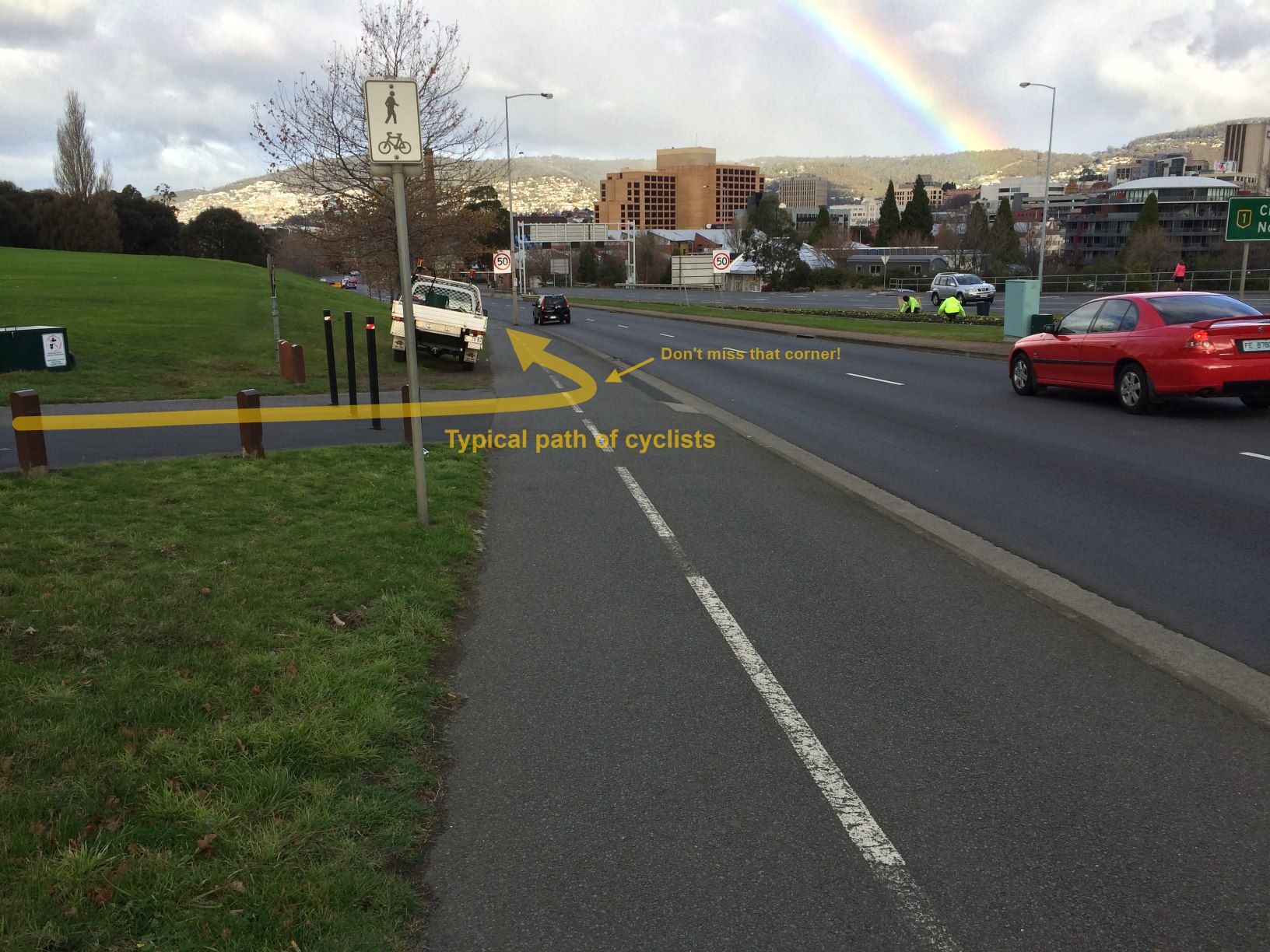
The “almost” comes into play shortly. The official route turns abruptly at the edge of the highway, where traffic is passing at 70km/h. There is no safety barrier.
Approach the Highway, and Turn Left
Here the path goes downhill, literally. The typical cyclist picks up a bit of speed here, coasting down the hill. We reach the other end of the Cenotaph route.
This point is just plain dangerous, which is no doubt why the newer, ‘official’ route was introduced. However, without signage or recommendation, there is nothing to encourage riders to use the slightly less dangerous, slightly longer route. So what’s the problem?
Mind you don’t miss the corner!
There is a conflict point with cyclists merging, at speed, coming down hill both on the official route, and the Cenotaph route. This can be a conflict with pedestrians as well.
Worse, cyclists coming down the Cenotaph route run a significant risk of overshooting, if not careful, into the highway. I have seen a cyclist do this. They were lucky: no cars were in the near lane.
Now we approach the bottom of the hill, with a blind corner. Pedestrians regularly round this corner on the “wrong” side of the shared path. Cyclists should ride their brakes down here to avoid picking up too much speed.
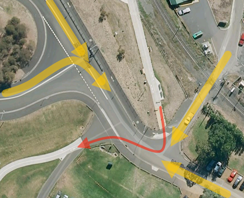
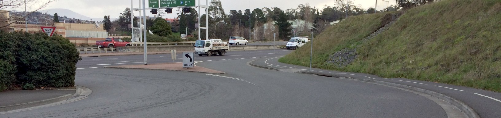
Approaching Boral Concrete
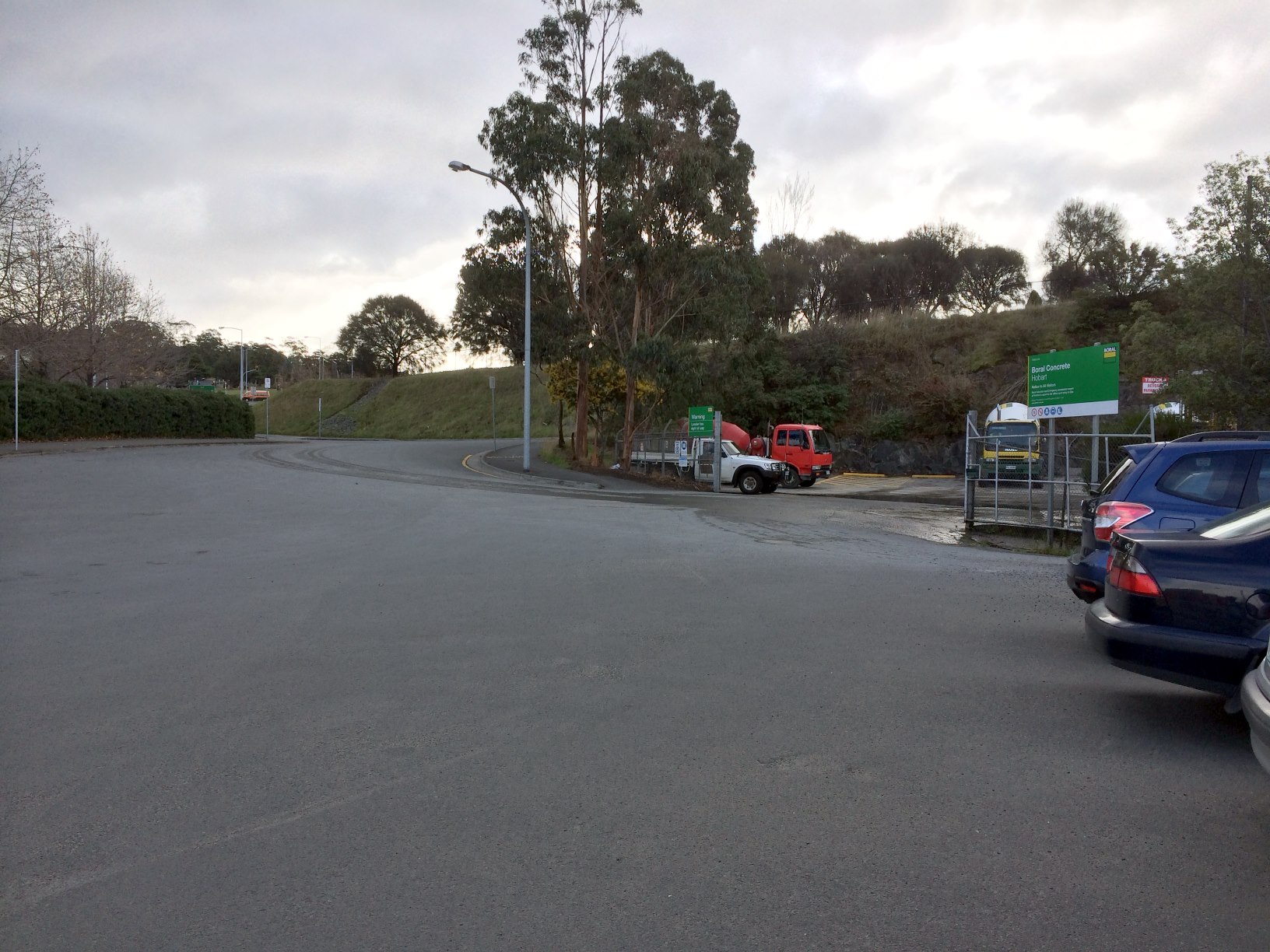
Confusion ensues: there are three marked routes here. Which is the proper route? The only frequently used route is the closest exit onto the forecourt roadway. But this exit is also the most dangerous, as I found today. The two more distant exits are just awkward to access. This forecourt is dangerous: with traffic entering from the highway, potentially at speed, and trucks turning and reversing, it’s just not a great place for bikes. Yet it is smack bang on the primary bike route into Hobart.
The iPhone does a Telephoto Spy Shot into Boral Concrete’s DepotThe Forecourt, Heading NorthYes, Ride Past the No Entry Sign to exit SouthThe Route North to the Intercity Cycleway in all its gloryOne of the three off ramps into the forecourt
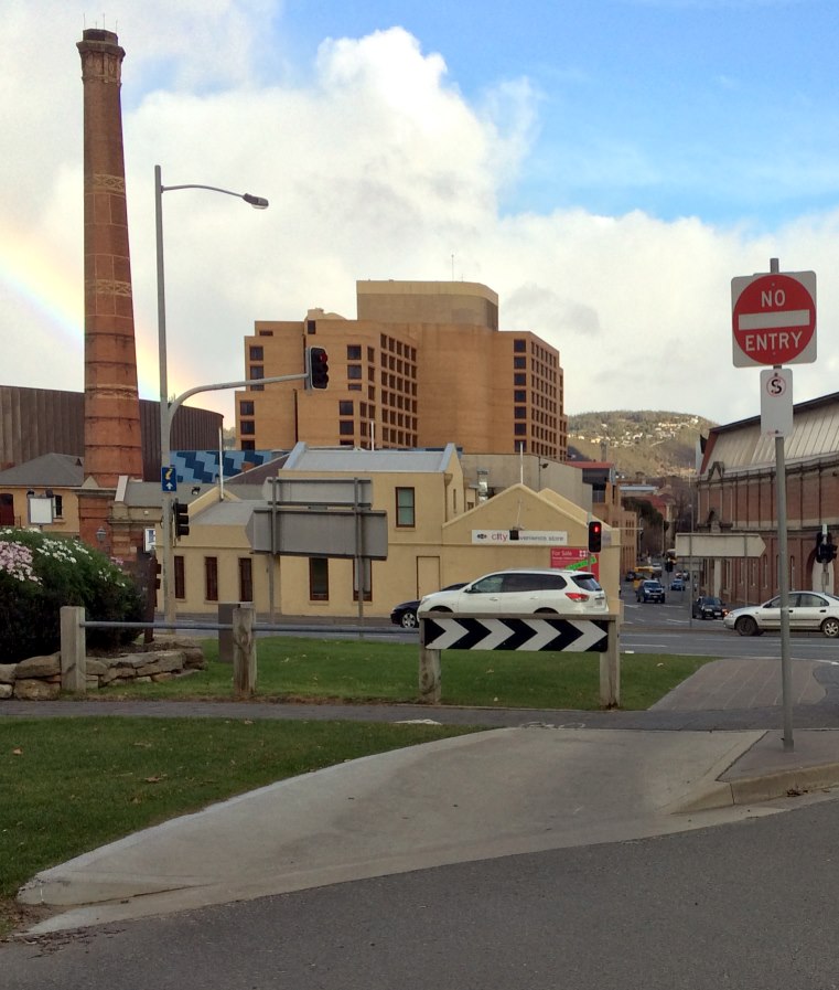
Things improve a little on the far side: we have a reasonably well marked pathway, albeit with another sharp corner right on the edge of the highway.
Turn Hard Left. This does not qualify as high quality infrastructure, sorry!
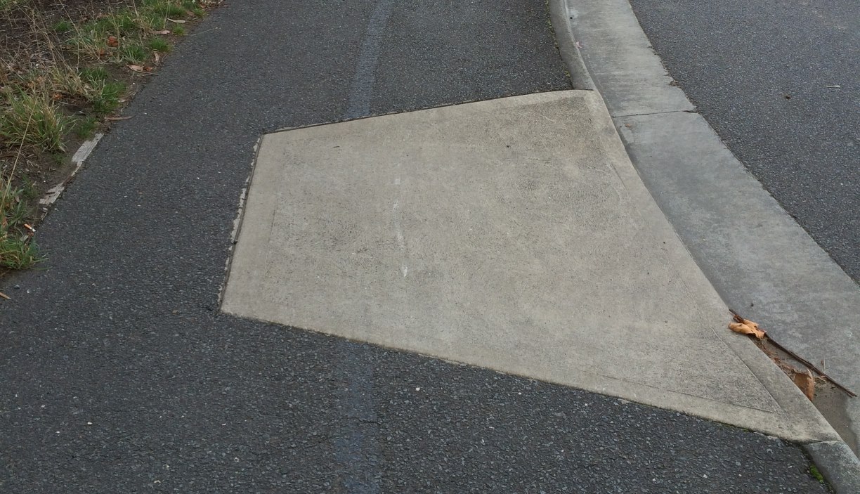
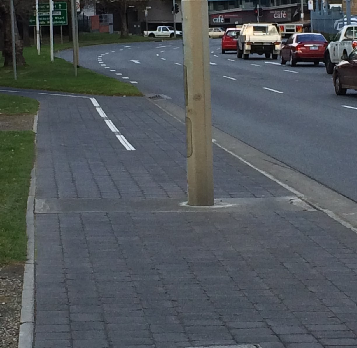
Now we are faced with a traffic light pole in the middle of the path, narrowing the path in one direction to less than a metre right beside a very busy roadway. That’s nasty.
The Pole
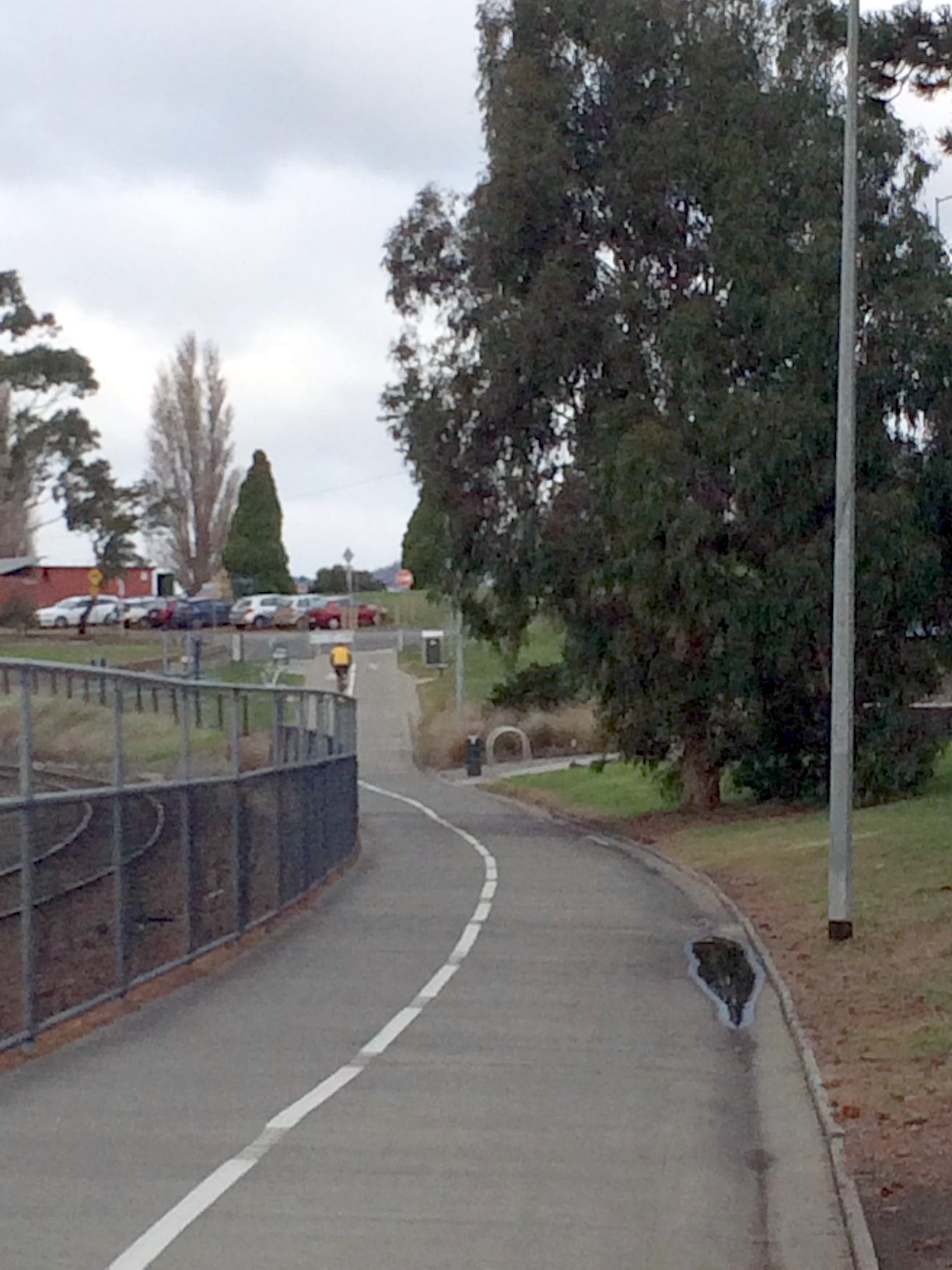
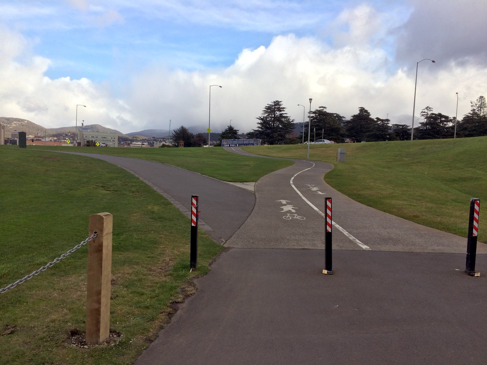
The next section, however, is quite pleasant, offset from the road and through an avenue of trees. Apart from some minor maintenance on the ‘cobblestones’ to level them out, I have no complaints.
Pleasant Times
Now we come to the Hobart Docks precinct. First we have a road crossing, with a separate light for and control system for bicycles. I’m not sure why. The button is on the wrong side of the path, causing conflict for oncoming bicycles.
Road crossing
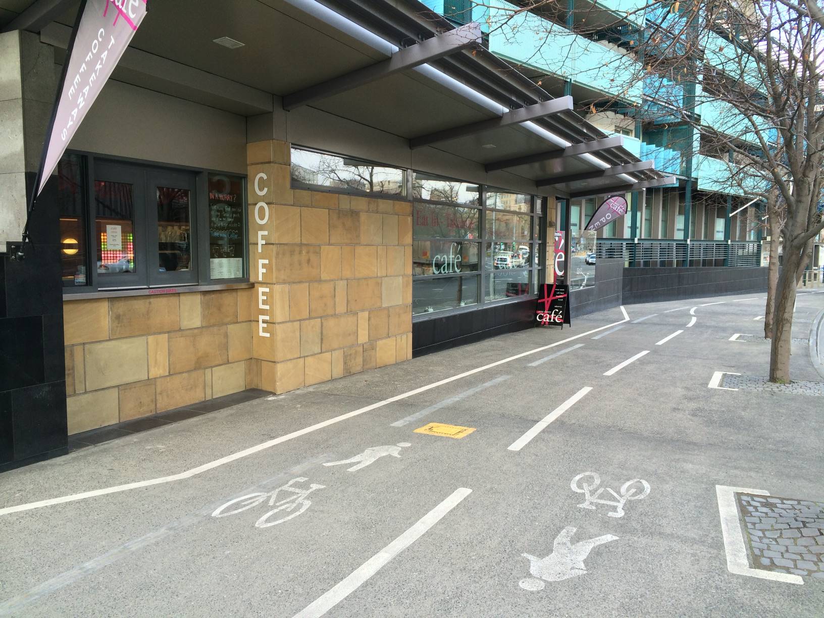
Enough has been said about the placement of this Cafe. But perhaps the signs which frequently encroach into the bike lane (not too badly in the photo today, but worse on other days) should be relocated.
The CafeA Sign Encroaches
Crossing the docks themselves is not ideal, with a path shared with pedestrians and parking cars. But it is a low speed area and most of the conflicts are overcome without too much trouble. However, the Mures carpark entrance is still dangerous, even with the upgraded crossing treatment. Sight lines are poor and I have observed drivers crossing this intersection at speed, attempting to make it into a break in the traffic on Davey St.
Crossing the Mures Entrance
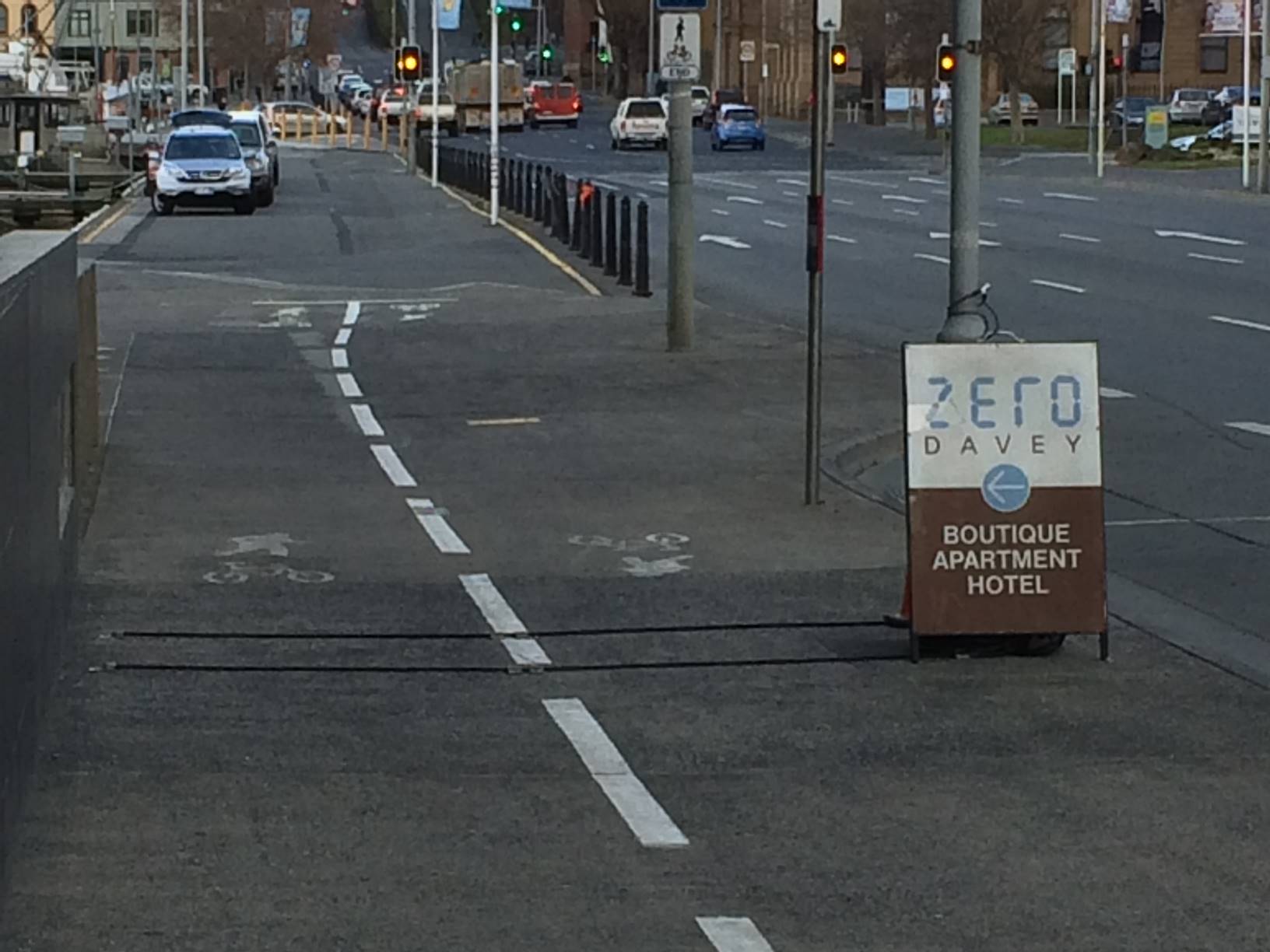
Finally, we have another shared path, with a somewhat ambiguously marked bike lane on the street side of it. Perhaps it would be better to treat the whole path as shared, and not ‘reserve’ a section for bikes if it isn’t going to be clearly marked, but it’s not a big issue.
Shared Path Past Docks
Mitigations
The sections of the track that need attention most urgently are those along the edge of the highway, and where the route crosses the Boral Concrete forecourt area.
Engineers Australia Building
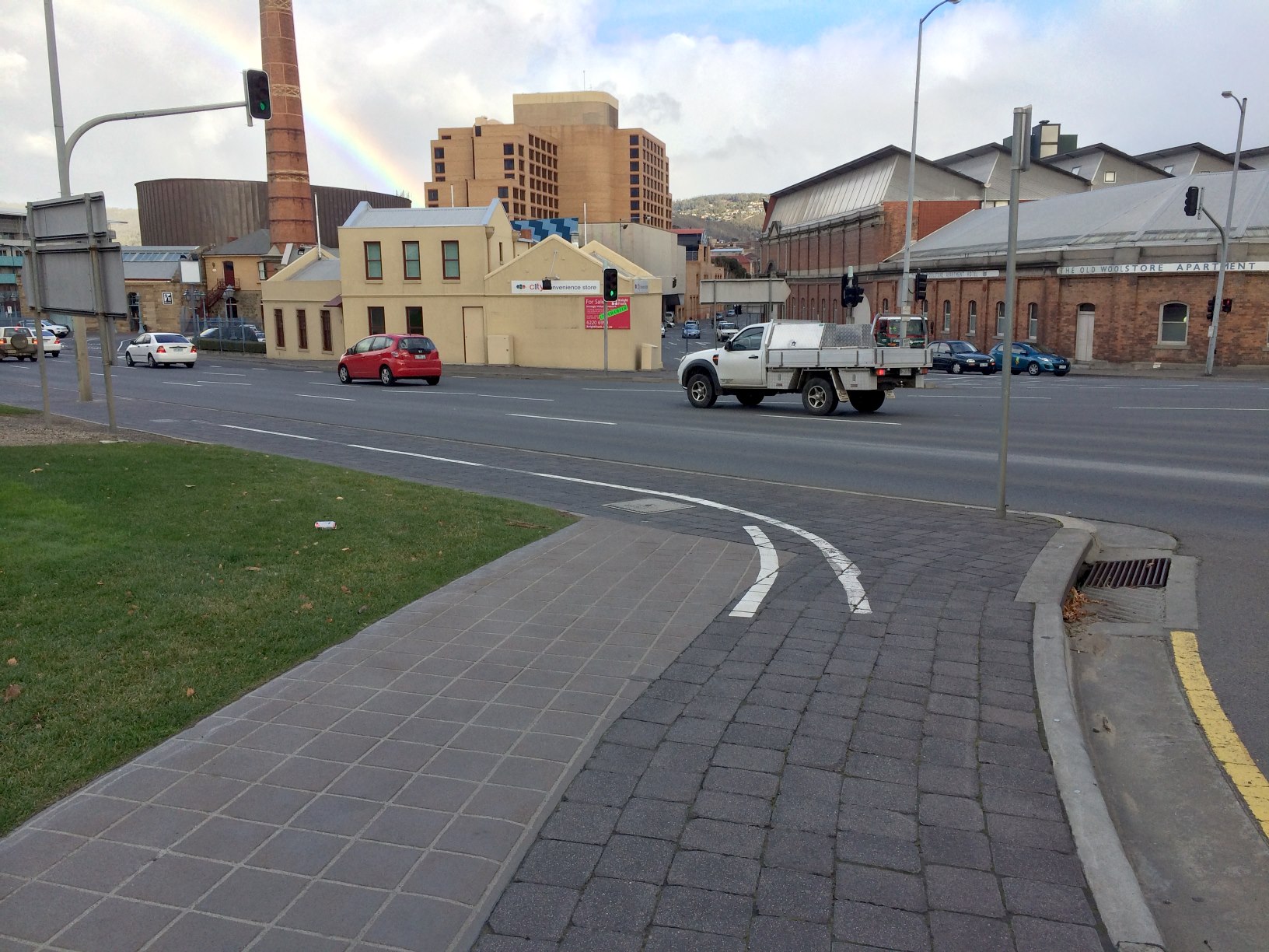
Travelling from the city this time, the first danger point, where the path traverses the edge of the highway and narrows around the traffic light pole, could be improved by shifting the bike path away from the edge of the road, and across the otherwise empty lawns outside the Engineers Australia building. No doubt there are some property boundary issues there. But perhaps it wouldn’t hurt to ask them? Even a one or two metre setback would improve the situation considerably.
Adjusting the shared path past the Engineers Australia building
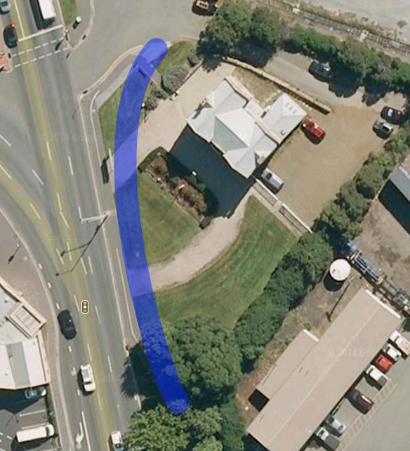
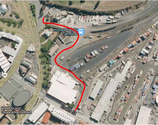
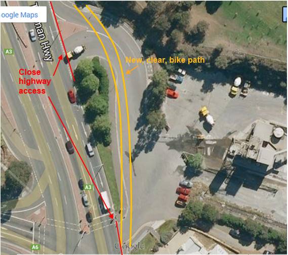
Boral Concrete Forecourt
The safest solution to this area would be to close the car and truck access to and from the highway entirely, and reroute traffic to Boral Concrete and the Engineers Australia building through the dockyards. This would also address the problematic entrance of vehicles onto the highway in the middle of a major intersection.
Alternative access to Boral ConcreteClose highway access to forecourt
This may be a hard sell, however if the Hobart City Council wants to increase the bike share into the city, it will need to take serious steps to improve the safety of this primary route through this area.
Realignment of path past Cenotaph
The bike path along the side of the highway could be rerouted behind the Cenotaph, or with some work, shifted away from the edge of the highway. Alternatively, a safety barrier could be put into place along the path beside the highway.
Alternate Cenotaph Routes: both would take some work
I’ve been wanting to write this post for quite a while. The Incident of the Cement Truck was sufficient to rekindle my blogging ‘abilities’. Other posts in the Hobart Bike Infrastructure series:
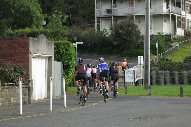
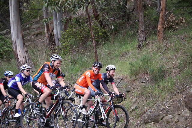
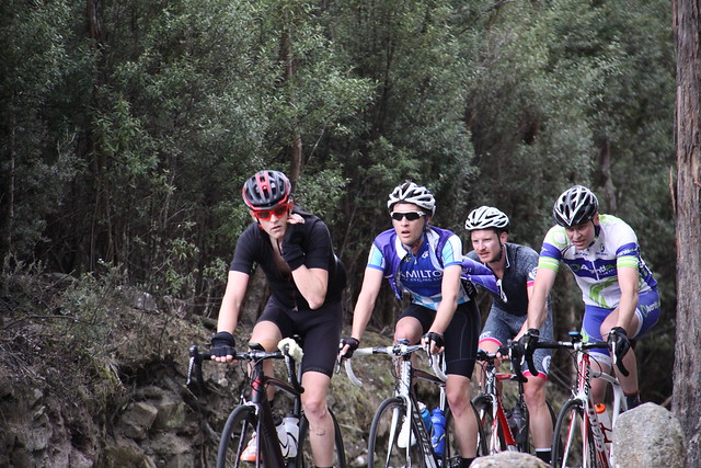
8am at sea level we gathered, 11 riders in all. The hills loomed above us, but we were not daunted. Climb them we would, and nothing would stop us. And when we had climbed them, we would descend to the depths of the valleys, and again we would ascend their lofty heights.
‘Twas a pleasant dream. And yet we prevailed. Eight and nine tenths of us completed the course, a 2600m extravaganza of climbing following a tortuous and tangled route around the foothills of Mount Wellington. One tenth of a rider? Well, Dan descended the mountain in the support vehicle. But he did complete all the climbing that was on the menu. The other Dan pled broken ribs in his early abandon. And one other rider — his name now lost to my ken — pled afternoon criterium.
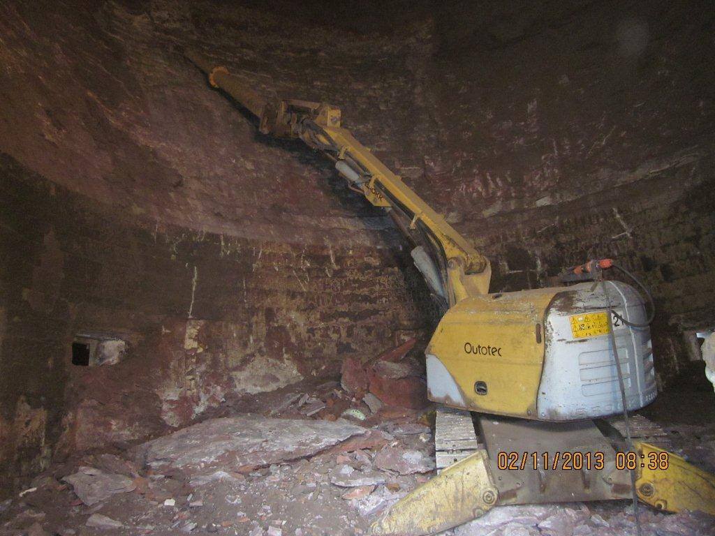
Our organisers had fled. Barry had a touch of the man flu. And Mark seemed to think it would be more fun to play with awesome slag-destroying remote control robots!
Mark’s Slag Destroying Robot
But we knew we could make it on our own.
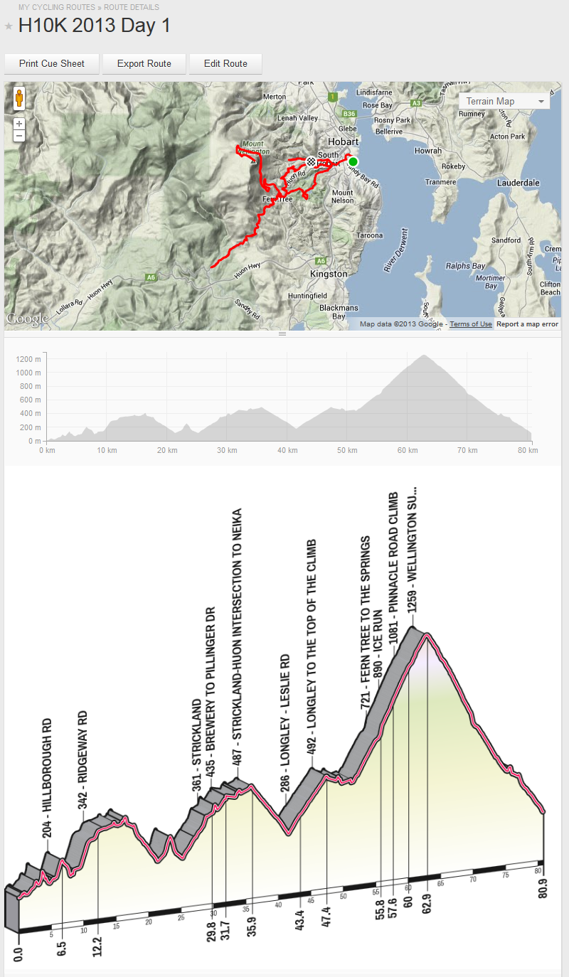
The full route, annotated
The morning started with a warm up on Napoleon St.
Napoleon St, 100m @ 16.1%. So short Mesmeride has trouble drawing it!
Then Lynton Ave.
Lynton Ave, 200m @ 12.5%
And Washington St.
Washington St. 400m @ 11.7%. But what a finish!Washington St
Followed closely by Hillborough Rd.
Hillborough Rd, 700m @ 13.6%
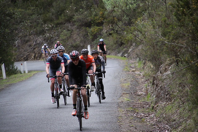
Lots of steep climbs. Even Sam was forced to swap into the little ring on some of those hills. After Hillborough Dan farewelled us, as we made our way to Waterworks, and then huffed and puffed our way to the top.
Waterworks, 1200m @ 11.8%
A welcome break was had there, as our intrepid and trusty support driver Stephen awaited with food and drink. Made the day so much better!
Back down the hill. A good sensible gradient this time, Huon Rd.
Huon Rd, 4.5km @ 6%
But back to the silly climbs with Old Farm Rd shortly thereafter!
Old Farm Rd, 1.8km @ 8.9%
That was the last of the crazy short steep climbs. Now we just had 2 climbs left: Strickland and Longley – Wellington.
Strickland we cruised, slightly quicker than I thought we would be able to.
Strickland, 3.0km @ 5.6%
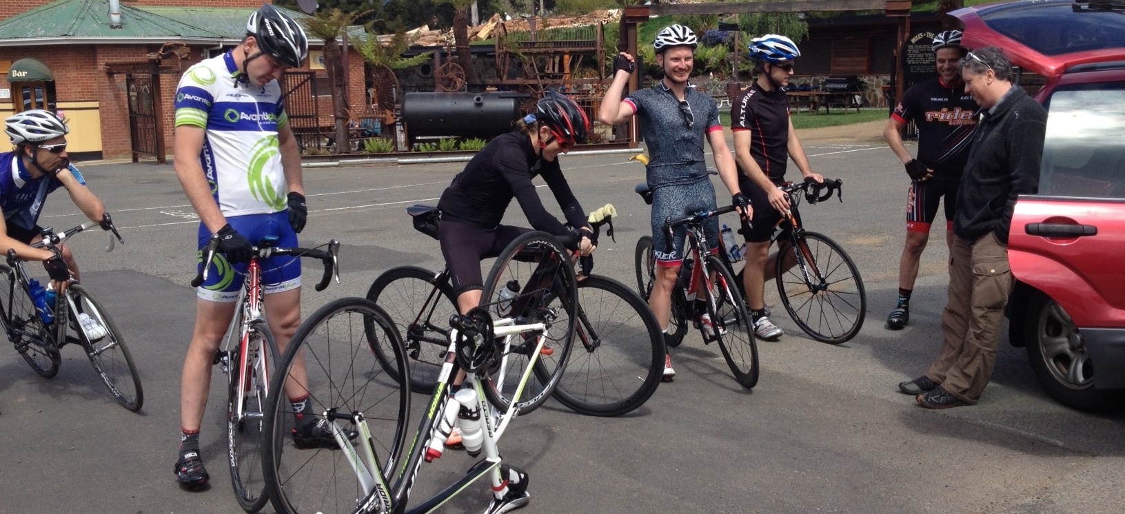
But when we arrived at Longley, another rider noticed that I had broken a spoke on my rear wheel. Yay! A quick text message to our support driver, and he turned up within mere seconds, we had the wheel swapped out and ready to ride in moments. So it seemed.
Longley Wheel Replacement
Up and up again! Longley – Neika. Neika – Fern Tree turnoff.
Neika, 5.6km @ 5.2%
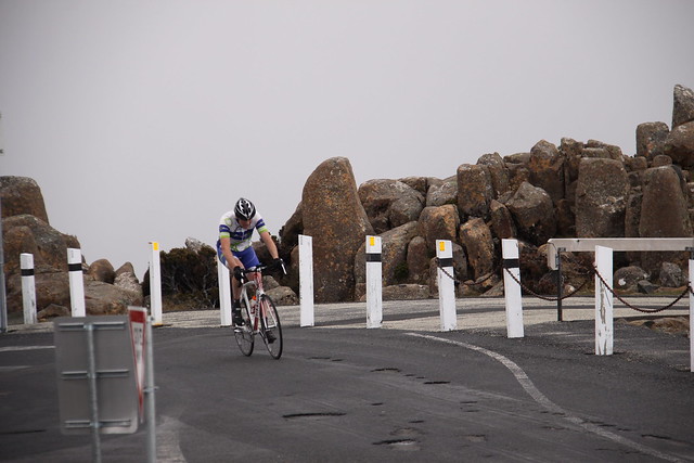
And Fern Tree to the summit of Mt Wellington. At this point, my legs were telling me ‘enough’! I dropped back from the front group, and found a more comfortable pace with Chris, and we made our way to the top at a much more survivable pace. Kudos to all the riders — Tim, Piers, Sam, and others — who finished with PRs up the final climb!
Mt Wellington, 11.2km @ 7.2%
The weather was good, still but not hot. Cloudy, just a fraction too cold on the descents, but not overly unpleasant. The company was excellent! Our support driver was great, and appreciated by all!
Sam did climb Wellington in the Big Ring. Kudos!
And the hills? Well, I was not quite defeated but I was surely sore at the end. My Wellington time was certainly not impressive, and while my heart and lungs were ready to give, my legs were not! And the next morning I could barely move, groaning my way out of bed and around the house. The forecast rain, sleet, hail and wind, together with my evident lack of form, were enough motive for me to pull out of day 2 🙁 I hope they had a good day!
Updated 5 Nov 2013: Photos added to the story. Full set of photos by our support driver Stephen are now available on Flickr
So I recently had some holidays. Weird, I know. I took two whole weeks off and only had to go into the office twice during that time. My first week had unseasonably nice weather, so I spent some timeon my bike making the most of it.
In the second week, the weather soured, so I took the opportunity to learn something of Ruby on Rails with the great Rails tutorial. I am not generally a big fan of tutorials but this particular one covered a lot of bases, and was well organised. Equally excellent were Railscasts.
OH: ruby is for people who think their programming language should make them happy. Python is for ppl who don't understand what that means
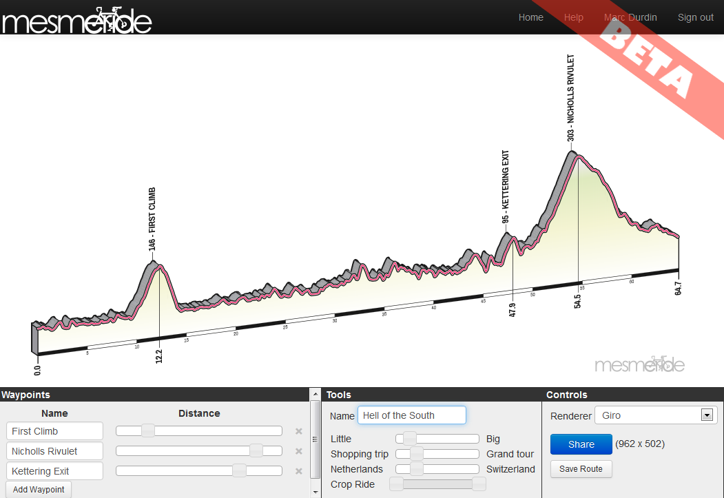
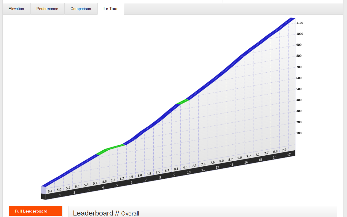
Mesmeride allows you to take any Strava activity or segment, and graph it out in a number of different styles. You can add waypoints and control the length, height and size of the presentation, making it suitable for print or web. After tweaking the style of the graph to perfection, you can share the result on Twitter or Facebook, embed the image on your blog, or save it for printing or offline sharing.
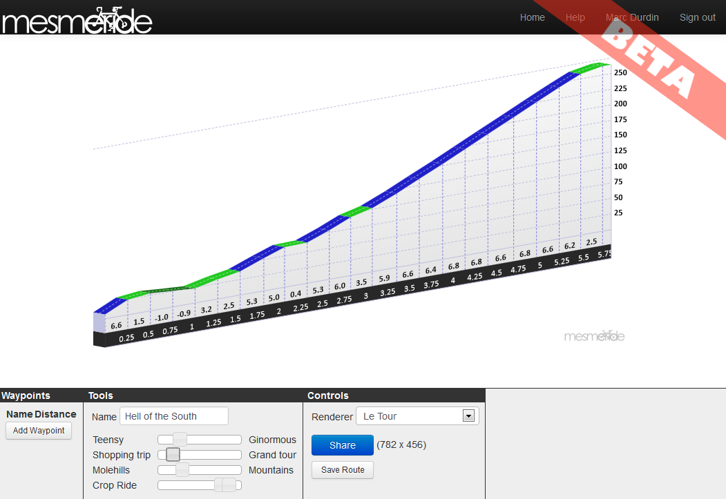
Waypoints
Any ride of a reasonable length will have points of interest. The Giro renderer will draw these onto the profile. You can add and delete waypoints, move them along the ride, and change their names in the left hand box in the controls section.
Mountains or Molehills?
The most popular or remarked-upon feature is the ability to make any of your rides, even the most flat and featureless, look like a day attacking the biggest climbs of the Alps. You can control the mountainosity of your ride with the Netherlands-Switzerlands slider (also called the Molehills-Mountain slider).
Size and Length
To help you adjust the dimensions of the graphic, for print or for web, you can rescale the entire ride graphic with the “Teensy – Ginormous slider”, or make the ride appear longer or shorter with the “Shopping Trip – Grand Tour” slider.
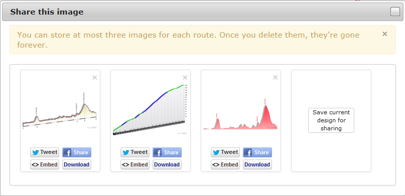
Sharing
What good is a graphic without eyes to look at it? Mesmeride has tools to share any of the graphics you create on Twitter, Facebook or even by embedding them in your blog. Or of course you can save the image and download it. The images are stored on Amazon S3, and you can save up to 3 for any given route.
Sharing your ride
I even drew the logo myself. Can you tell?
Mesmeride will save the design you create as well, and you can come back later and change it round into many other styles.
In the future I may add mapping, additional gradient styles, and more controls and waypoint types to existing styles.
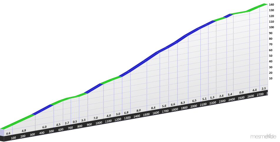
Here are a few examples from my race last weekend, via Strava. No, I didn’t do well, but never mind 😉 The screenshots above show the editor in action; what you see below are the resulting files. I even fixed a bug in Mesmeride when preparing this…
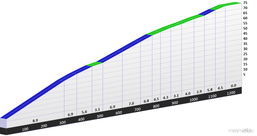
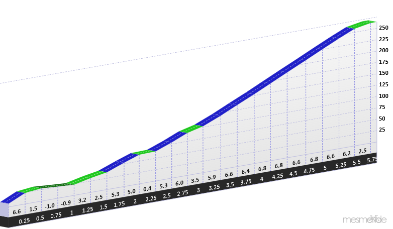
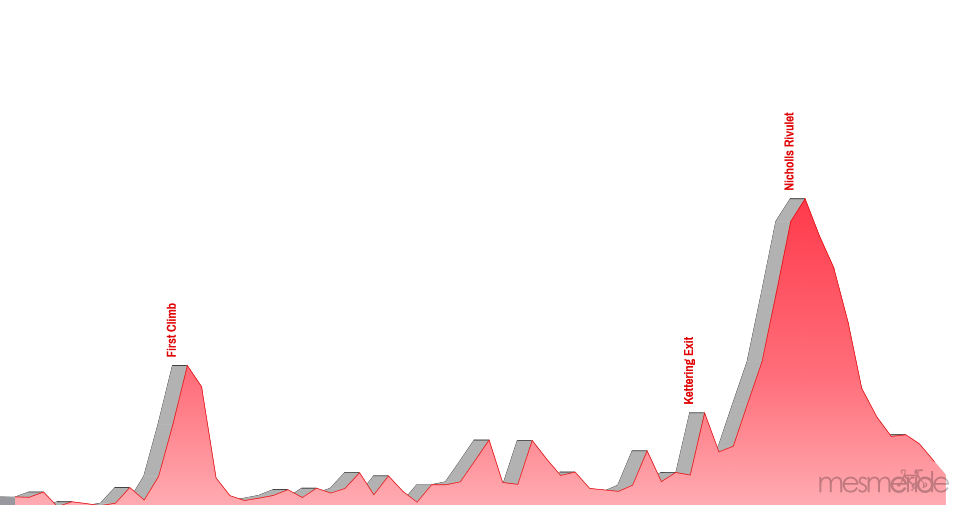
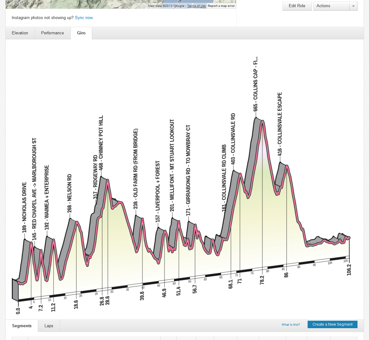
Hell of the South, full route profile, with the Mesmeride “Giro” Renderer. The waypoints are fully customisable!The Gardiner’s Bay Climb at the start of Hell of the South. Presented with the Mesmeride “Le Tour” segment rendererThe climb out of Kettering, presented in the “Le Tour” rendering style. This is the climb I came unstuck on…The Nicholl’s Rivulet Climb, a lovely, smooth winding climb which I suffered greatly on. Off the back… 🙂
To finish with, the whole ride again, in another style.
Update May 2014: As Strava’s ride pages have changed format significantly, Giro-Your-Strava no longer works. The good news is that Mesmeride does rides — but unfortunately not routes as yet.
After a comment from Mike on my previous Giro-Your-Strava post asking if the bookmarklet could support Strava’s new Routes feature, I took a few minutes over breakfast to spelunk and found it wouldn’t be too hard.
Firebug’s DOM explorer actually made the task much, much simpler. My approach was simply to look for Great Big Arrays Of Numbers. I soon found, amongst all the Google, jQuery, Modernizr, Optimizely and other objects, a pageView object, which contained a number of juicy functions, including pageView.chartContext().dataContext().elevationStream() and pageView.pageContext().routeSegments(), which gave me all the information I needed. The data structures for routes are somewhat different to those for rides, so I opted to massage the Great Big Arrays those functions returned into the same basic structure as the ride data already used by the bookmarklet, rather than touch the rendering code at all.
So… after that overly detailed introduction, here ’tis. I’ve updated the bookmarklet to draw Giro-style elevation profiles for Strava Routes as well as for Rides. And of course, Le Tour-style elevation profiles for segments still work, within individual ride pages.
Note: this still won’t work in IE10, as Github returns the wrong Content-Type for the Javascript and IE gets a little panicky about it, and, well, just use a different browser.
1. Install the bookmarklet.
Here’s the bookmarklet. Just drag it to your Bookmarks toolbar to install it:
After a few seconds the gradient graphic may refresh with the correct font — this takes a second or two to download.
That’s it! This new bookmarklet still works with rides (so delete the old one!)
The source is still all on GitHub. Again, if you improve the code, or accidentally hurt yourself while reading it, please do share with a comment on this post.
Update May 2014: As Strava’s ride pages have changed format significantly, Giro-Your-Strava no longer works. The good news is that Mesmeride does the same and more!
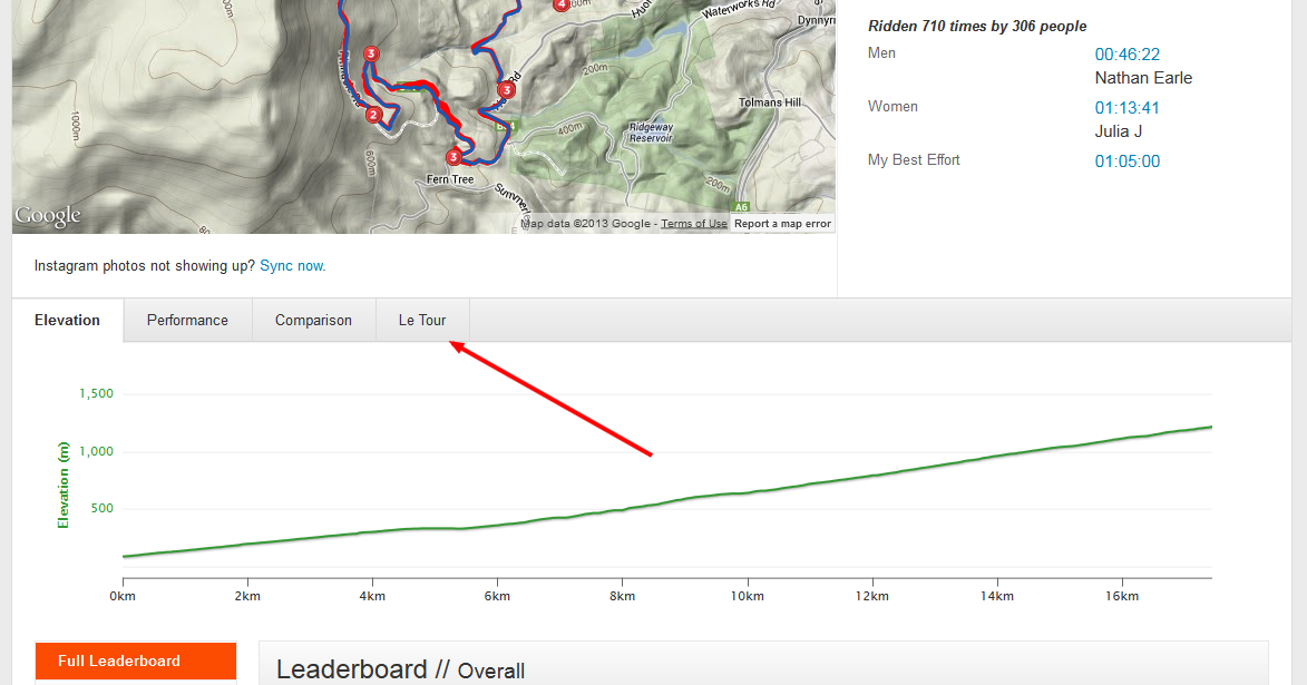
After the Strava API debacle, my little Tour Segment Gradient tool no longer works, which is sad. I’d put together a number of other Strava API-based widgets, but this was the only one which was really at all popular. Yesterday, DC Rainmaker himself mentioned (thank you Ray!) the Giro-Your-Strava elevation graph tool (which does still work) on his blog, so what better time to update the Tour Segment Gradient tool?
In short, what I have done is to dump both the Giro and Le Tour gradient mashups into the same bookmarklet. One click and you get beautiful isometric graphs for your ride (in Giro style) and your efforts (in Le Tour style). Yes, I get the inconsistency, but what would life be without idiosyncracies?
1. Install the bookmarklet.
Here’s the bookmarklet. Just drag it to your Bookmarks toolbar to install it:
2. Load a favourite Strava ride and click the bookmark.
(It’s best to wait for the page to load completely before clicking the bookmark.)
Presto, you’ll get two spiffy new buttons, one for your ride:
And one for the segment view:
So go ahead and click the Giro button, and you’ll see:
Click the Le Tour button for the new elevation profile for a segment:
Have fun!
One danger with bookmarklets that fiddle with an existing site in this way is that they will tend to break when the site updates. There are no stability guarantees that APIs (ususally!) provide, so YMMV. However, if the Strava site layout changes, it’s probably only a simple tweak to the code to get it working again.
There’s nothing beautiful about the code on the backend. It really needs rewriting and modularisation etc etc etc but hey, it works 😉 Do what you want with the code, just share it with us all if you improve things!
I received an email from Strava today which was very disappointing.
Hello Marc,
As of July 1, 2013, V1/V2 API endpoints have been retired. Libraries, sites, and applications using these endpoints will cease to work.
In previous blog updates, we’ve discussed status and access to V3 of our API. As mentioned then, we had to make difficult decisions this year about where to invest time and resources – feature development or a full-fledged API program. We have chosen to focus on feature development at this time and so access to V3 of our API is extremely limited.
Any developer who has been granted access to V3 of the API has been contacted. We will revisit our API program and applications from time to time, but for the time being, we have no plans to grant further access in 2013.
If you have questions or comments, please send an email to [email protected]. Given our limited resources, you should not expect an immediate response.
Thanks for your understanding,
Your Friends at Strava
The highlights (or lowlights) from this email:
Strava have no plans to allow anyone else to access their new API for at least six months
It seems Strava aren’t interested in dialogue with their community about this decision.
I’ve been using the Strava V1 and V2 APIs now for several years, and have written quite a fewblogpostsabout how to use it. The V1 and V2 APIs were always fairly experimental, but that was okay. We all understood that and it was part of the fun of working with Strava.
Discontinuing the V1 and V2 APIs was in the pipeline, and again we Strava API users could understand limiting the V3 API beta program to a small number of developers. However, the abrupt announcement today that not only are the V1 and V2 APIs no longer available, but now Strava won’t be making the V3 API available to anyone else for an Internet Eternity (that is, at least 6 months) either is completely unexpected.
The only Windows Phone app that integrates with Strava no longer works. My apps no longer work. And there appears to be no future for any of these apps.
Now, I’ve been a Strava Ambassador since before they started their official Ambassador program, and have had a lot of fun promoting Strava. I’ve developed populartools that integrate with the Strava API. It is a very big disappointment to me that they’ve decided to throw away all that good-will with their developer community. This is not the way to treat the most dedicated and enthusiastic portion of your user base, Strava!
Update May 2014: As Strava’s ride pages have changed format significantly, Giro-Your-Strava no longer works. The good news is that Mesmeride does the same and more! Update 13 July 2013: An updated version of Giro-Your-Strava is now available here.
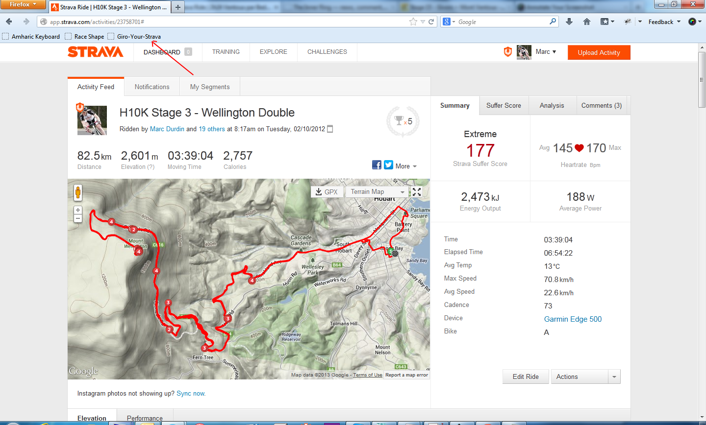
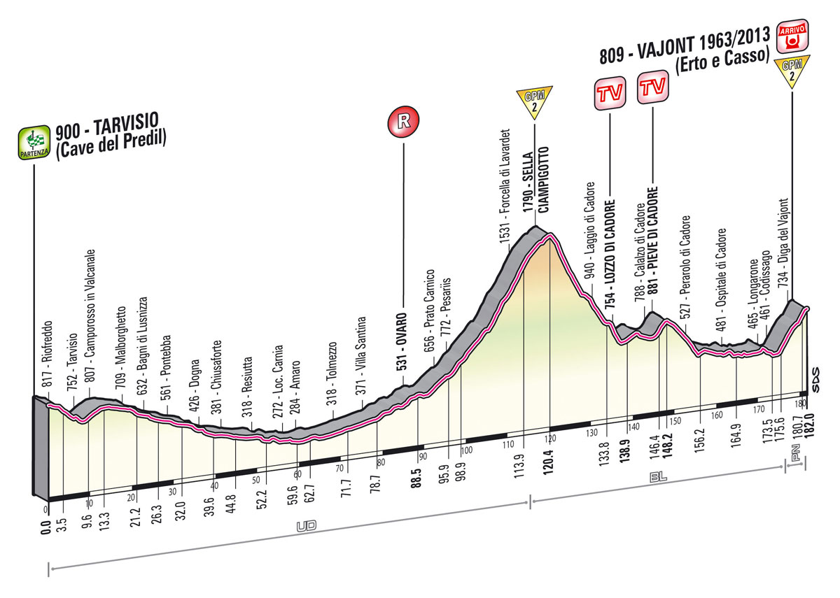
Just in time for the last few days of the Giro, I’ve finished a little after-hours Strava mashup project that builds on the segment graphs that I originally created for the Hobart 10,000.
I’m sure you’ve seen some of the Giro elevation graphs. Here’s one, from Stage 11:
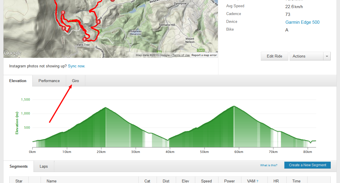
Now, here’s a bookmarklet. Drag it to your bookmarks toolbar, load up a favourite hilly ride on Strava, and click the bookmarklet.
A mysterious new button will appear in the graph menu. Go, on click it!
And up pops an elevation graph that makes it look like you’ve been riding the Giro!
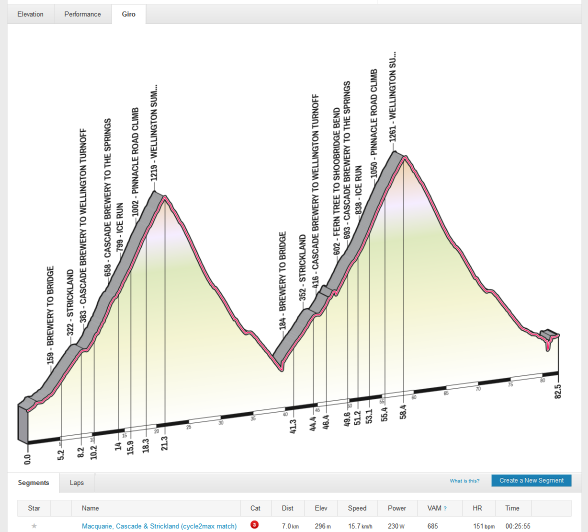
The algorithm picks the categorised climbs from your ride (and tries to figure out the most appropriate segment where multiple segments finish at the top of a hill). Non-categorised segments are currently ignored. The whole project is published on GitHub, so you can tweak it and improve it to your heart’s content. Your first step should be to tidy up the mess I’ve left you 🙂
Held each year just before the Hell of the North, Paris-Roubaix, this race nonetheless bears little resemblance to that famous race. It’s a 60km race over lumpy terrain just south of Hobart, Tasmania, and has no cobbles.
I had not planned to do this race. I had looked wistfully at the weather forecast and then my wife surprised me by encouraging me to go. Bear in mind that we have a one month old little boy, and so sleep, fitness and all the usual things necessary for riding competitively were somewhat out the door, and so it was a big gift from my wife for me to go and ride.
Still, I did jump at the chance to ride. My last race had been about a year ago, and I had really enjoyed it. I figured I’d struggle today but decided to go along, give it a crack, and just make the most of the opportunity.
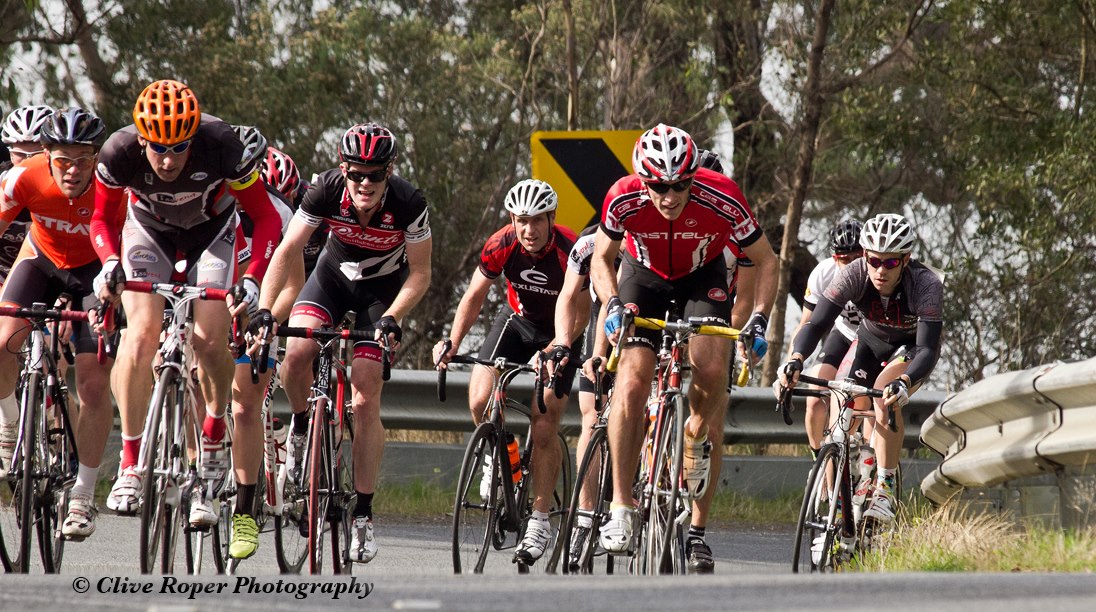
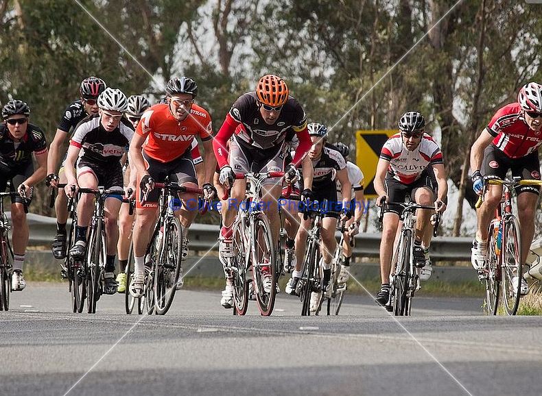
The weather was grand: warm, a light breeze, and overcast meant dry roads and a pleasurable ride whatever happened. It also meant there would be a decent turnout, and we had nearly 20 starters in B Grade. I chose to ride B Grade, mostly because my mates would never let me live it down if I sandbagged in a lower grade!
The B Grade bunch – I’m on the far left, yep in the Strava gear – photo courtesy of Clive Roper
Being a scratch race, A were off first, followed by the lower grades, one after another. B set off in a somewhat haphazard manner, at a pace that was more reminiscent of an afternoon amble to the pub than a race. Not that I was complaining…
C grade proved just how somnolent that pace really was when they roared past us and made the whole grade feel deeply ashamed of their lacklustre efforts thus far. B grade subsequently made up for this by surging back past C.
However C Grade were not done yet. They came back past B Grade and their efforts were probably solely responsible for a respectable pace in the bunch up the first real climb. Barry rode off the front a little up the climb, but we all knew he wasn’t silly enough to try and solo the entire race, so no one panicked.
At this point, my legs were a little heavy but I was doing fine. Dogga and I had been a little silly on Thursday with a well-over-threshold attack up the lower slopes of Strickland Ave, and while I suffered somewhat from this, I think he suffered more!
The next 40 or so kilometres proved to be all over the show. A dog’s breakfast. A shambles.A few half-hearted attempts to setup a pace line were tried, and some even more half-hearted attacks followed, but mostly it was just surge followed by soft pedal!
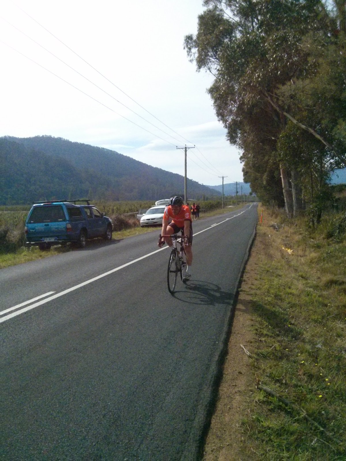
Just outside Kettering. Photo courtesy Clive Roper
This meant the final climb would be intense. Everyone was saving their bikkies for the Nicholl’s Rivulet climb.Everyone except for me. I was just hanging on, using tactics like drifting from the front to the back of the bunch on the little climbs, and feeling very aware that my longest rides recently had been only 30km or so!
Once through Kettering, the pace started to hot up a bit. A 1.2km climb at 6% sorted out the candidates from the pretenders. Me, a pretender for sure as I watched the bunch get 5 seconds — doesn’t seem like much, but was enough to make it very hard indeed to get back on. Through the turn onto the Nichol’s Rivulet climb, just a few seconds off the back and I could feel my legs telling me “enough”. I struggled to rejoin the bunch but never really made it back.
I plodded up the final climb, with a few other riders ahead and just out of reach.Over the top and decided that I would give it all I had on the descent and flat run into the line — not that I’d catch the leaders, but at least I could be somewhat satisfied with the day’s efforts!
I managed to catch Sam, but Brendon and one other rider remained tantalisingly out of reach. Adam (congratulations, I understand, are in order), Joe, Mark, Barry, Jonathon, James, Mike and others were even further up the road!
At the finish, with a very empty road behind me… Photo courtesy Dan Wood
After this appalling debacle, I expect the Strava team will want their Ambassador Kit back 😉 It seems that the great Velo Flow website is currently down, so we can’t relive the race in all its glory at present, but hopefully it will be back soon!Update: Velo Flow is back! Replay the race. You can easily spot Gerald (overall A Grade winner), and the mysterious flying Torben, and Dogga. I am represented by the bigger blue dot…
Just a short note about the group ride I organised for last weekend. The Hobart 10,000 took in 10,000 metres of climbing on hills around Hobart and went great (although only 1 rider made the 10,000m quota!) Legs still hurt! I wrote up the full story on the Hobart 10,000 site.
The riders on Stage 3, second ascent of Mt Wellington! (Photo by Iain Sheppard)