Category Archives: Cycling

Working around limitations in Strava’s Segment Efforts API

The Strava API has a call to retrieve the first 50 efforts for a segment.  In theory, the API supports an offset parameter to allow you to download additional efforts after the first 50.  However the offset parameter does not work currently in the segment efforts API.  I didn’t want to wait until V3 of the API, so…

Additionally, the segment efforts API returns efforts ordered fastest to slowest, so a naive date-based retrieval does not work, and this may also be why the offset parameter is not currently supported.

I now have a workaround which does the job (albeit a little more slowly): use the startDate and endDate parameters, which do work, to initially pull the efforts across “all time” (or, say, from 2010 to now).  If you receive 50 efforts back from the call, then split the time window in half, and retrieve each half.  Rinse and repeat until you receive less than 50 efforts for a window, at which point you know you have all the efforts for that window.  It’s simple enough to merge the arrays that you receive in response.

This works fine, but is a bit more load on the Strava servers.  For example, a segment with 425 efforts required 28 calls as opposed to 9 if the offset parameter worked, or just 1 if you could request the full set of efforts (which is still not a huge download, although really busy segments may be a bit more problematic).

I now optimise to retrieve all efforts for segments just once, then just the last few days worth later on.  The downside is that new subscribers will not have old efforts uploaded (to resolve this I may periodically do the full sync again). New segments would also bump into this issue until a global sync is done.

My implementation is not perfect (I’m ignoring errors for now), and if there are 50 efforts in less than 1 second then I’ll get none of them 🙂  Nevertheless, this little PHP code snippet is one way it could be done.

  function getSegmentEfforts($segmentId, $startDate = 0, $endDate = 0)
  {
    if($startDate == 0 && $endDate == 0)
    {
      $startDate = mktime(0,0,0,1,1,2010);
      $endDate = time();
    }
   
    if($startDate >= $endDate) return null;
   
    $startDateString = date(“Y-m-d\\TH:i:s\\Z”, $startDate);
    $endDateString = date(“Y-m-d\\TH:i:s\\Z”, $endDate);

    $efforts = $this->callApi(“/v1/segments/$segmentId/efforts?startDate=$startDateString&endDate=$endDateString”);
    $numEfforts = sizeof($efforts->efforts);
   
    if($numEfforts == 50)
    {
      // split the time period in 2
      $midDate = round(($startDate + $endDate) / 2, 0);
      $firstEfforts = $this->getSegmentEfforts($segmentId, $startDate, $midDate);
      $secondEfforts = $this->getSegmentEfforts($segmentId, $midDate, $endDate);
      if($firstEfforts == null) return $secondEfforts;
      if($secondEfforts == null) return $firstEfforts;
      $firstEfforts->efforts = array_merge($firstEfforts->efforts, $secondEfforts->efforts);
      return $firstEfforts;
    }
   
    return $efforts;
  }

Hobart’s Top 10 Climbs, #8: Longley to Neika

Huon Rd: what’s around the next corner?

This is the third post of a series on some of the great road cycling climbs around Hobart. You can be notified of new posts in the series by following me on Twitter.  The order of these climbs is completely my own whimsy.  No doubt you’ll disagree with me: leave a comment to tell me what I got wrong.  Do go and ride these climbs 🙂

Now for the climb! Longley International Hotel is a famous little pub at the base of this climb. The pub features as the starting point for the annual Wellington Challenge time trial to the summit of Mt Wellington, a 1100m climb, with the current record holder being Richie Porte, who did the climb in 2008 in 49:51, with an astonishing average speed of 25.43 km/h. In this post I only look at the first third of the climb, as the Mt Wellington climb itself will be a separate post.

The climb from Longley to Neika is very pleasant, low traffic, with mostly farmland scenery just starting to edge into the mountain forests as you approach the top. The climb is not particularly steep, averaging 5.7%, but it is long enough at 5.5km that you’ll have to work to make it to the top. The turnoff to Leslie Vale is roughly at the 40% point, which makes a nice milestone. Until you reach this corner, your views will be focused on the North West Bay River valley as it winds its way around the back of the Wellington plateau from Wellington Falls down to the sea.

After the turn-off, you continue climbing on the other side of the ridge. The views are now massive vistas of Storm Bay and the D’Entrecasteaux Channel between the Tasmanian mainland and Bruny Island. I particularly enjoy the two corners which have a divider in the centre of the road; they are also great waypoints and once I pass the second one, I know I am near the top of the climb. The gradient is relatively consistent, until a slightly steeper ramp at the very end as you approach the old Neika Schoolhouse.

I can’t think of much more enjoyable riding than this climb on a sunny summer morning!

This road is also wonderful for descending, without any overly steep corners and a decent surface. Just watch out for damp shaded sections and leaves, even in summer.  (Note: roadworks in recent weeks has trashed the surface and left lots of mud on the road…  I hope they clean up their mess.)

Your Challenge: ride this climb entirely over your heart rate anaerobic threshold.

Coming up in my next post, a climb that is not in the foothills of Mt Wellington

Longley to Neika
Distance 5.5km
Category 3
Elevation 314m
Gradient 5.7%
Maximum Gradient 8%
Time from city 45 minutes
Traffic low
Strava http://app.strava.com/segments/629095

How to get to the climb: The nice way: Take the “commando” route south through Kingston and turn right towards Sandfly just before Margate. Cross the Huon Hwy and turn right into Longley. This route takes more than 45 minutes — just take Davey St and stay on the same road until you get to Longley for the short route.

Longley Pub (or Longley International Hotel)

The valley at the base of the climb

Your climb starts here!

The first third of the climb is lined with sparse gums

Leslie Rd to the right will take you towards Kingston

The climb continues

If you are taking it easy, enjoy the views.  If you are trying to beat Richie’s record, here’s a view that you missed…

And more views

Evening light

Onward and upward

Lots of shaded (damp) corners

Waterfall on the way

Near the top here!

And there’s the crest!  Sprint!

The climb in winter — a little more treacherous!

Early morning descent

Descending Huon Rd with my daughter

Other posts in this series:

Hobart’s Top 10 Climbs, #9: Nelson Rd

Bend 3 of the 7 famous hairpins.

This is the second post of a series on some of the great road cycling climbs around Hobart. You can be notified of new posts in the series by following me on Twitter.  I have ordered these climbs according to my own preference.  No doubt you’ll disagree with me: just tell me in the comments!  I hope this will inspire you to go and ride these climbs 🙂

Enough blather, what about the climb?  I was in two minds as to whether or not I’d include Nelson Rd in this catalogue of climbs. It is quite a suburban road, and doesn’t have the quiet back road feel of most of the other climbs around Hobart that I’ve chosen for my top 10. However, the road has some unique and fun features, particularly 7 hairpin bends, and it is also well suited to a tempo style climb for each straight. This allows you to build up a nice rhythm with a high tempo run to each corner, out of the saddle to power around the hairpin, and then back on the seat and into your previous cadence on the next straight. Unfortunately, the lumpy road surface does throw your rhythm as you bump over driveway ramps, but I guess that’s all part of the fun!

I mark the start of this climb at the intersection between Churchill Ave and Nelson Rd, although Nelson Rd does start down at the Casino at sea level. The section of the climb between the Casino and Churchill Ave has a lot of traffic and the intersection with Churchill Ave is a hassle because of the traffic, so I’ve excluded that from the climb.

As I said above, the best features of Nelson Rd are the seven hairpin bends, which make great waypoints on the climb. Although after Bend 4 one starts to lose track and there’s always a bend or two more than you hope!  In future years, no doubt these will be commemorated with the names of famous cyclists who have conquered this climb.  I think I’d like to have Bend 3 (pictured above); you can claim one of the other ones.

After the seventh bend, marked by two big water tanks, you crest onto the “plateau” of the hill and follow the climb, which continues at the same gradient, albeit without all the zigzagging, to the finish at the intersection with Olinda Grove. This section of the climb is not very interesting but you will need to keep the power on all the way to the very end if you want to take the KOM in Strava!  (I should mention that the KOM is currently mine and I’d like to keep it that way, okay?)

Take a left at the end to ride to Mt Nelson Signal Station for incredible views over south eastern Tasmania (definitely recommended) and coffee. Turn right to take the quick way down on Proctor’s Rd. Or if you are crazy, down the Southern Outlet.

Your Challenge: ride 3 repeats in a lunch break

The next post describes a climb with a very different feel

Nelson Rd
Distance 3.9km
Category 3
Elevation 232m
Gradient 6%
Maximum Gradient 10%
Time from city 10 minutes
Traffic medium (watch for buses)
Strava http://app.strava.com/segments/628934

How to get to the climb: Take Davey St south, and turn left onto Antill St, and follow Antill St/Regent St/Churchill Ave through the University. Nelson Rd is on your right just after the University.
Nelson Rd: the climb starts here.  Bend 1 is immediately ahead

Nelson Rd is made up of long straights, and …

… Hairpin bends.  This is Bend 2

Lumpy driveways to negotiate ahead

Pleasant scenes on the climb

Bend 3

And another long straight!  Keep that tempo going

Bend 4!

More trees provide some shade

Bend 5…  Two to go.

Bend 6 ahead

Gardens to distract from the pain

Bend 7, no more hairpins after this, just a slog to the top

And here’s the top

You can ride back down Proctor’s Rd — take it easy though, it’s busy!

Other posts in this series:

Hobart’s Top 10 Climbs, #10: The Domain (Carriage Drive)

Carriage Drive on The Domain

This is the first post of a series on some of the great road cycling climbs around Hobart. You can be notified of new posts in the series by following me on Twitter.  I have ordered these climbs according to my own preference.  No doubt you’ll disagree with me: just tell me in the comments!  I hope this will inspire you to go and ride these climbs 🙂

Onto the climb!  The Domain is a great little climb within 5 minutes ride of the city centre. My friends and I use it for doing repeats. The climb starts at the bottom of Carriage Drive, a smooth little one way road that winds its way up the Domain. Be aware that the road becomes two-way half way up the climb.  Initially a gentle gradient, the climb lures you into a pace of up to or even over 30 km/h, until you round a bend half way up and the gradient triples! This is guaranteed to pour that lactate pain in as you drop through the gears.

But immediately after the steep pinch, the road levels out for a couple hundred metres, where no doubt you’ll work hard to put the pace back on again. On reaching a 4 way intersection, turn right (don’t forget traffic in your pain-induced haze), and follow the curves in the second half of the climb around to the summit of the hill. Keep following the road straight round the circle at the top, and back down the hill, then roll round to the bottom of Carriage Drive to do it all again!

See if you can fit in 5 repeats in a lunch break!  Coming up in my next post, a climb that zigs and zags…

The Domain
Distance 2.2km
Category 4
Elevation 102m
Gradient 4.6%
Maximum Gradient 15%
Time from city 5 minutes
Traffic low
Strava http://app.strava.com/segments/634467

How to get to the climb: From the Cenotaph, ride under the highway, turn right, and immediately after entering the highway, exit left. Carriage Drive is 50m ahead on your left.

Your climb starts here

Continuing up the hill

Governor’s digs on your right

Watch for traffic as you fly through this intersection

Round past the sports grounds

Turn right here

Road surface is a bit rougher now

Almost there!

The top of the climb

Other posts in this series:

Strava segment statistics site updates

I made some small tweaks to my Strava segment stats website recently. This includes:

  • Fixes for rendering issues in the lists
  • Ability to hide bogus segments, similar to the Strava flagging function
  • Dynamically sortable tables
  • Underpinnings for anyone to be able to have their stats updated automatically (but UI for this not yet complete)

Currently I also have an issue with the Strava API, where segments with more than 50 efforts cannot have all efforts populated. Once I have a resolution for this, I’ll publish another update with the ability for anyone to view their stats.

Hell of the South

I’m sitting down on a quiet Sunday evening writing this race report with rather a sore shoulder.  I guess I’m writing this race report for Iain — others can read if they want!  So the race was The Hell of the South, a great race run by Southern Tasmania Veterans Cycling Club, a 65km loop around some lumpy roads and including two decent climbs, starting from the small Huon Valley town of Cygnet.  This is the only race I’ve done with STVCC.

Today the race lived up to its name.  Unlike the gentle and gracious conditions the Orange Army were contending with in Victoria, we had a real race to fight!  The turnout to the race was surprisingly good, given the terrible weather conditions and the Around The Bay challenge happening in Melbourne on the same day.  I was feeling reasonably good about my condition and how prepared I was for the race, so I signed up for B grade.  With the format of the race being graded handicap, no drafting of other grades was allowed, so B grade was sent off last to prevent a mixup with A grade.  That’s a good incentive not to get dropped…

While we waited for our turn to leave, the weather just kept getting worse, until when we finally left, it was raining properly, cold, with a bit of wind just to keep us motivated.  A controlled roll through Cygnet, then the race set off in earnest — well, not really.  I think we were all happy to ride at a decorous pace with the level of water on the road and in our faces.  When we hit the first climb, things amped up a bit but it wasn’t out of this world crazy.  I ended up on the front for the descent, which was nice, because it meant I could descend at a pace that suited me, and the conditions meant that no other rider was going to try and pass.  We swapped turns in the bunch all the way through to Kettering, even getting a little bit of sunlight on the way, and things were starting to look up.  I was happy on the front for my turn, I was able to hang on in the bunch, and I was wondering if I might even be able to challenge for a podium position.  But just after Kettering, disaster struck.

I was following another rider, who I shall leave unnamed, when he suddenly sat up — I’m not sure if he then realised that he should move out of the way before slowing down, or not, but as I started to go around him, he moved right, and we crossed wheels.  I came straight off, and at least one other rider also collided with me and came off.  The other riders came off okay, but my bike was unrideable.  The left hand brake lever was twisted and was no longer working.  Without two good brakes, there was no way I was going to ride down the soaking wet descent.  So my race ended right there, at the base of the big climb.

One of the unofficial race support cars stopped to pick me up (thank you ladies!), and we took off again to follow the riders.  Not 2 minutes later, the skies opened, and started hailing in earnest on the remaining riders.  Now I wasn’t sure if I was so upset about being out of the race any longer.  The remainder of the race saw increasingly sad riders grimly struggling against hail, wind and rain — not a pleasant descent of the hill!  I sat resplendent in the comfort of a nice warm car and watched their pain.

Later, I discovered that the brake lever did still sort-of work, and I could probably have straightened it out and kept riding.  However, as it was damaged I guess it’s probably for the best that I didn’t depend on it for the descent.

Coming back into Cygnet in the comfort of the car…  Hailing outside.

Bike seat a little the worse for wear

And twisted brake lever.  Sort-of working now.

I came off lightly. (Photo by my daughter who was keen to do the photography of my bruised shoulder)

My brother survived an expected side trip onto the gravel on the big descent a couple of years ago.  Lots of fun!  And that’s the only picture I have of the course…

Reviewing my ride afterwards, I don’t think anyone in B grade was riding at threshold today.  At no time during this race did I find myself desperately struggling not to be dropped.  It was certainly very different to Longford – Campbelltown or Grindelwald Challenge, both of which stretched me mightily — and broke me!  My average heart rate this time was only 155, even with a small bunch and the inclement weather.

I didn’t hang around long after the race — I was quite cold, late for family and well, I didn’t win anything 🙂 Next time.  For now I’ll have to live with the three little letters DNF next to my name…  Note — the elevation profile in the Strava map is pretty inaccurate, so everything based on that, i.e. power averages, etc, will also be out of whack.  I reckon the Garmin was so wet its altimeter was on the blink (there’s a hole on the base of the Garmin for sensing air pressure — if it gets blocked, no altimeter).  Lucky I wasn’t in a plane I guess.

The Tour of Tasmania Team Time Trial

Update: Photos now included.  All photos bar the last one courtesy of Rob Cumine.

There was quite a bit of buzz leading up to the initial stage of the 2011 Tour of Tasmania, an 18km team time trial (TTT) up the 1200m Mt Wellington climb starting from Cascade Brewery. As various commentators described the stage as “innovative”, “unique”, “ground-breaking”, and even “stupid”, I was keen to see for myself how it would pan out. I was a little dubious as to how it would work, but it turned out to be a spectacular way to shake up the General Classification and inject some spice and suspense early in the race.

So why the controversy? While up-hill individual time trials are common, the tour organisers claimed that this was a world-first for the team time trial format. Some riders suggested that only a team stacked with climbers could win, and this meant it was not a sensible format. But I wondered if that was any different to having a team stacked with time trial specialists for a traditional TTT.

I took the day off work to watch the stage. The day dawned foggy and pretty chilly; together with my mates Ant and Phil, we scouted out the climb early in the morning, then descended back to the start line to meet the rest of the group who would join us to cheer on the pros. The mid-morning descent left all of us shivering and I found myself in that zone where one struggles to care enough to keep focused on the road. Thick fog on the descent kept our speed at about 20km/h, cars looming out of the mist at the last moment to keep us on our toes. Even at that low speed, we still froze. Fortunately, the fog thinned out a bit by the time the race started, but half the climb was still fog shrouded.

After joining the rest of the group at Cascade Brewery, we climbed at a much more leisurely pace for a second time, before selecting a vantage point about 2km from the summit to watch the race unfolding. Our vantage point was chosen mostly on the basis of it being a bit sunny!

The race favourites were definitely Genesys Wealth Advisors, given that they’ve won every National Road Series race this year so far, as well as collecting a hefty swag of stage wins. But they expected a challenge from the Russian National Team and Jayco/2XU, and a challenge they got! In this TTT there was not a time cut, and the top 4 riders for each team all got the time of the 4th rider over the line. For those teams with 4 riders, it was just pure survival. Larger teams could afford to burn up some domestiques in the faster first third of the climb up Strickland Ave.

I think the key image I took away was the pain etched into so many riders’ faces, especially the 4th rider of most teams — I’m sure this would have been a resounding personal best time for many of these riders, while the strongest climbers on each team had it relatively easier. In a typical TTT, stronger time triallers do take longer stints on the front, but in this climb I’m guessing the stronger climbers were on the front the whole way to the top!

Most teams were down to four riders as they passed us, and in a couple of cases the fourth rider was really struggling, with lots of urging and encouragement from team members and director in the team car following.

Jayco/2XU gave us a new call for future group rides. No more “easy on the front” calls: as they rode past us, the leading rider accelerated slightly, provoking a heartrending cry from the fourth rider, “what on earth are you doing?!?” and the team director panicking a little with a “hey hey hey hey hey” yelled out of the car window. Even in 2-3 seconds that little acceleration had opened up a sizeable gap in the group.

Also amusing was local rider Danny Pulbrook of Pure Tasmania tonking past on a green mountain bike borrowed from Scott of Ray Appleby Cycles after apparently destroying his derailleur earlier in the climb. He nearly stopped to swap to one of our road bikes but decided he couldn’t afford to stop again…

After the last Genesys rider passed, we hopped back on our bikes and followed him to the summit. By that point I had put on my winter rain jacket as I was getting pretty cold, so I was surprised by how many riders opted to ride down given the chilly, foggy descent!


Heading down afterwards, approaching the fog (R.Cumine)

So he’s not one of the pros, but at least he’ll survive the descent, right?

So what’s the verdict? Jayco/2XU took line honours with a strong group of climbers; Genesys managed 2nd place, 17 seconds behind the leaders, with the Russians a further 17 seconds back. The results were closer than I expected, with all teams finishing within 8 minutes of the leading team, and the last rider crossing the line 20 minutes behind the leader. The stage essentially became a test of each team’s ability to encourage its riders to climb faster, but it was much more dependent on having 4 strong climbers than a traditional TTT where stronger riders do more work — no chance of any real recovery behind the other riders on a climb! The format actually worked a lot better than I expected, and kudos to the tour directors for generating some press and interest in the race this way. That said, however, I don’t reckon we’ll be seeing a TTT hill climb in the major international tours any time soon.

Now forget about the pros; what about our times? I came in at 1:09:24, about 1 minute behind the slowest “pro”; Ant is a great climber, and was 3.5 minutes ahead of me (and looked fresh as a daisy at the summit), and Phil 2 minutes ahead of me — and they waited for me at one point. But at least we did the mountain twice!

The two abreast rule: when is it safe for cars to pass cyclists?

One of the most contentious Tasmanian road rules regarding cyclists is the Two Abreast Rule (quote here from VicRoads):

Bike riders must not ride more than two abreast (two bike riders riding next to each other) unless overtaking. Bike riders riding two abreast must not ride more than 1.5 metres apart.

Whenever this rule is mentioned, you’ll typically also get some free advice:

When riding two abreast please consider other road users and, if necessary, change to single file to allow motor vehicles to overtake safely.

So, my question today is, when is it safe for motor vehicles to overtake? I’m going to look at this in the context of Bonnet Hill in Hobart. Channel Highway on Bonnet Hill is a narrow, 60km/h semi-rural road connecting Hobart and Kingston. It is a minor road, and most traffic uses the 100km/h Southern Outlet. There are no overtaking sections on Bonnet Hill.  It is one of the most-used bicycle routes in Hobart.

In terms of my measurements, here are the basics.  Bonnet Hill is fairly typical of Tasmanian rural roads — in fact it is wider than many roads around Hobart.

Lane width 3m (total roadway 6m)
Typical bicycle width 0.45m
Typical car width 1.75m
Recommended distance from edge of road for cyclist (to tyre) 0.5m
Recommended minimum distance between car and cyclist when passing 1m (urban)/1.5m (rural)
Typical distance between double file cyclists 0.5m (max 1.5m)

When a car driver wishes to pass a cyclist on this road, can they do this both legally and safely?  Let’s look at this graphically.  In this hand-crafted image I have even moved the car closer than recommended for a rural road: only 1 metre from the cyclists who are riding single file.

Is it safe and legal to pass?  The measurements shown are in metres

Well that’s pretty clear. Either the driver has to illegally cross over the double line, or they have to pass at an unsafe distance. Personally, I’d prefer that they pass safely!

This clearly also illustrates that regardless of the legality, on a road such as Channel Highway over Bonnet Hill, it is never safe to pass if there is oncoming traffic.  A minimum of a metre is so important.

Why is a metre important?  Here are several reasons:

  1. A cyclist may be forced to negotiate around debris or damaged road surfaces, especially if they are riding close to the edge of the road.  This means you cannot be sure they’ll take a perfectly straight line while you pass them.
  2. With cross or gusty winds, a cyclist may be abruptly blown sideways with little or no notice.
  3. If you pass too close, the wind of your passing will blow the cyclist about and may even suck them into your vehicle.
  4. Driving past at speed will startle the cyclist and that may cause them to crash.  Consider: if you pass a cyclist riding at 20km/h at 100km/h (as one motorist recently admitted doing), that is equivalent to being overtaken on the Midlands Highway by a car doing 190km/h.  Do you think perhaps you would not be expecting that?  How much time do you think you’d have to become aware of a vehicle approaching from behind at that sort of speed differential?

The next diagram illustrates again why there is not enough space to pass bicycles when there is oncoming traffic. As I have shown, even if the cyclists move onto the very edge of the road, there is insufficient space between the car and the cyclists.

Oncoming traffic: is it safe to pass?  No: that’s considerably less than a metre between the car and the bikes.

OK, so consider what happens if you do try to pass when an oncoming car is approaching, and you run out of space.  What will you do?  That’s right, you’ll instinctively swerve to avoid the oncoming car, and the loser is the cyclist.

Overtaking when there isn’t room.  Hitting the poor cyclist is the likely outcome.

Finally, let’s look at the double file situation.  Here we have two cyclists riding 50cm apart, in the recommended position on the road.  The car is giving the cyclists 1m of space.  Again, this is technically illegal, but it is safe for the cyclists.  The situation for the driver is no different: they must still ensure there is no oncoming traffic.

Safely (but illegally) passing double file cyclists.  The car is only 1m further right.

So, in the end whether the cyclists are single file or double file, the driver always needs cross into the oncoming traffic lane in order to safely pass, at least on typical Tasmanian rural roads.  Also note that you can actually pass double file cyclists in a shorter time than when the cyclists are riding single file!

And to finish off, I wonder if a common sense clause in the road rules could be a help in resolving the conflict between drivers and cyclists on these low-traffic Tasmanian rural roads?  Something like:

When passing slow moving bicycles, horses, or farm vehicles the vehicle is permitted to cross a solid centre line if and only if there is no oncoming traffic and the driver can clearly see that it is safe to do so.

The exciting episode of the race marshall

Today I got to play safety car for a bike race. That means either following the bunch along the winding hilly course, or leading to warn oncoming traffic of the impending peloton. This also means a cool magnetic orange light on the roof of the car (my daughters didn’t believe that I got to use a flashing light, until I showed them the photo) and insane descents with tyres squealing and passengers screaming while we try to stay ahead of the breakaway riders who are descending like the very hounds of hell are on their heels.

Right, I might be exaggerating a little bit: I didn’t have any passengers. But there most certainly was a hound from hell, and he (or she) was grey, fluffy, about 8 inches high, and fiercely defended his (or her) patch of road from the marauding cyclists, about 2km into the race. The organisers were so concerned about this frightening beast that they declared the first two kilometres would be neutralised. All heard and obeyed, except one. You always gotta have a smart guy in the bunch, John…

The riders line up for the start

Turns out it was a smart move. He stayed away for the whole race and finished nearly 3 minutes ahead of the next rider. And set a course record.

But I’m getting ahead of myself. This was out-and-back course, so my job was to follow the last rider in the race as the tail car, until I saw the first rider returning, at which point I would turn around, pass them, and become the lead car for the return leg.

Of course, the leg out is mostly up hill. So I enjoyed a lovely drive on a beautiful spring morning, enjoying the fresh air, the new spring blossoms, the 4WDs and the serenity, all in 1st or 2nd gear.

I got to drive my sister’s High Performance Barina as Race Marshall.  A very important job.

A few kilometres before reaching the turning point, things suddenly changed. A sole cyclist shot past going up the hill somewhat faster than we were going down. Not far ahead of him was a little grey tourist car.  He was followed by a police car doing its bit of safety work. Quick! That means I need to turn. Pop into a driveway, check for more riders or cars, flip the car around and take off to catch him. Yikes. This was near the crest of the hill, and now he was over the other side and descending like a pro. I was pushing the little safety car just a little bit faster trying to catch him, but at 70km/h was not really gaining. Fortunately the road goes over a little rise soon after that and the police car behind him pulled over to let me past, and I was able to shoot past John to take my official position.

Then we’re heading back down the hill and for a moment I could imagine myself as a Directeur Sportif with my mike in one hand, map in the other, yelling at my rider as he flies down the hill, driving with my knees, my rookie reporter passenger sobbing as I take the corners on 2 wheels just to keep up.

But while the reality may have been a little tamer than that, ole John was pushing 90 soon after I passed him. He told me afterwards that he kept having to slow for the little tourist car in the corners earlier in the descent.

Fortunately we were soon off the steep descent and my job was merely to keep John in my rear view mirror and a few hundred metres back so he can’t cheat by drafting me.  My sister’s High Performance Barina was capable of handling this task.

The return leg was over much faster than the leg out! I rolled through the finish line, parked and was able to congratulate John after his impressive finish.

As I wiped the sweat off my hands and brow and made my way to the finish line, I reflected on all the excitement that a race marshall experiences in the course of an ordinary day. Who woulda thunk it?

The race officials confer over whether the race winner (not pictured) should be penalised or congratulated for his win

Hobart Bike Infrastructure – Kingston On-Road Cycle Lanes

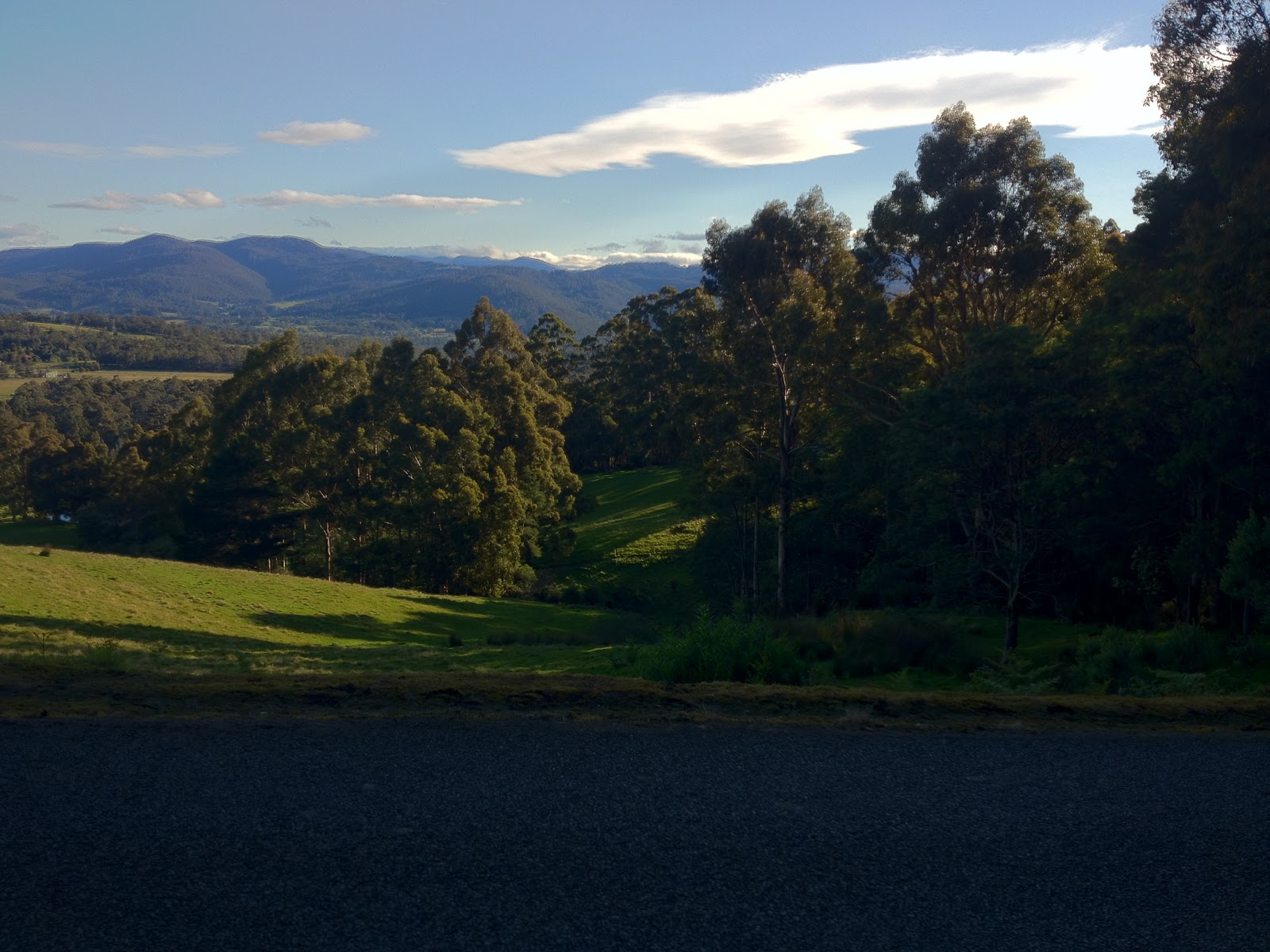
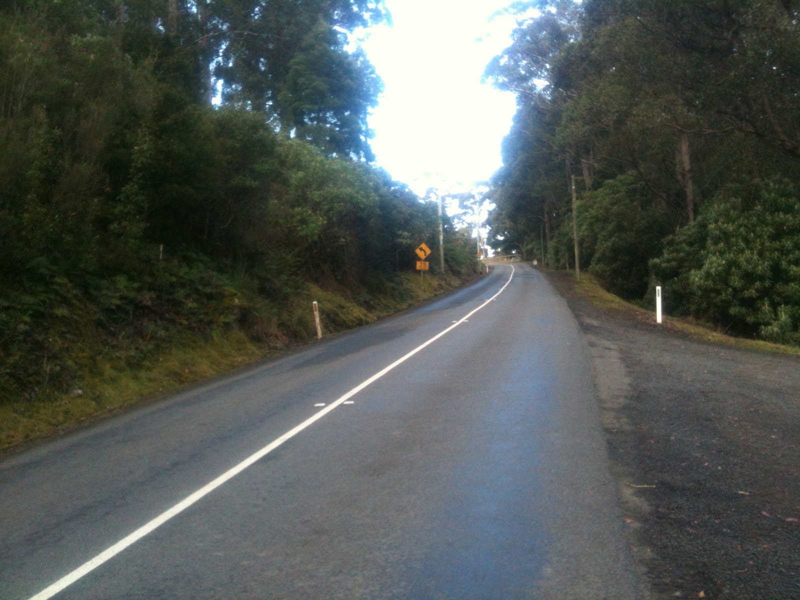
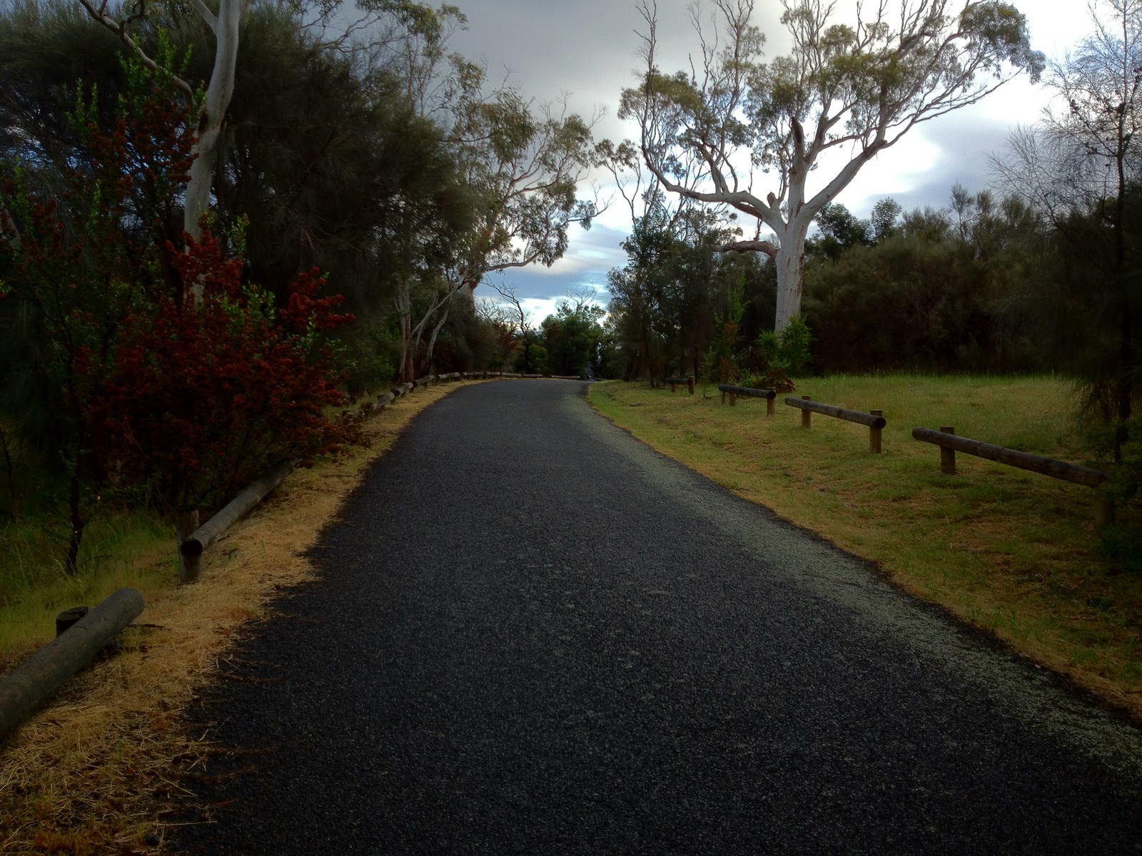
After receiving quite a few positive comments, online and offline, about my previous blog post on the Taroona cycle lanes, I thought I might explore some of the cycling infrastructure in Kingston.  I have focused on the on-road cycle lanes, but Kingston also has a bike path or two that are good recreational routes, especially for families, and more are under construction.

I would describe the quality of bicycle lanes in Kingston as good, and the newer lanes in the centre of town are of high quality. The Kingborough Council also has the distinction of being the first council in Tasmania to install a bike lane, on the Channel Highway.  The Kingborough Council is also in the process of reconstructing roads in the town centre, which I believe will include bicycle lanes.

If I was to pick one problem with the Kingborough bicycle infrastructure, it is that most of the lanes end abruptly on very busy roads or roundabouts.  This problem is certainly not unique to Kingston — I saw the same issue many times in Melbourne, for instance.

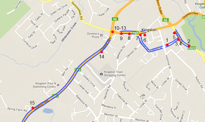
On with the tour!  The map below shows the approximate locations of the photos.  In most photos I will pick on an issue, quite unfairly of course.  The on-road bike lanes are also marked in blue.

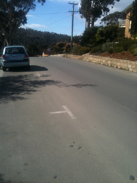
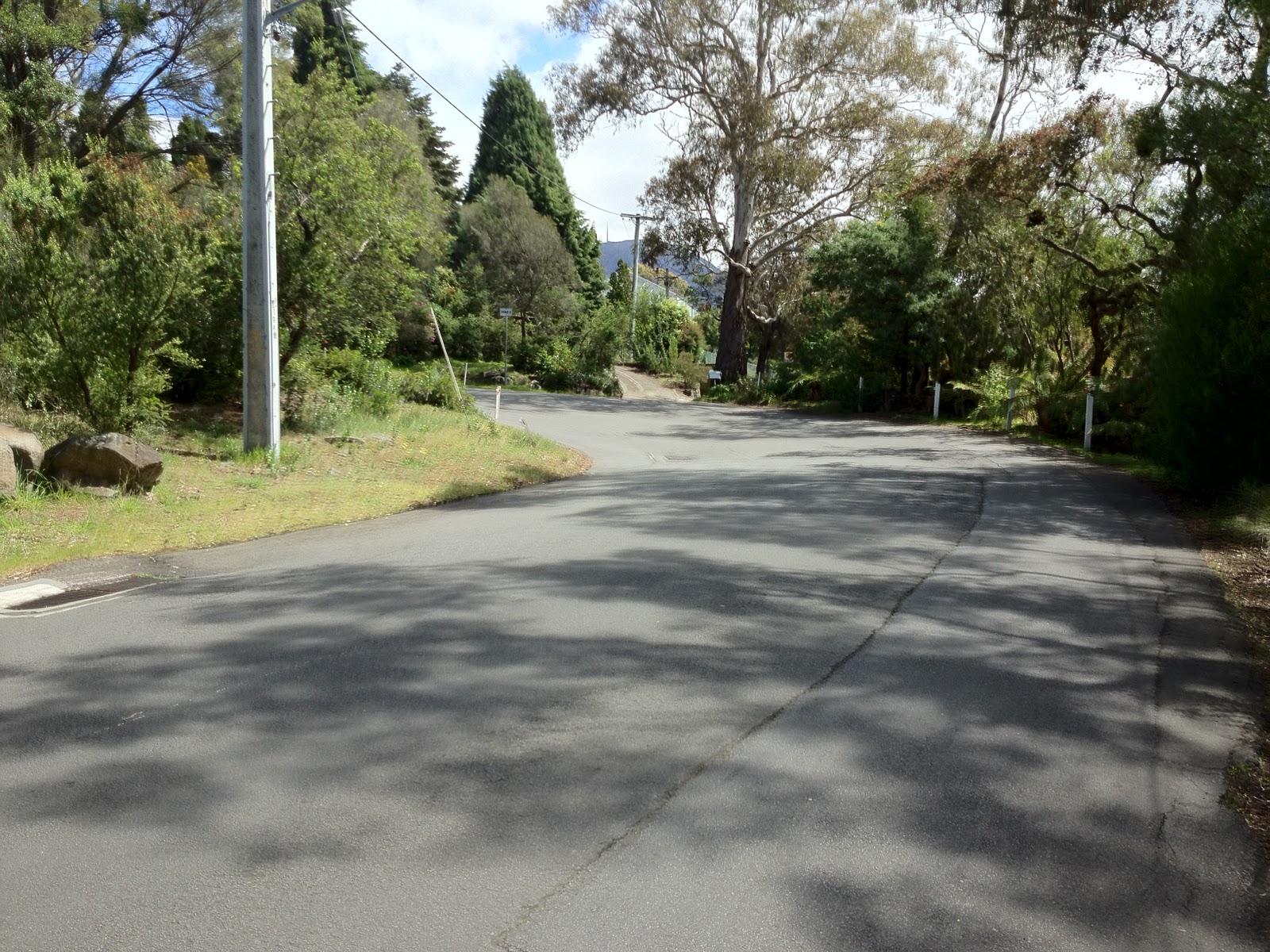
1. Church St.  Minor.  Bike lane markings are worn, as cars frequently cross into the lane.

This is a typical problem with bicycle infrastructure everywhere — the lane markings tend to be driven on, and not just by larger vehicles that have somewhat of a reason.  Of course, as the markings get less distinct, the problem is exacerbated.  This particular lane is reasonably wide, in a 40 zone, and hence is quite safe, apart from the very steep descent to Beach Rd immediately ahead.  The parking spots are not highly used and so dooring is not a huge risk (but always be aware!)

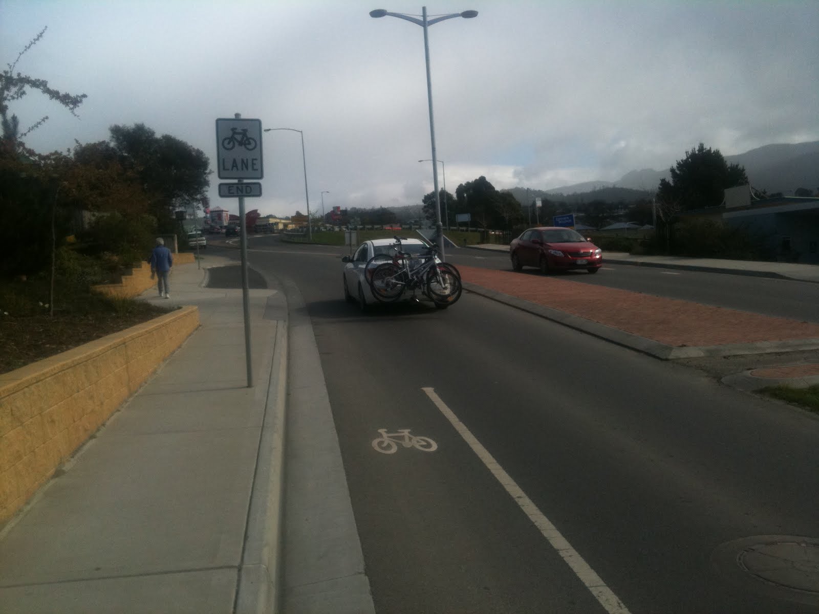
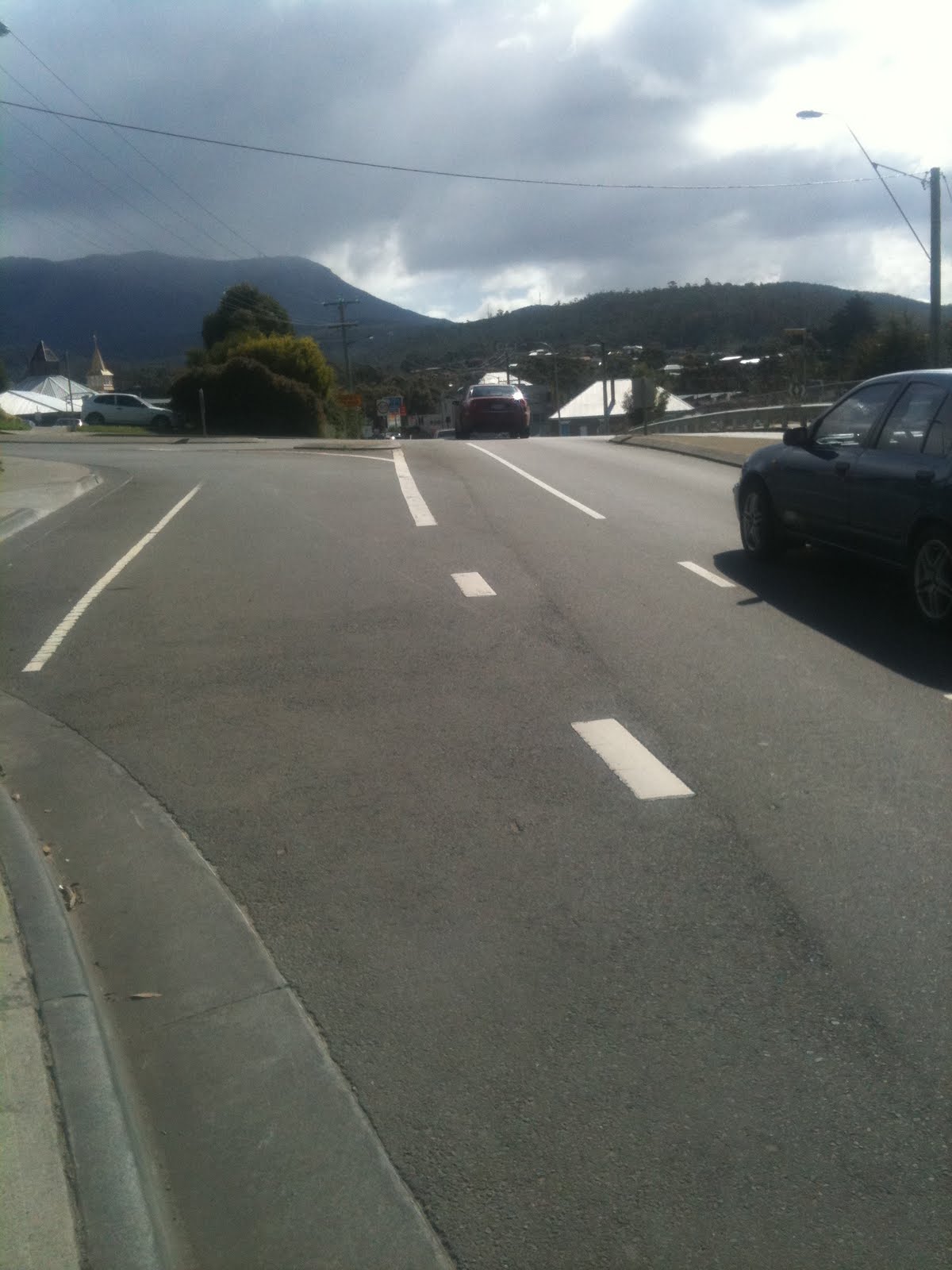
2. Beach Rd.  Moderate.  A beautiful bike lane that abruptly ends as the road narrows.

Again, the lane markings are very worn, but what I wanted to pull out here is how the bicycle lane ends and leaves the cyclist in the middle of a very busy section of road.  This is a very popular route for cyclists through to Kingston Beach, and it is disappointing that the lanes which start so well do not continue on at least through to the traffic lights 100m down the road.

3.  Good  Beach Rd / Church St Intersection: Clear and safe bicycle lane

On the opposite side of the road, this intersection has a clearly marked bike lane.  It is wide, clean, and smooth.  Great!  For extra points (or to get an ‘excellent’ rating), paint the bike lane green.

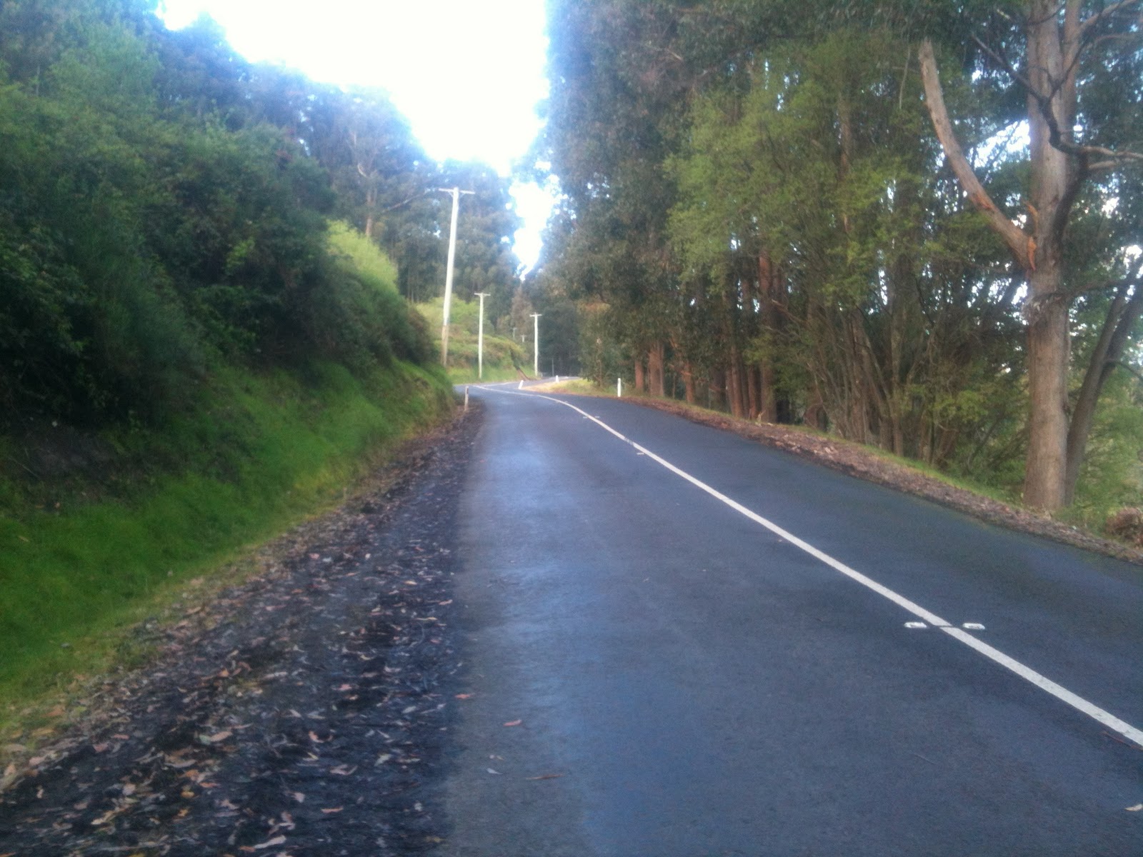
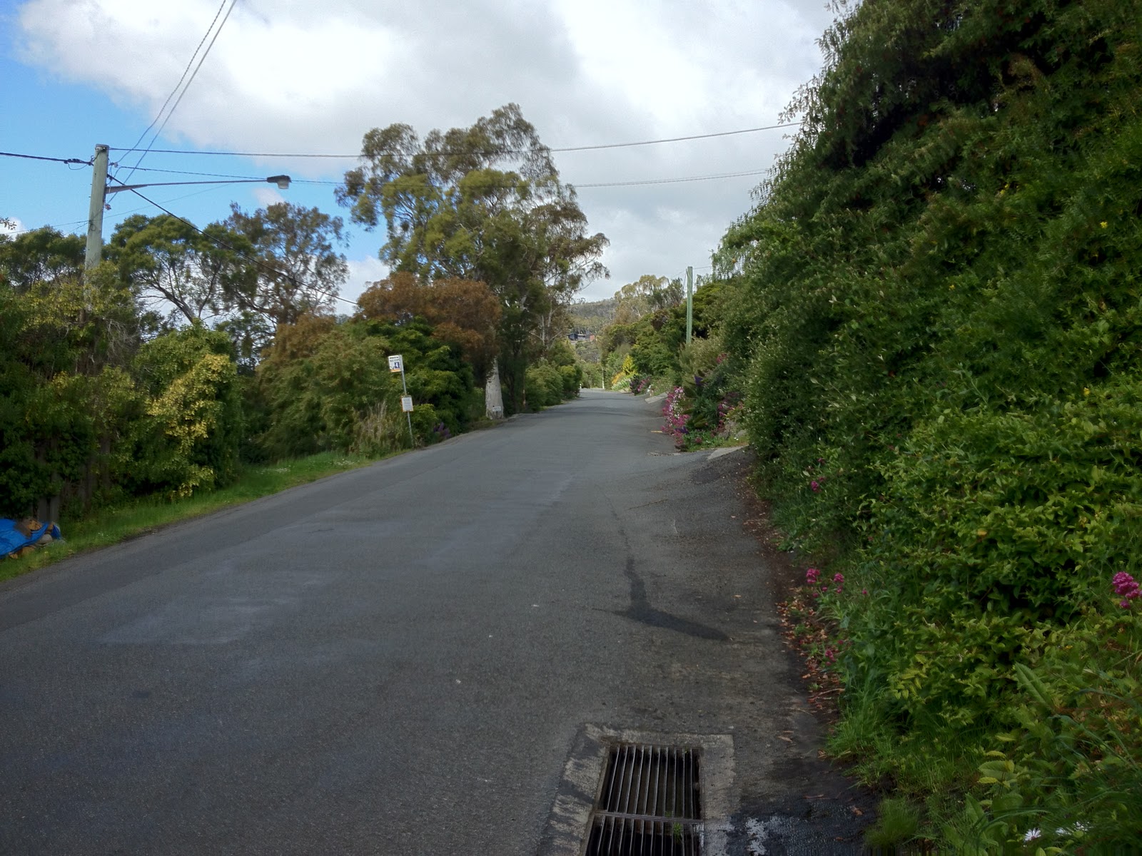
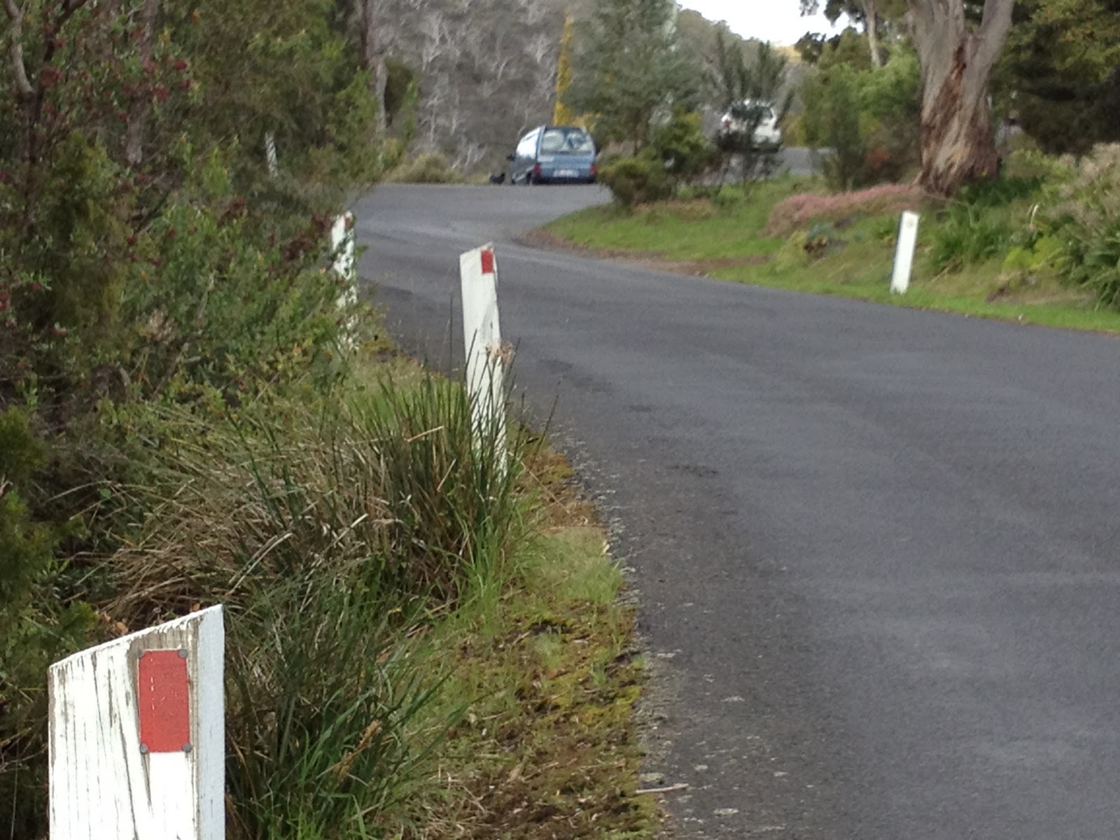
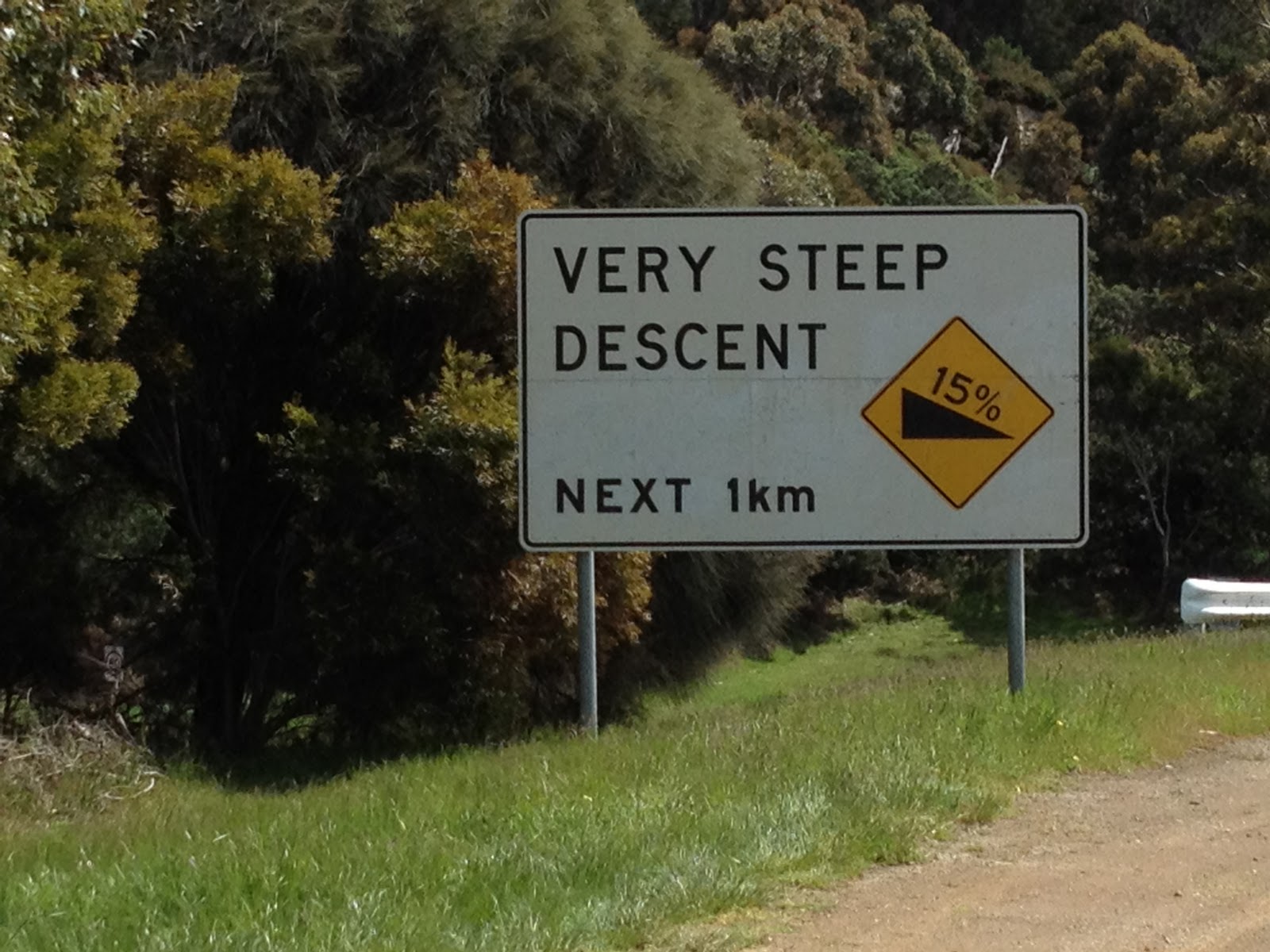
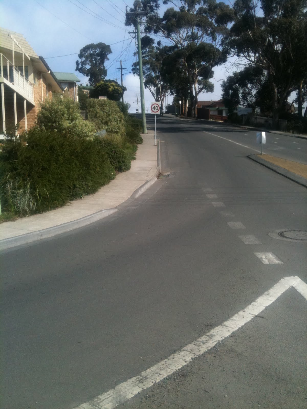
4.  Minor  Church St: this up-hill lane has worn markings and is very steep (15%)

The lane in this picture has worn lane markings, and is not sign posted.  The street is also very steep, which would deter some riders.

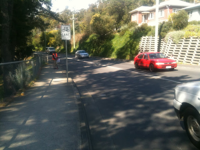
5.  Moderate  Beach Rd: Again a situation where the bike lane ends in a busy intersection.

This bike lane ends at a busy 4 way traffic light.  There is no provision for bicycle storage boxes in the intersection.  You’ll also note the roadworks signage encroaching right into the middle of the lane.  Roadworks signage obstructing bike lanes is a common problem in Hobart — this forces the cyclist to merge into the traffic lane.

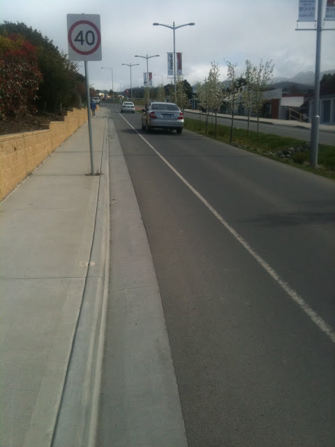
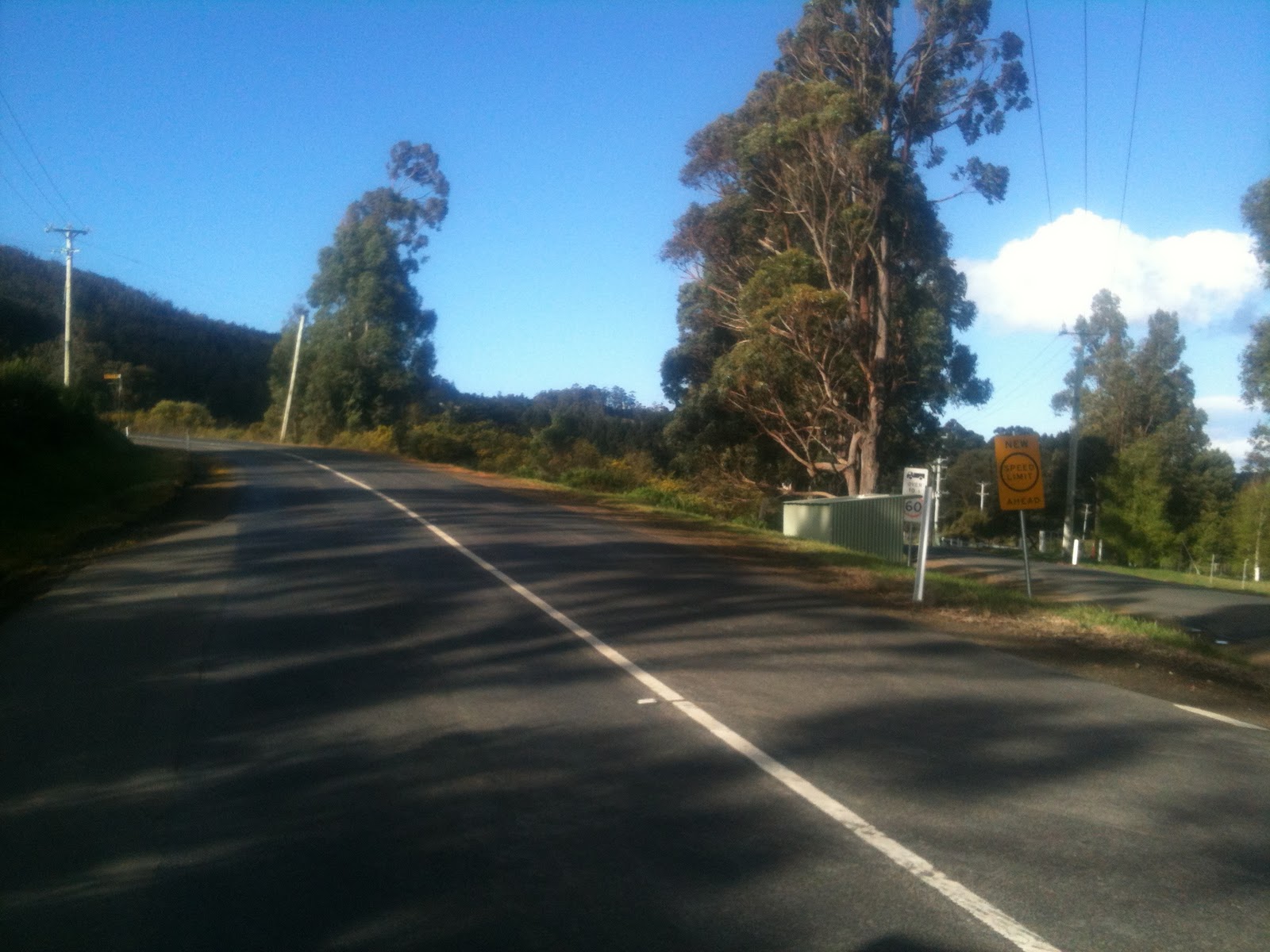
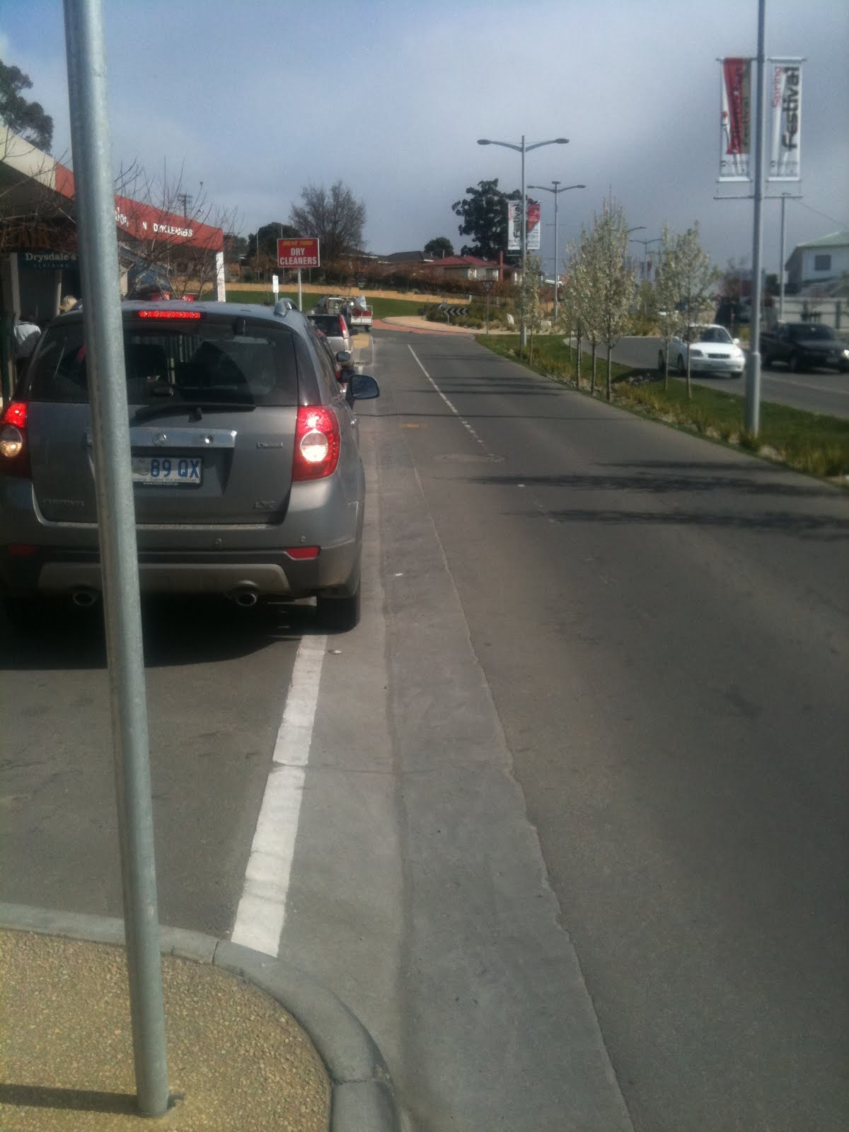
6.  Minor  Channel Highway: Good but isolated bicycle lane

This bike lane is wide, with sufficient room to negotiate around parked cars; beware of dooring of course. This section of road is also posted at 40km/h, which means that although it is busy, there is a much lower risk of serious accidents.  The only real problem is that this section of lane does not extend all the way back through the town centre.

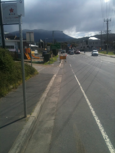
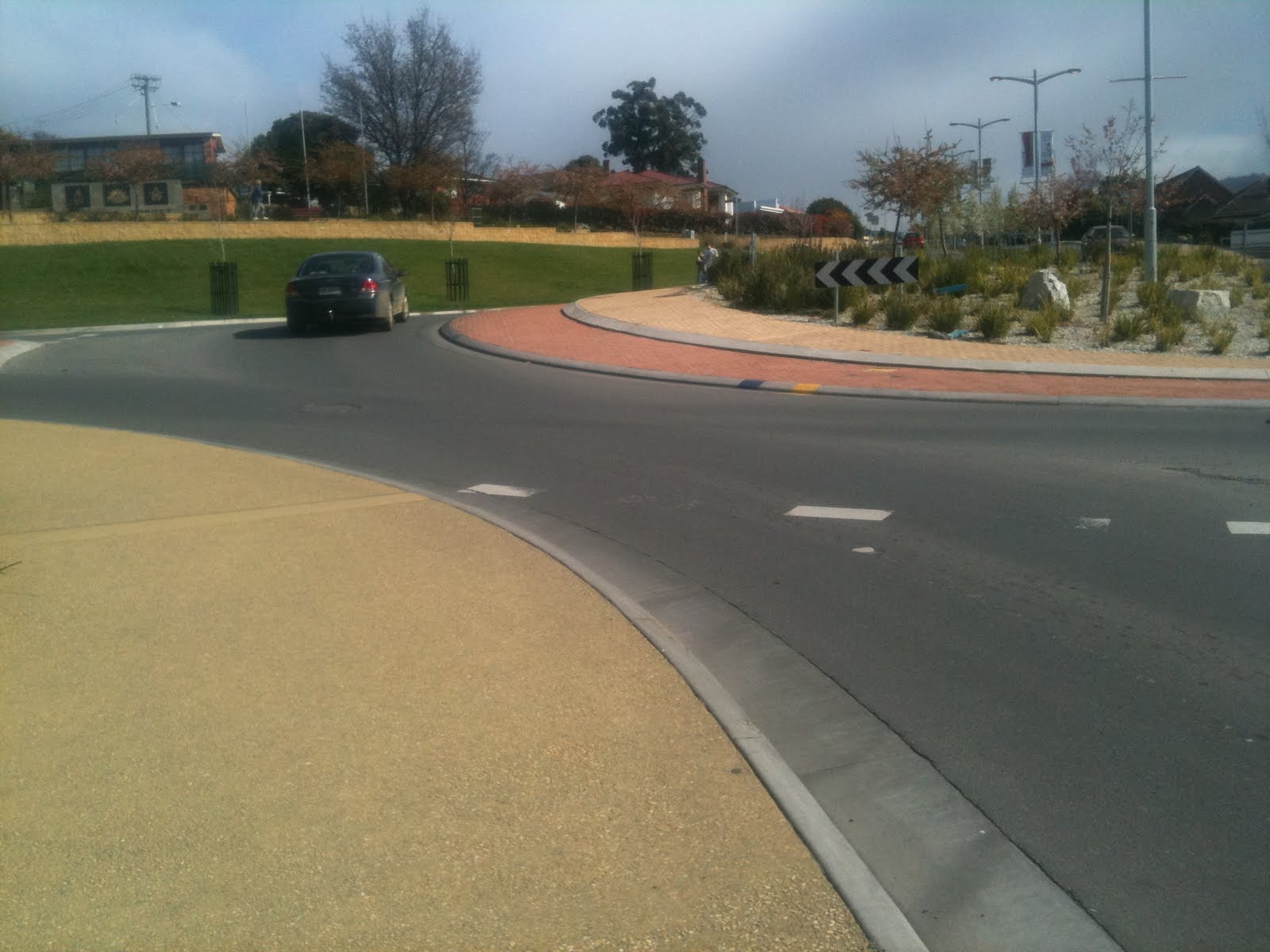
7.  Moderate  Channel Highway. No provision for cyclists in the roundabout

All three major roads entering this roundabout have cycle lanes in both directions.  That’s fantastic.  But there’s no provision for cyclists at the roundabout, and hence some confusion from drivers who are not sure where the bicycles are going.

8.  Good  Channel Highway. Nice clear section of cycle lane

The image above shows a section of Channel Highway south of the town centre.  Clear, clean and smooth bike lanes in both directions!  But…

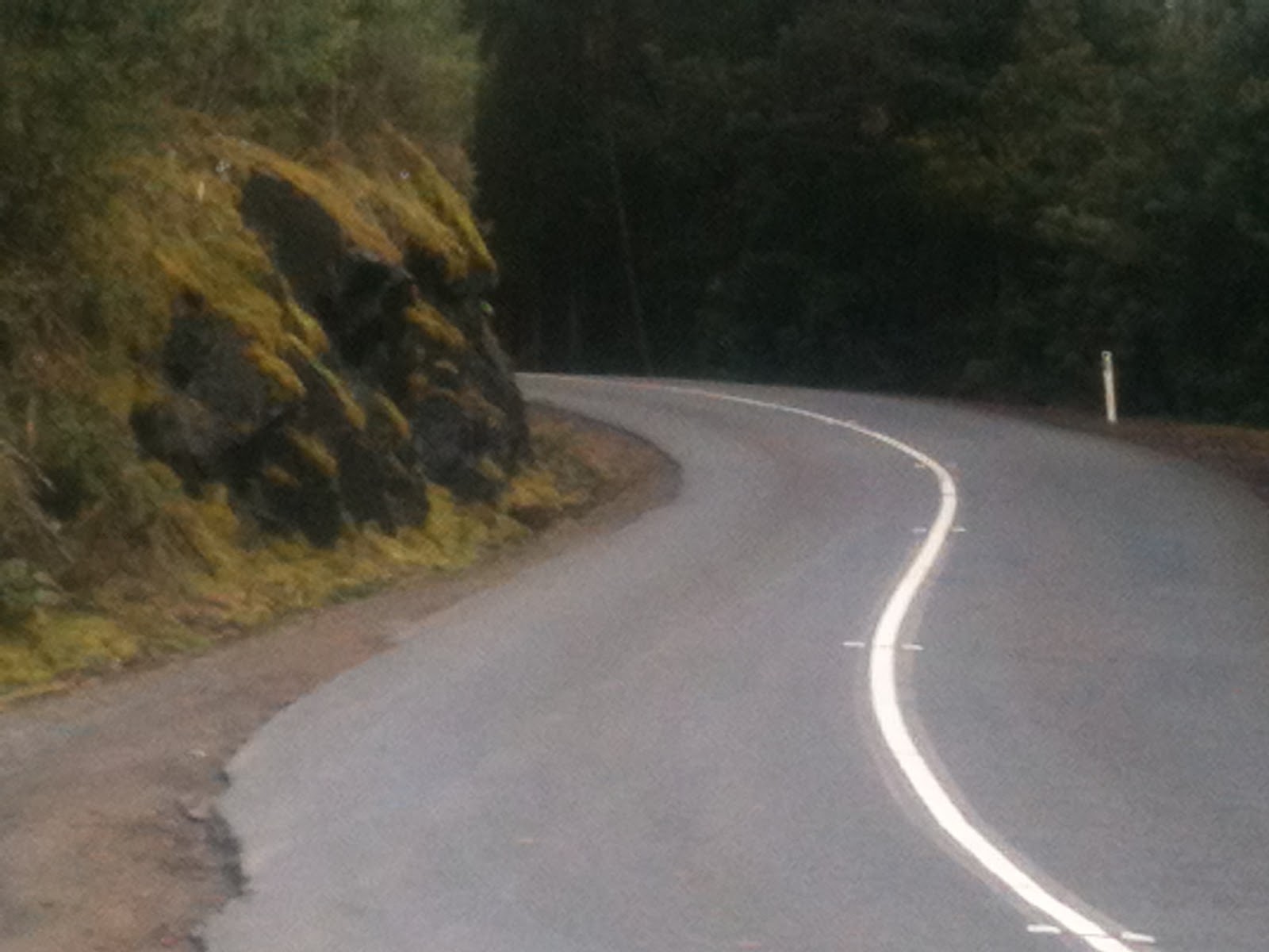
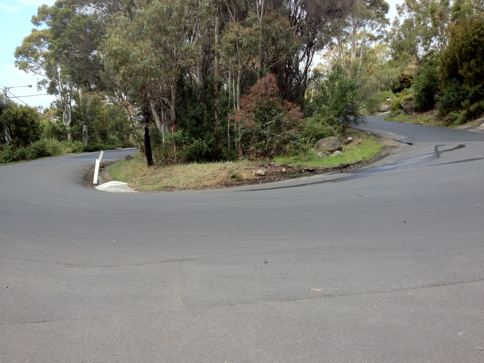
9.  Not so good  Channel Highway. The lane ends abruptly on a busy road

Just 100m further south, this is one area that really needs some work.  The roundabout just ahead is extremely busy, is not flat, and you see a lot of rapid entries and exits by car drivers.  It’s not a great place to be cycling through.  But unfortunately this cycle lane just ends here, with no direction for the poor rider.  If you look closely at the base of the light pole, you can see an underpass.  That’s where you should be heading (unless, like me, you are silly enough to just ride through the roundabout…) — but there’s no clear way for you to get there.

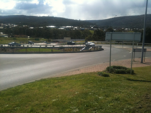
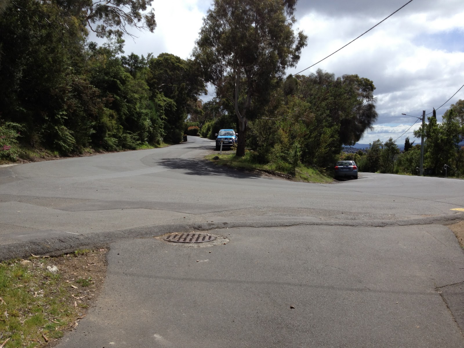
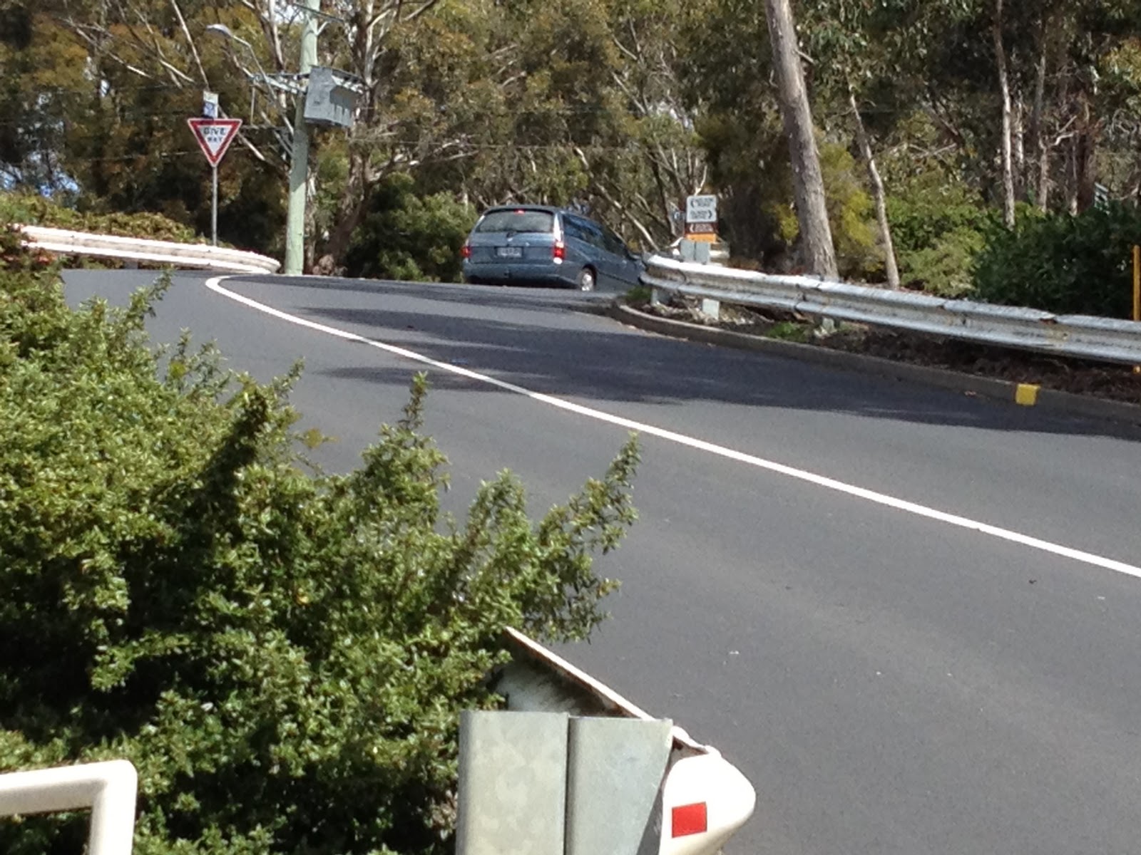
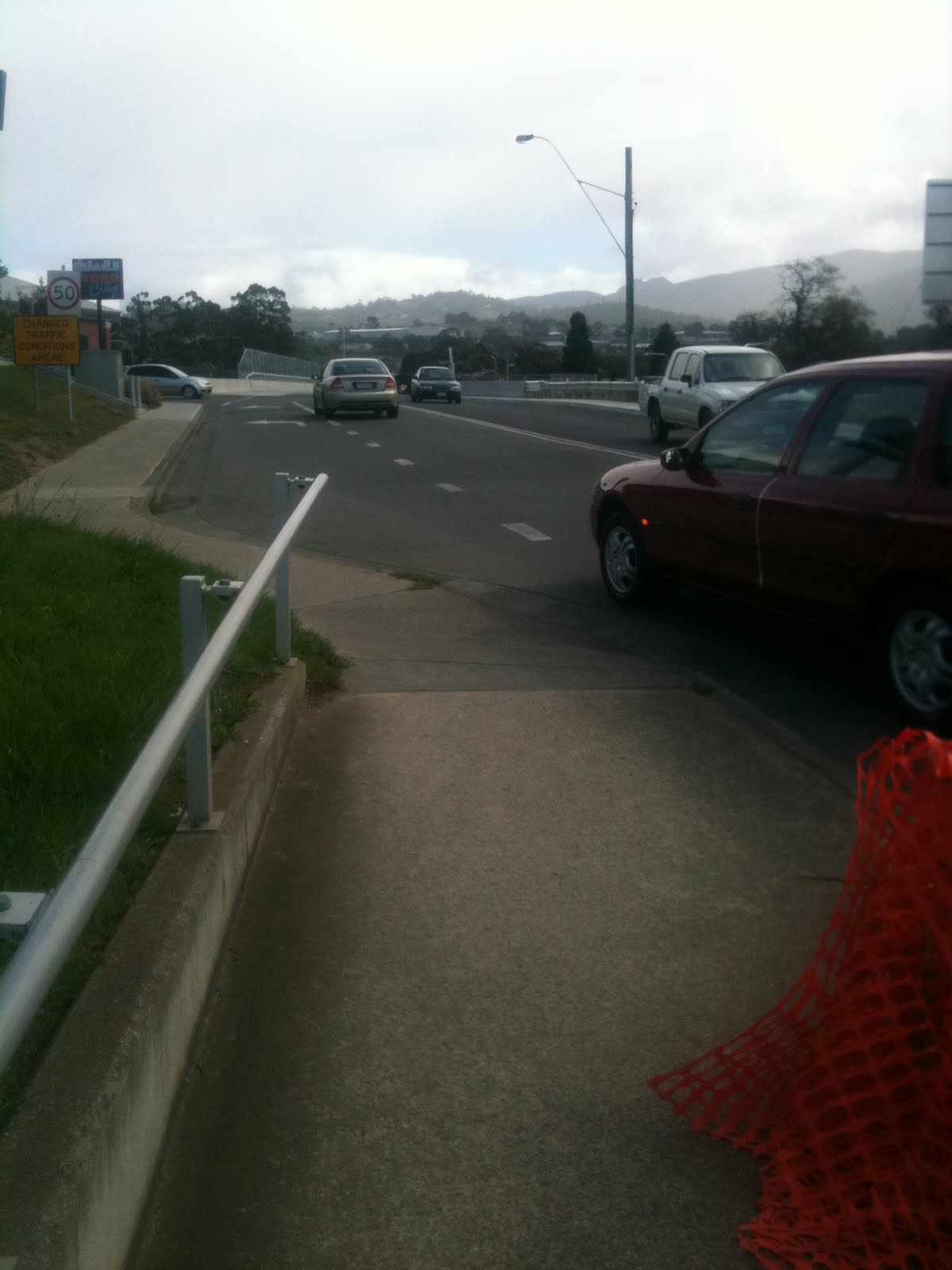
10.  Serious  This roundabout is the focal point of nearly all traffic south of the town centre

Here’s a picture of the roundabout I was just talking about.  No provision for cyclists on the roundabout.  But if you look closely, you can see the underpass.  But again, there is no clarity on how cyclists get from the end of the cycle lane to the underpass.

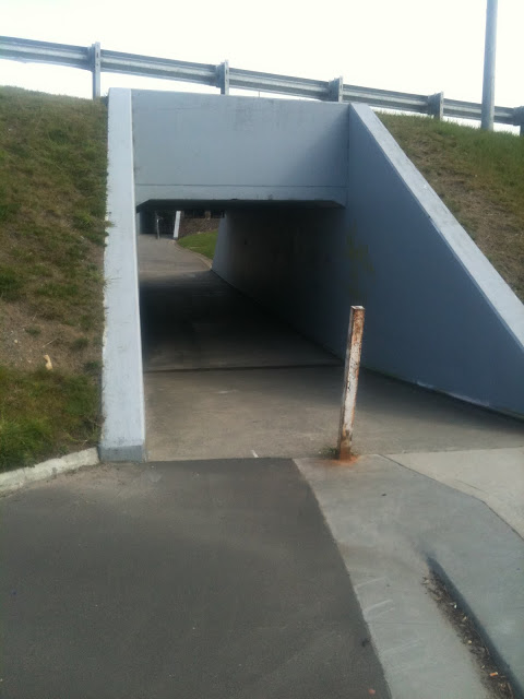
11. Underpass #1 through the roundabout

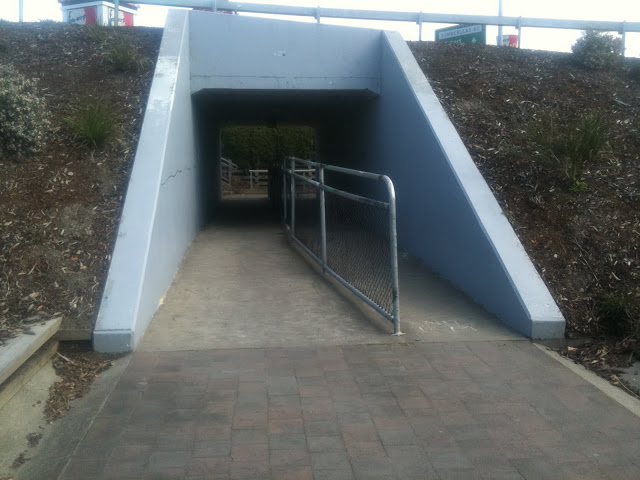
12. Underpass #2 through the roundabout

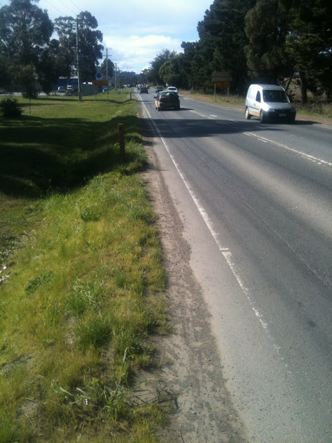
13.  Far side of the roundabout, exiting to Summerleas Rd

I think most safe bicycle access through this roundabout could be resolved quite easily.  The only difficult route really is Summerleas – Channel Highway (Southbound).  Even that can be solved with signage and directions.

The image above shows how the cycle infrastructure could be easily improved at the roundabout:

  1. Add a clearly marked bicycle and pedestrian crossing on Westside Circle, with railings on each side of the road.  To the west, this joins the existing off-road cycleway.
  2. Add a clearly marked bicycle and pedestrian crossing on Channel Highway, with railings on each side and in the centre of the road.  On the north side of the road, construct an off-road two-way cycle path to the entrance of the underpass.
  3. Widen and tidy up the exit of the underpass, and construct a ramp heading south for bicycle access.
  4. Extend the cycle path, possibly off-road, on Channel Highway south through the small service road, and signpost clearly the route.
  5. Add access to the new ramp down to the underpass from the Channel Highway.

For the ideal solution, you would construct an underpass from the centre of the roundabout under the south-western side for the best bicycle and pedestrian access in all directions.

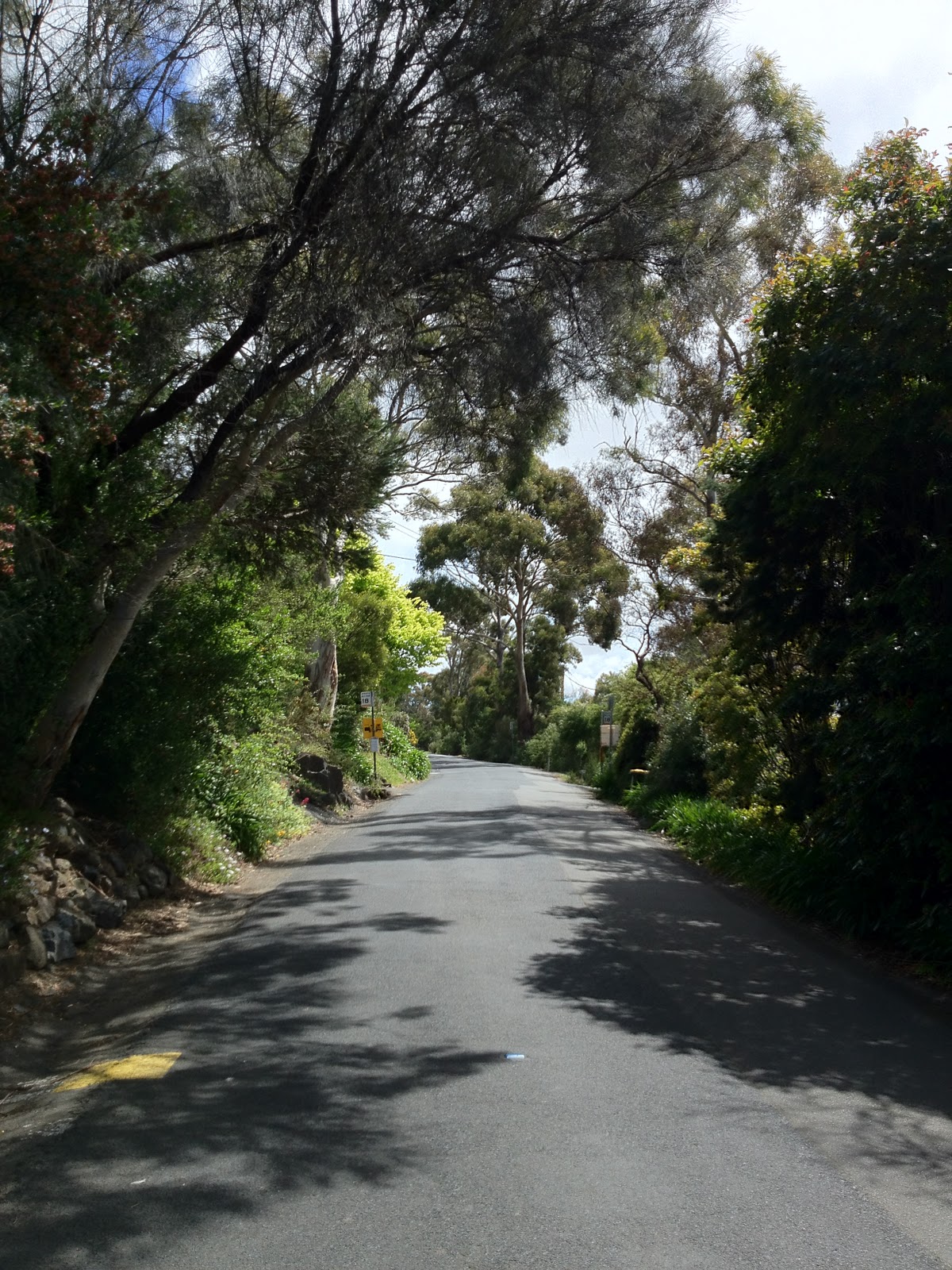
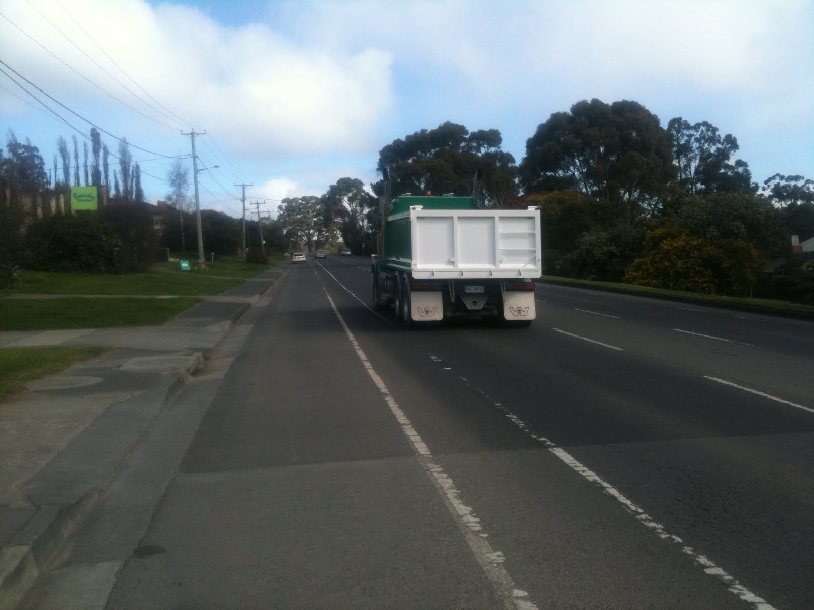
14.  Good  Bike lane heading south on Channel Highway

This section of bike lane is on an extremely busy road.  It is in reasonable condition, and was actually the first bike lane constructed in Tasmania, as far as I know.  However, some clearer markings at intersections would be worthwhile, and as you can see from the picture above, there’s not a whole lot of room for larger vehicles.

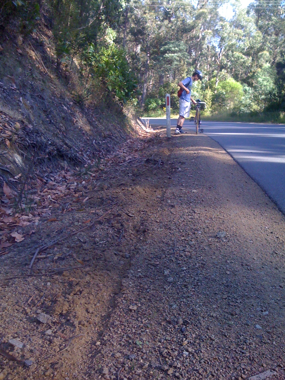
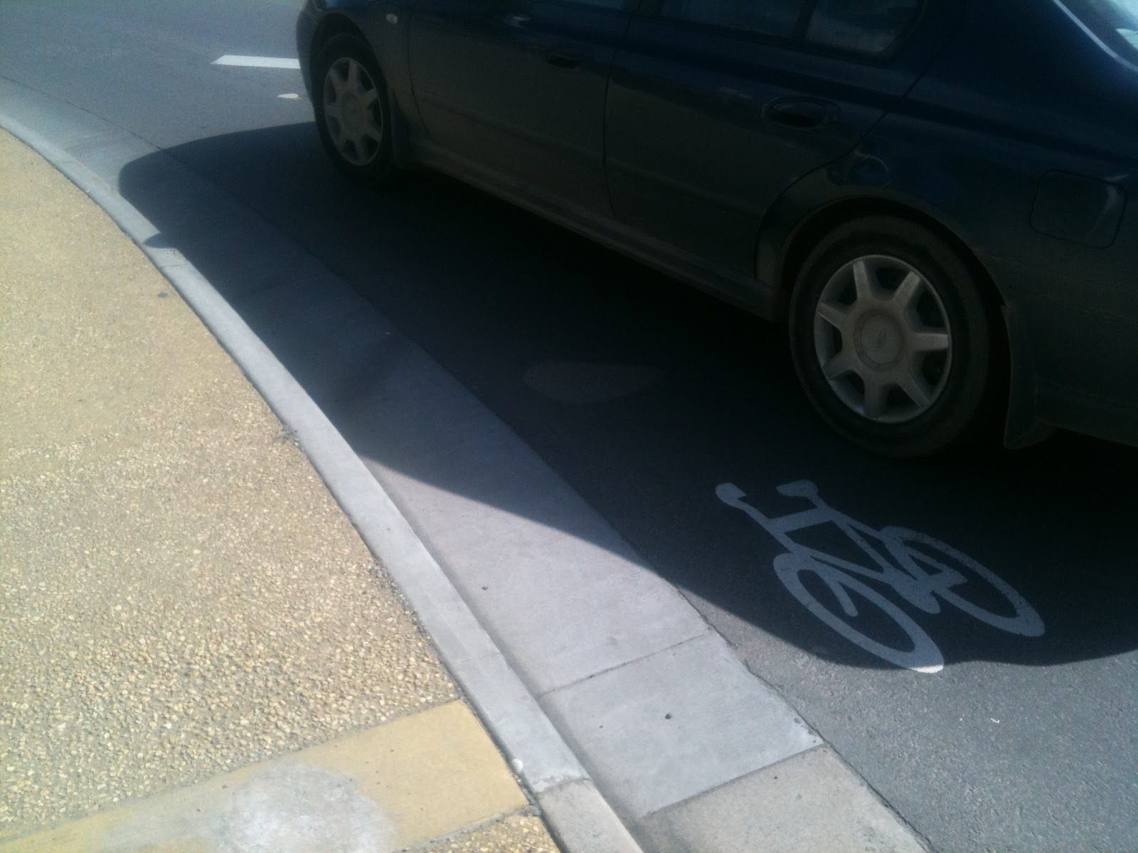
15.  Serious  Channel Highway, heading south Bike lane is far too narrow and not clear

Along this stretch of road, the bike lane needs some attention. The dirt in the lane has narrowed it significantly, and this makes it the worst kind of bike lane: drivers expect you to ride in it, but there is not enough room to do so safely.

Overall, Kingborough is certainly heading in the right direction in terms of the scope of its bicycle infrastructure.  I haven’t touched on the off-road cycle paths, but these are also becoming significantly more extensive.  I’d love to see some of the disconnection issues above resolved — my biggest gripe with cycle infrastructure all over Australia is that it is all so disconnected.  I leave you with a picture of how this feels to a cyclist.

Cape Town’s abandoned freeway, started many years ago and never finished.